LAUREL FORK FALLS

One of the most majestic waterfalls the Fat Bald White Guy has visited is the Laurel Fork Falls near Hampton, Tennessee. We ventured there on a hot day at the end of July and found a truly idyllic natural portrait unveiled before our eyes. Previously in the week, I was attracted to the observations of Barbara Brown Taylor in her book An Altar in the World; A Geography of Faith.

There she wrote: Earth is so thick with divine possibility, it is a wonder that we can walk anywhere without cracking our shins on altars. Well the Fat Bald White Guy and his Faithful Hiking Companion sure do have bruised shins from this hike.

 Where is Laurel Fork Falls? It is located in eastern Tennessee, forty miles west of Boone near the picturesque Lake Watauga. I had never visited this area before. Lake Watauga is a hidden gem! Beautiful man made reservoir at the head waters of the Watauga River. There are plenty of various water sports opportunities there as well a very nice public beach. If you vacation in Boone, take a day trip to this lake.

To get to the falls, you follow Laurel Fork which appears to flow into Watauga Lake. The trailhead is a popular spot located on Highway 321 just west of Lake Watauga on the outskirts of Hampton, Tennessee. A small parking lot on the left accommodates about 15 vehicles and provides a very nice map.

The trail is a less than six mile round trip and is rated moderate. There is one short steep climb to the top of the river bluff in one bend of the river. It is a thumper of a climb but not something too hard for most people to handle. The trail is mostly smooth and flat with occasional slippery rocks to manage. The constant views of this mountain stream keeps your interest all the way to the falls.


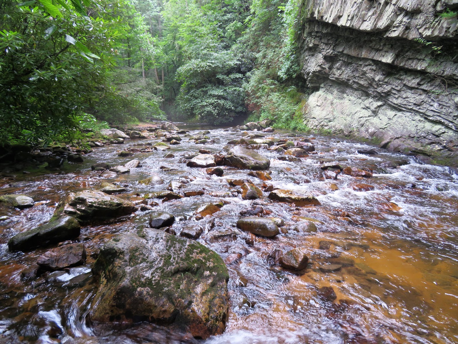 Early in the hike the stream hugs a rock wall that must be over a hundred feet tall. It makes you appreciate the power of the water as you understand that each line in this rock wall was caused by a hundreds of years of flow of this ancient river. You also get used to the constant roar of the water clashing with the rocks which only increases as you get closer to the falls.

The Laurel Fork Trail is a blue blazed trail that is easy to follow as it snakes along the riverbank. A little over a mile into the trail it merges with the Appalachian Trail and becomes a white blazed trail to the falls. This sign indicates the merger of the trail and directed us toward the falls.

Near the 1.5 mark, the trail crosses the river. You are tempted by the trail to ford the river but just past this ford is the first of two really nice bridges.


The bridge offered a few photographic opportunities that I gladly took up. The rustic wooden structure contrasting with the wilderness was not quite the same as the lamppost from the Chronicles of Narnia, but was "kinda but different".


Another bridge crossing provided us a nice place to take a break. The day was hot and humid and hydration was required. As we paused, I got to reflect on the beauty of the view from the middle of the bridge.


Not far from the second bridge, we encountered a fork in the trail. The green moss covered logs are a good place to rest your dawgs and take a drink of fluids as the white blazed trail takes you up a steep climb to a river bluff, some 300 feet above the stream. The hollow log reminded me of an old bluegrass tune Doc Watson would sing about catching a rabbit with a brier hiding in a hollow log. Doc Watson and Bill Monroe "Feast Here Tonight"


I waded out the cairn and was joined by one of the dogs accompanying the young folks swimming. I believe her name was "Kono". She was reluctant to jump in but the male Labrador was an eager swimmer.


Behind the falls rises a rather impressive promontory. I wondered what the path was like to that peak. Also the path leads to the top of the falls but since I had already climbed a rocky bluff I was not interested in another excursion.

 The rock cairn is always a reminder to me of the majesty of God's creation and again the words of Barbara Brown Taylor echoed in my mind: "People encounter God under shady oak trees, on riverbanks, at the tops of mountains and in long stretches of barren wilderness. God shows up in whirlwind, starry skies, burning bushes and perfect strangers. When people want to know more about God, the son of God tells them to pay attention to the lilies of the field and the birds of the air, to women kneading bread and workers lining up for pay. Whoever wrote this stuff believed that people could learn as much about the ways of God from paying attention to the world as they could from paying attention to scripture?
 The trail is a near perfect day hike. Located 40 miles west of Boone, the trail head is accessible directly off US 321. Access is a 10. The trail is well maintained and moderate (if you follow it that is!!) and the constant scenery of the flowing river allows it to be rated a 10 as well. The scenery is continuously breathtaking culminating in one of the best waterfalls I have ever seen...10; the effort to view ratio is near perfect...5.86 mile hike makes it a hike worth the trip....rarely does a trail impress me as this one did...a perfect 10 hike!
Rock cairns are man-made and are banned by multiple national parks and recreation areas across the country. They're particularly debilitating in the southeast as moving rocks from streams destroys endangered salamander habitats. I really think you should stop promoting them in most of your blog posts. You could get fined if caught building one by a ranger.
ReplyDeleteYou are correct and since a Ranger friend of mine explained to me that the building of these have gotten out of hand in her park, I no longer build a cairn during my walks....the one in this post was there when I arrived...I will continue to reference them when I see them if I believe their presence adds to the description of my hike....simply because rock altars are a biblical reminder of God's goodness to his people....many cultures have erected standing stones to honor God...and for me it reminds me of that simple fact....thanks for following the FBWG
ReplyDelete