Saturday, April 27, 2013

Ocean Isle Beach

Ocean Isle Beach

A Hike Is Where You Find It...


Every year for the last three decades a group of guys from Kernersville attend a golf trip at Ocean Isle Beach....18 holes on Wednesday...36 on Thursday....18 on Friday and 18 on Saturday....so how did the FBWG find time to take a hike....well on Friday afternoon since we did not have a golf game, I spotted a trail through the marsh on the east end of the beach .... and had to hoof it to see what I could see....


The trailhead is 1.5 miles from the Atkins "Hilton" Hotel and Spa...about 2 miles from the big water tower and begins at a street corner with a familiar name: Winston-Salem St.


The bridge leads into the depths of a salt water tidal marsh...it is the first of many bridges erected to preserve the marshlands.


The bridges crossed the tidal marsh connecting various tree covered elevated dunes giving me an idea of what OIB must of looked like before all the tourists showed up and made OIB such a popular beach destination.


In the distance I could make out an American Flag fluttering over the Ferry Landing Park which I had made my destination.  While never far from the beach cottages, the trail was designed to provide some solitude to the hiker. In fact, I was not so sure I would not encounter a victim from an episode of Criminal Minds. I was also glad it was a cool spring day and the wind was blowing cause I got a feeling this place has a few "skeeters" flying around.

There are bridges seemingly at every turn... if you begin the hike at the Winston-Salem trailhead, keep taking the bridge to the left and you will follow the longest trail through the tidal marsh.   


The trail provides several interesting views of the tidal marsh that runs parallel to and just south of the Intercoastal Waterway.


After about a half mile, the trail ends at the intersection of Charlotte Street and to get to the park you have to walk about a third of a mile down the street where you can soon see the Ferry Landing Park.  


The Park is really just a gazebo with a small fishing pier....but it provides a nice place to watch the sunset and a convenient place to drop a hook into the water.


Looking west down the Intercoastal Waterway I captured a couple of nice shots of the setting sun reflecting on the water.


The trail was an interesting diversion to a lazy afternoon but in comparison to the views the FBWG gets in the mountains, a saltwater marsh really is not that exciting....glad I took the hike....about 5 miles total. Take the hike if you like but the best views are at the Ferry Landing Park....no need to rate this one.

Now a few words about our Golf Tournament...we had a great time and got some glimpses of nature while we were waiting for some duffers to find their lost balls.....


Especially interesting was a hawk perched in a tree above a small pond. We actually got to see him dive into the water trying to catch a fish!  As he emerged from the water he provided us with an amazing flyover as he returned to his perch.
       These turtles were seen sunning themselves a rock in the middle of a pond.

The tournament is not played to win....you see our motto is taken from Matthew 20:16- "So the last shall be first, and the first last; for many be called, but few chosen."  Gary Spring says that these words must be true because Bob Dylan said the same thing.  So the only person who gets a trophy is the loser....or shall we say: "the best of the wurst".  This year Chip Cooke took home the "prize"!

We also honored one of our players who is no longer with us.  Shirley G. Smith better known as "Smitty" carpooled with me to the beach for years. The stories that man could tell were legendary! He was one of our better golfers and was surprised to learn the first year he played that he "earned" the pink flamingo in spite of his finely honed golf game! We often were teammates and on one memorable trip we won every match we played. I am a better person for having a man like Smitty in my life. I learned a lot of things from Smitty on these beach trips...some of which I can even repeat to my wife....I miss him and so do the rest of the crew.... May God's Peace be upon him and all those who mourn his passing.

Sunday, April 7, 2013

Crowders Mountain State Park - King's Pinnacle

KING'S PINNACLE 

               at  Crowder's Mountain State Park

Driving north up I-85 from Gaffney South Carolina as you approach the North Carolina State line, there looms a small mountain with distinctive features.  In fact it looks similar to Pilot Mountain as seen on NC 52 north of Winston-Salem.  The difference is that this peak is missing the distinctive dome.
King's Pinnacle is part of a small range of mountains millions of years old.  All but the quartzite rock has been eroded away.  Geologists name these mountains: monadnocks.  Its sister ridge, Crowder's Mountain, along with Stone Mountain, Morrow Mountain, Pilot Mountain, and Cooks Wall Mountain are similar seemingly oddly placed mountain peaks within a piedmont plain.

As with all North Carolina State Parks, Crowder's Mountain is a well maintained facility boasting a large visitor's center with a friendly staff and a small natural history museum.  As you can tell from the number of cars in the parking lot, the park is very popular...to the point that one trail review pointed out that the trails were "sociable" which is a chamber of commerce term for "crowded".  
We chose to take what we thought was a path less traveled to the peak of King's Pinnacle via an ominously named trail: "Turnback Trail"
In about 1.2 miles Turnback Trail intersects with Pinnacle Trail and you begin an ascent of about 600 feet to the summit of King's Pinnacle.  The trail is mostly moderately steep switchbacks. 


However as you approach the summit the trail is noticeably steeper and narrower.  Due to the number of people on the trail at times we had to stop and let folks descending pass.  One urban youth who was no doubt experiencing her first and perhaps last hiking experience was overheard saying: "Hiking is the devil"

Right before you reach the summit, the Pinnacle Trail intersects with the Ridgeline Trail.  This trail connects Crowder's Mountain State Park with King's Mountain State Park in South Carolina. This is a six mile trek which I would guess is not as "sociable" as the Pinnacle Trail.


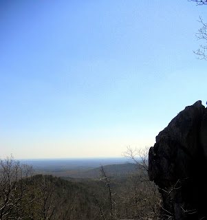
You know you have reached the summit because there is a sign that states: "end of trail".  Most folks elect to scamper up the rocks to an overlook but we elected to follow a trail to the southern end of the peak from which we began our exploration of the rocky ridge of King's Pinnacle and as a result got to enjoy many varied views of the surrounding countryside.
Looking south into South Carolina is the King's Mountain National Military Park, the site of one of the most crucial battles of the War of Independence.  There Col. Benjamin Cleveland and his Over The Mountain Men defeated the Loyalist Regiment commanded by Col. Patrick Ferguson, the first of three victories which led to General Cornwallis' surrender at Yorktown.
Looking East from the Southern Summit
The summit features many rock scampering opportunities as there are trails which lead in every direction, each offering another view of the countryside.  We took time to explore the western side and were treated to some nice views of the town of King's Mountain, NC


We found a less "sociable" spot and took a lunch break next to a neat rock formation.  From this spot we could enjoy another southern view and could see I-85 snaking southward into Gaffney.


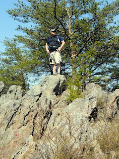
Finishing our trail mix and Gatorade we begin our rock scamper of the summit trekking  north and found the highest peak of the mountain some 1724 feet high.  


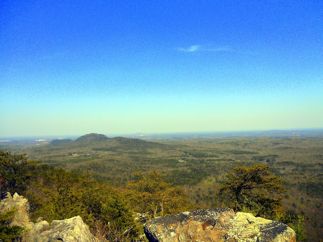
Looking East


From this spot there is an 180 degree view of the countryside.


Looking South
Looking West
We always are fearful of injuries on the trail and on this hike I got lucky. As I was descending from the pinnacle rock, I took a nice fall, fortunately landing between two large rocks rather than on them...only a jammed thumb to show for it...like I said before, the good Lord looks after drunks, fools and Fat Bald White Guys.


Our last stop was the northern overlook where we got a nice view of Crowder's Mountain, the city of Charlotte and the green roofed visitor's center.


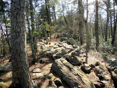
Hiking back we elected to remain on the Pinnacle Trail which intersects with the Crowder's Mountain Trail so that we could create a loop back to the parking lot and perhaps find a place a little less "sociable". At the intersection of the Turnback Trial, the Pinnacle Trail leads across a small rocky ridge.   While navigating through the rocks, we discovered one of life's truisms.  Kurt Vonnegut said it best: "Love is where you find it. I think it is foolish to go around looking for it..." 


Returning to the visitor's center I was drawn to a dogwood tree arrayed with golden blossoms. Spring is upon us for sure!


This hike is hard to rate. It was a moderate four mile hike. The Park is a really nice place to visit but it is so popular that the trails are crowded and escape to a wilderness is impossible....heck, every fifth person we saw had a dog! I rate the Trail a 5 only because it was so popular and well used....Scenery is a 7, nice views for a small mountain....Access is an 8...easy to find off I-85.  
Overall a 7.