ROCKY KNOB AND BLACK RIDGE ON BLACK FRIDAY


About two miles from the Rocky Knob Visitor center and the trail head for the Black Ridge Trail, we encountered an unmovable object...a gate across the Parkway..... with no alternate route available we were undaunted....heck we drove all this way to hike....so what if we would have to hoof it a couple miles to the trail head....so we parked on the side of the road and started up the closed Blue Ridge Parkway.

To the our right was a large fenced cow pasture. My trail research led me to believe that this was a part of the Rock Castle Gorge loop trail....the 11 mile Rock Castle Gorge loop trail.... but remembering that the trail ran along the ridge line to the summit of Rocky Knob, we jumped the fence....dodged some cow patties and started up the trail to the summit of Grassy Knoll (3475')

From the summit we enjoyed a view of the surrounding countryside and spied for the first time our destination....Rocky Knob in the distance.


With the sun at our back we started down the Rock Castle Gorge Trail along the ridgeline toward Rocky Knob.


Soon the pasture trail ended and we crossed the fence over a wooden step ladder of sorts. It was a good place to hang my Red Sox hat while I removed my toboggan. It may be 35 degrees but the FBWG was working up a sweat.

The trail became a ridgeline wooded trail with many nice views to the south. I am sure in the summer these views would be obscured by the foliage but on a winter day we got an good idea of how steep the trail into the Rock Castle Gorge would be and decided that reaching the Rocky Knob summit would be our destination and not the 11 mile Gorge Loop.


 The trail ran along the ridgeline for a mile or so and we came to a place with an unusual name Twelve O'clock Knob Overlook. From this place we could see the Visitor Center and learned we were not the only folks who jumped the fence and were taking a hike in the sunny Black Friday.....we could not help but think of the poor souls waiting in line at Walmart as we gazed from the overlook at majestic Virginia Mountains.


 At the Twelve O'clock Overlook, we were able to read the trail map and realized that the loop hike we envisioned could be cobbled together even though we started a mile short of the trailhead at the visitor center....so off we trudged up a narrow, snowy, rocky ridgeline trail toward the summit of what we thought was Rocky Knob.....along the way we marveled at more views of the Rock Castle Gorge.


 The summit of Rocky Knob is 3572'.....and just below the ridge top is a shelter similar to that we saw at Mt Rogers and at Bluff Mountain.
 The Shelter was 2.57 miles from where we started the hike but we agreed that the .4 mile summit of Rocky Knob was much more difficult than we imaged...duh....walking in leaves and snow is sorta like hiking in sand....we welcomed the break in the shelter....and seeing that everyone else had carved their initials, the FBWG had to leave his mark as well.
 We decided to take the trail to the picnic area and linked up with the Picnic Loop and soon found ourselves at the Visitors Center where our original destination the trail head of Black Ridge Loop trail. Seeing the ominous sign, we knew we need to get a move on as we did not want to meet Yogi or Boo Boo.

Leaving the Visitors Center, we plunged into the woods and being that the trails were on the northern side of the ridgeline found ourselves hiking along an increasingly snowy path.


Leaving the homestead the trail merged with a fire road. It was icy and slick and steeper than we appreciated.


From the top of the fire road we emerged onto Black Ridge and during frequent rest breaks captured some nice views of the mountains to the north.

The fire road turned into a farm road as it ran along the border of the Park with a neighboring cow pasture. Near the end of the trail we passed a dilapidated shed and I captured a nice window view from an opening the wooden slats.
We found our way back to the parkway as the Black Ridge trail crossed the road about the same spot as we jumped the cow pasture fence to begin our hike. Before we turned to walk down the road I turned and snapped a picture of Rocky Knob to remind me just how far we had trudged.

 This was a 5.5 mile loop which we constructed just by chance. It turned out to be exactly the hike I had planned to walk but from the trail head at the Visitors Center. It was a great winter day and the scenery was much better than I had imagined. Access is an 8 only because the Parkway was closed and we had to sneak around to get in.....the trail was an 8....well marked and maintained....scenery was an 8.....Overall a solid 8.....great loop even if it is not marked as such on the map...I believe the fall views along this hike would rival any on the Blue Ridge.....we gonna come back for sure
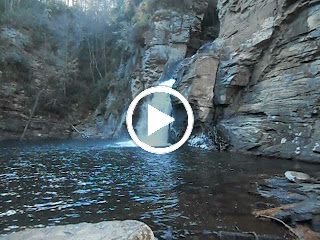
On the way out we stopped by a sight we observed on the way in. About a half mile north of Mabry Mill, there is a rock wall about 50 yards in length and 30 feet or more high. From this wall water from mountain springs flow...during the recent wet weather the wall was turned into a sheet of ice adorned with icicles some over a foot in length......quite a sight


.jpg)


.jpg)
