YADKIN ISLANDS AND THE BEAN SHOALS CANAL


Nestled in the corner of the Pilot Mountain State Park is the Yadkin Island section. Connected to the main park by a six mile corridor, the Yadkin Island section is next to the Horne Creek Living Historical Farm and houses the remnants of the Bean Shoals Canal. It is a great park to visit for folks in the Piedmont Triad accessed off the Jomeokee exit on NC 52 just south of Pilot Mountain.

 We parked on Hauser Road just past the entrance road to the Yadkin Island Section of the Park. The sign at the trail head is confusing. Following the Yadkin Island trail the out and back is less than five miles...doing the loop as we did and including the Bean Shoals Canal trail, we logged over 5.5 miles. But if that seems too much of a walk, you can drive to within a half mile of the river. So pick your route...we took the long way.

A short trail leads from the parking lot to the Bean Shoals Canal access road. The trail follows Horne Creek as it meanders towards the river. The first part of the trail is very wooded and almost overgrown but it soon connects with the gravel access road. Soon you cross the first of two creek fords.


It turned out that the
Yadkin Island Trail is a winding old postal road that climbs over a ridge that the gravel road goes around. But since it was not well marked we decided to travel a bit more down the gravel road to find the trail head to the Horne Creek Trail.


 On the left about a half mile from the second ford is a small picnic area. At this spot is the trail head to the Horne Creek Trail. It is a 2.5 mile trek to the river which intersects with the Bean Shoals Canal trail. This is a wonderful winding forest trail on the banks of Horne Creek as it meanders to the Yadkin River. But before leaving the picnic area, we enjoyed the colorful blossoms of summer wild flowers and a butterfly.

About a mile and a quarter into the Horne Creek Trail, we came upon a nice trail bench which overlooked a nice creek crossing and a small waterfall. The trail wrapped around to the crossing, but we took a shorter route down from the bench. It proved to be one of the better views of the trail.


Passing the creek crossing the trail tops a small ridge and soon emerges at some "active railroad tracks". Yep, the trail crosses the railroad before you get to the river. Better look both ways and listen for a train whistle!


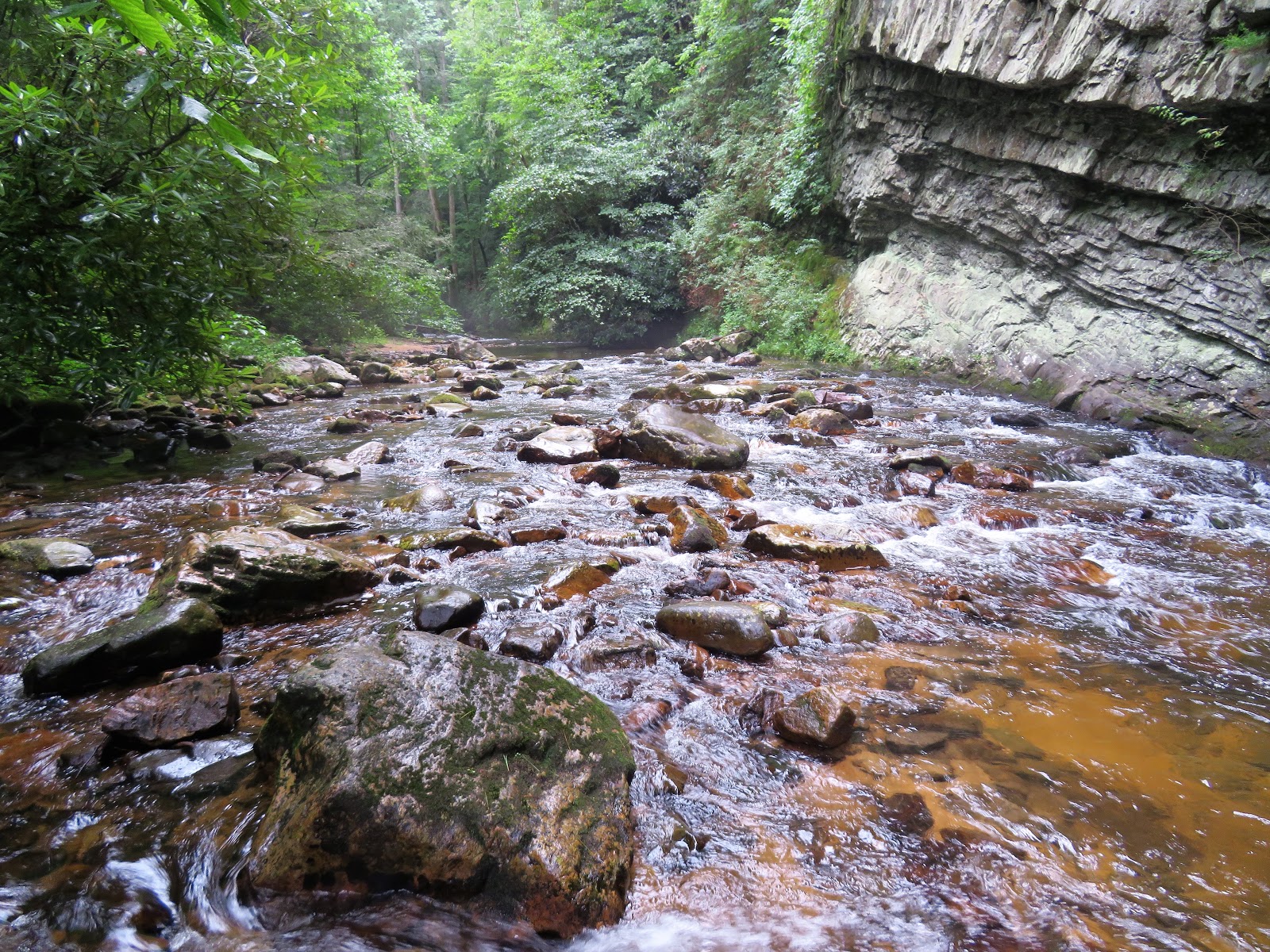
All along the river bank trail we had various views through forest windows. There are very few open views. But we sure could hear the flowing river and occasional laughter of kayakers who were drifting down the slow flowing river.


 It is no wonder that folks looking to connect Wilkesboro to Salisbury by river in the early 1800's would have tried to figure out how to bypass this rocky ridge. In 1820, some enterprising business folks raised over $30,000 to build the Bean Shoals Canal. That would be over a half million dollars in today's money. The idea was to create a low water dam from the Surry County shore to one of the midstream islands and divert the water through the Bean Shoals Canal.

The water would be deep enough to transport goods by small bateau thus opening trade with the western piedmont and mountains. Before they could finish the project, they ran out of money and the stone works were abandoned to the forest. If it had worked it would have been an engineering marvel. The railroad used the foundations left from the canal upon which they constructed their tracks. The remnants of hand hewn and laid stones give tribute to the unknown craftsman who laid them over 200 years ago.

 At the end of the Bean Shoals Canal ruins, the trail narrows and views are harder to come by. The river divides into three channels as it flows around several river islands. I understand that the water at this point was shallow enough that a horse and wagon regularly forded the river carrying mail. All that we saw in the river at this point was a river nymph....fishing with her boyfriend for small mouth bass.

 At this point we turned around and decided to walk out by way of the Yadkin Islands Trail but were unsure about where to pick up the trail off the Bean Shoals Access Road. To our rescue a Park Ranger appeared and not only told us how to complete our trail loop but even gave us a ride up the road to the trail. (which is why there is a gap in our route map above)


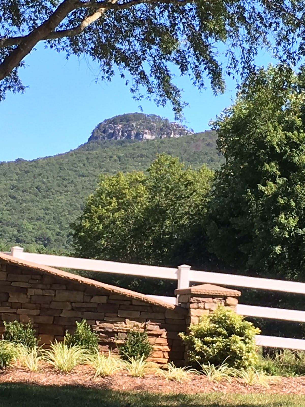
On the way out we ventured down the Shoals Road into the Surry County community of Shoals and took a view pictures of Jomeokee....aka Pilot Mountain.


In the late 1810s, Hillsborough landowner and lawyer Archibald DeBow Murphey hatched a plan to turn the Yadkin River into a commercial waterway, linking the western and central parts of North Carolina to the eastern part of the state. He wanted to make transportation easier between these regions, directing commerce from the western regions of North Carolina to Fayetteville and Wilmington rather than Virginia and South Carolina. As part of this project, it would be necessary to navigate around the Bean Shoals, an area of the Yadkin River with granite shoals, rapids, and shallow water.
Locals John Hixon and Hiram Jennings were commissioned in 1817 to devise a plan for getting around the shoals. They advised building a 3-mile-long canal, requiring a dam and three locks, to bypass the area; the cost for this was estimated at around $30,200. Murphey and others formed the Yadkin Navigation Company to sell stocks and raise money for the canal and other construction efforts. English engineer Hamilton Fulton was hired for the large sum of 1200£ in the summer of 1819, after the canal building had begun. By summer of the following year, much of the work had been done, but the company was running bankrupt with costs for the canal running over $38,000. In 1825, the company conceded that their plans had failed, and the project was never finished. Parts of the 1200 ft long canal wall, originally up to 20 ft high, can still be seen along the north bank of the Yadkin River at Bean Shoals.
http://www.journalnow.com/news/local/northwest-almanac-the-yadkin-river-canal-that-wasn-t/article_2f618bc5-2a81-5dc6-88d9-0ef4e6b9074f.html


