ROCK JOCK REDUX

 |
| Information Cabin and Rest Room is a required stop |
 |
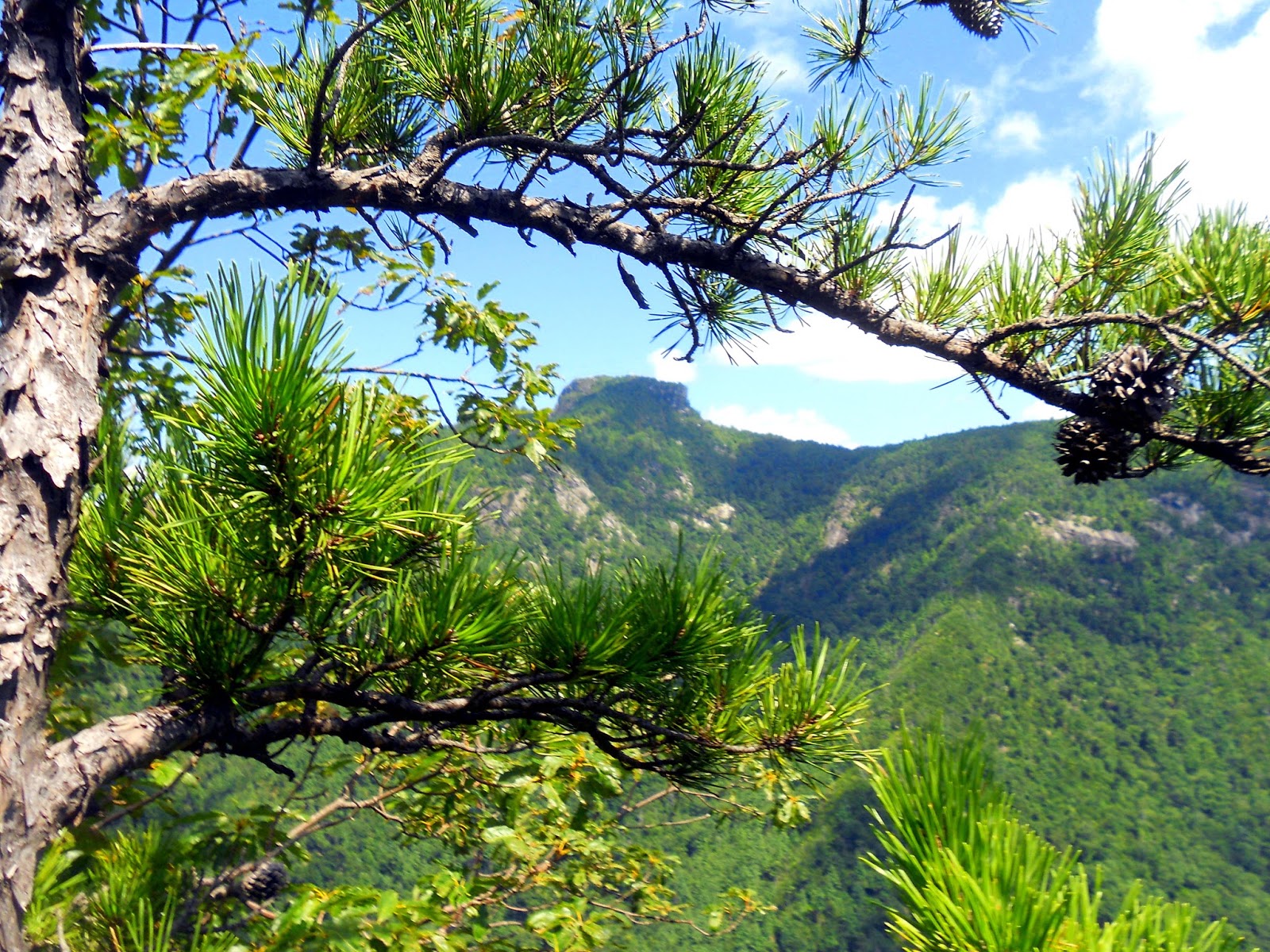
| Looking west beyond the Linville Gorge |
The views along Kistler are breathtaking. We were tempted to forego the hike and just take in these views instead but we knew as good as these vistas were that the ones on Rock Jock would be just as stunning.
 |
| Hawksbill from Kistler Highway |
 |
| Dead Snake |

Along the road in we saw a rare sight. A black timber rattler....fortunately a dead black timber rattler. But it was a foreshadow of things to come... Rock Jock Trail veers off from the Conley Cove trail and is a narrow moderately inclining forest path for about a half mile. We noticed that we were the only folks on the trail that day which is surprising for a Saturday afternoon hike. In fact the trail had many spider webs built across the path. I removed my collapsible police baton and was using it to knock down the webs when I heard my hiking companion let loose a scream that echoed across the Gorge...."SNAAAKE!!!!"
 |
| Live Snake! |
Truthfully, in reflection, the snake was very beautiful but neither of us were interested in anything but getting away from creature.....but it would not move until we lobbed some rocks at it and as it scurried into the woods it rattled its tail just so we knew it was a Timber Rattler.....how I was not bitten I do not know. More on that later...
Gathering ourselves we quickly left "Rattlesnake Alley" and scampered to the first rock cliff overlooking the Gorge to catch our breath.

We got a glimpse of Hacker's point and the North Carolina wall, a view that on our last trip was shrouded in clouds. Our first of many views of Table Rock Mountain was stunning.

It was with humble satisfaction that we gazed on these peaks recognizing that just last summer we had hiked to the summit of each and had gazed at the western side of the Gorge wondering what views were offered there. We even tried to spot climbers on the peaks of the Chimneys.

 Moving to Hacker's Point we were in awe of the majestic North Carolina wall. And of course Table Rock Mountain and Hawksbill Mountain

 We even got a glimpse of the peak of Shortoff Mountain in the distance to the south and the Linville River down below.
Moving on from Hacker's Point we were anxious to visit Blue Jay Falls which was the focal point of our first trip to Rock Jock....


It appears that on our earlier visit we got to observe a rarity in nature for Blue Jay Falls in fact is really not much of a falls at all.
There were several interesting views beneath the rock cliffs.


 We moved on from the falls and scampered through a rock canyon where we turned back on our last visit. The rock canyon is a steep incline that for a couple of hundred yards we actually thought we were off the Rock Jock trail. But soon at the base of a large tree we spotted the Rock Jock Trail which led us to the Split Rock of Rock Jock Trail.

The Split Rock is two large rocks which looks like the end of a loaf of bread sliced in half. We elected to take a lunch break in the shade of this rock.

Leaving the Split Rock we traveled upon the Rock Jock Trail seeking more views. I was told by folks on the Linville Gorge.net that the current Rock Jock Trail is a replacement of a Lost Trail that runs long the cliff sides. After about a half mile of forest trails with little prospect of Gorge views, we gave in to the lateness of the day and backtracked hoping to take in side trails on the way out and snap a few more views of the Gorge.

found many cliff side views we missed on the way in.
 |
| Table Rock Mountain |
 |
| North Carolina Wall |
We were treated with a variety of vistas of familiar peaks of the eastern side of the Gorge. The weather cooperated with a blue canvas of sky and clouds.


The "monster" looks like it is chasing something flying in the air....


The southern end of the Gorge is nicely framed with puffy white clouds. Shadows help frame the picture of Hawksbill Mountain to the north.


We sat quietly on this picturesque cliff, silence only interrupted by the quiet roar of the Linville River hundreds of feet below. A previous occupant of this site had constructed a campfire. I rearranged the rocks to form a cairn, thanking Almighty God for the beauty of His creation and saving me from being bitten by a Timber Rattler!
 It is always tough to leave the Gorge as there is just so much to see. But we left with the satisfaction that as much as we have seen, there is more left to see. I think the Rock Jock Trail is best hiked in two sections. The northern section which we hiked today offers so many views it must be taken in completely in one hike. We will return to hike the Rock Jock from the south next time.
On the way out we walked carefully through "Rattlesnake Alley" making lots of noise hoping our friend was long gone. On the way home I questioned my hiking companion about what she saw and pondered how I avoided a snake bite. Then at home I examined my hiking boots and learned that I had not escaped a bite....I was just lucky the bite was absorbed by my hiking boot!

You see like I have always said, the good Lord looks after, drunks, fools and Fat Bald White Guys!

Rock Jock Trail North may be one of the best trails in the Gorge. Relatively short and moderate in intensity, it offers some stunning views of the Gorge. Access is an 8.....scenery is a solid 9...... the trail receives an 8 only because of "Rattlesnake Alley". Overall an 8+....


