Saturday, July 28, 2012

Fort Fisher State Park Carolina Beach State Park

                            FORT FISHER

                            CAROLINA BEACH STATE PARK


FORT FISHER

Looking Down the Barrel of Shepherd's Battery


Taking a trip to the Wrightsville Beach did not deter the Fat Bald White Guy from finding a trail to hike.  Late Thursday afternoon we set off to explore one of the most important Civil War Sites in North Carolina-Fort Fisher. Located on a peninsula south of Wilmington, the fort guarded the Cape Fear Inlet and allowed Blockade Runners to supply Gen'l Lee via the port at Wilmington.


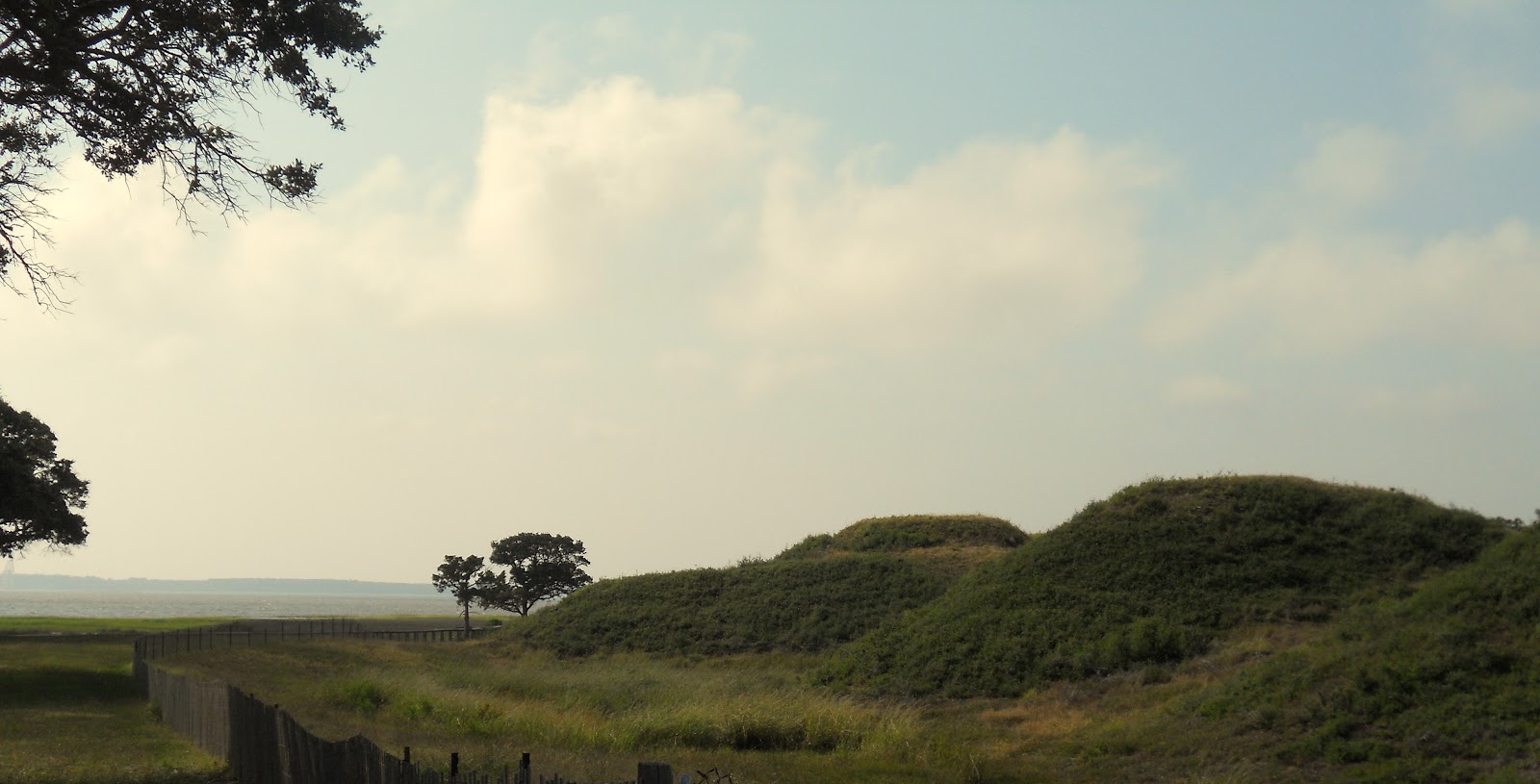
The Fort Fisher State Park maintains the remnants of one of the largest coastal fortifications of its time. Only about 10% of the Fort remains and there is a nice one mile tour trail that circles the sand embankments.  On the western end of the northern wall Shepherd's Battery has been restored, providing you with a glimpse of what it must have been like as Yankee troops marched up the Old Wilmington Road to attack the fort.


The Fort was named for Colonel Charles Fisher from Rowan County, the commander of the 6th North Carolina who was mortally wounded at the Battle of First Manassas.


The walls were constructed of sand in order to absorb a bombardment. The seaward wall boasted 22 guns atop 12 foot walls.  The southern wall had two large gun emplacements on top of embankments over 45 feet tall.  The northern wall faced landward with 25 guns distributed among 15 sand embankments each 32 feet high. Fronting the north wall was a nine foot tall wooden palisade.  Some called Fort Fisher - "the Gibralter of the South"


Shepherd's Battery features a fully operational ten inch Columbiad which is a smooth bore cannon capable of firing a 130 pound round ball three miles.  Also a part of the restored Battery is a "bombproof" where ammunition was stored.


Fort Fisher kept open the port of Wilmington throughout the Civil War finally falling in January of 1865, just months before Lee surrendered at Appomattox.  

An obelisk was erected in 1921 on the site of fort's command post.  There in the midst of the bombardment of 58 warships, the Stars and Bars were shot down.  A new flagstaff was erected and Christopher Columbus "Kit" Bland, a teenager from Shallote, shimmied up the flag post on two occasions to replace the flag.  Observers recalled that Union ships paused their bombardment in deference to this act of bravery. 
Surpassed only by the bombardment of Normandy in 1944, Fort Fisher was subjected to the largest naval bombardment in the history of battle.
Looking South toward Battery Buchanan from atop of Shepherd's Battery


If you drive past the State Aquarium you will soon come to Federal Point.  There stood Battery Buchanan, a separate fortified sand bunker.  This was the last portion of Fort Fisher to fall.   The Battery no longer looks very menacing.  It is a tall sand mound occupied now by a single tree.


Federal Point now serves as the northern port of the North Carolina Ferry that connects Fort Fisher to Southport.  Make sure you get there in time to ride the Ferry to Southport!


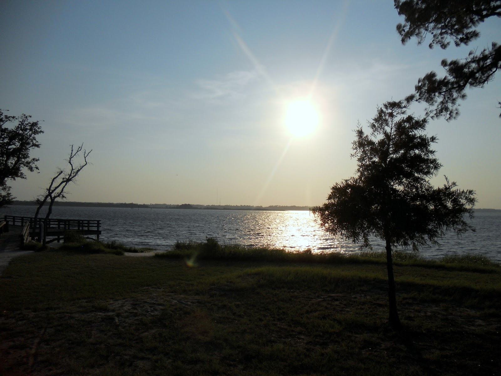
From atop Battery Buchanan there is a wonderful view of the Cape Fear Inlet.


Once a battlefield where Americans fought Americans in an unnecessary bloody civil war,  Federal Point now is a recreation site.  I am not sure what you call the sport but "para-surfing" seems to be an apt description.


The point is very windy and there is a grassy marshland that separates Battery Buchanan from the Cape Fear Inlet waterway.


The path from the top of Battery Buchanan connects with an asphalt and stone jetty that seems to extend endlessly into the Cape Fear Inlet.  This is not a trail the Fat Bald White Guy needs to attempt!


"Eventually all things merge into one, and a river runs through it.  The river cut by the world's great flood and runs over rocks from the basement of time. On some of the rocks are timeless raindrops. Under the rocks are words, and some of the words are theirs."  Norman Maclean


CAROLINA BEACH STATE PARK


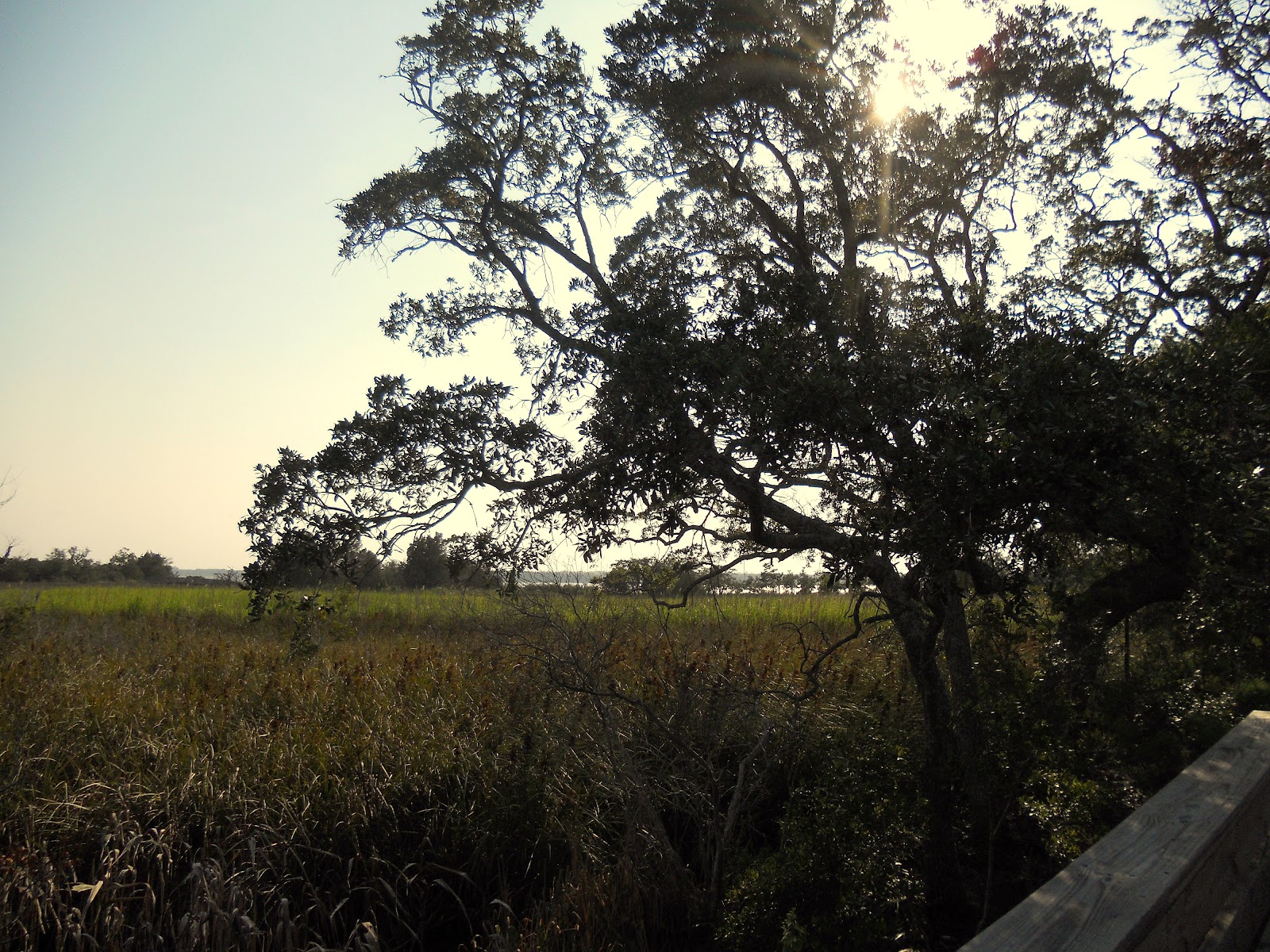
About three miles north of Fort Fisher is the 761 acre Carolina Beach State Park.  Located on land originally occupied by the Cape Fear Indians, it also served as the temporary camp for Union soldiers preparing to attack Fort Fisher.  The park contains a nice campground, marina and clubhouse.....and hiking trails.  The North Carolina State Park system has a very nice IPhone App that allows you access to a real time GPS map of State Park hiking trails....thanks to my reference of this App, we set out about 5:45 PM to hike the Sugarloaf Loop....a three mile jaunt through a coastal forest.


After struggling along rocky trails on the way to Mt. Rogers, we were thankful for trails that were sandy


We also had a chance to get some nice views of the Cape Fear River in the hour before sundown.....


The trail weaved along the coast line until it disappeared into the water....it seems the trail to Sugarloaf Dune has been washed out...but no worry....there are many interlocking trails at the Carolina Beach State Park and we took another route....


Looking across the marsh grass we could see where the Sugarloaf Dune trail used to be.....


We soon encountered a most interesting ground cover in the coastal forest.  It looked from a distance like it had snowed!....but the closer we got it looked more like the ground was covered with dryer lint....but finally we got a close up look at "Raindeer Moss" or  "Powder Puff Lichen"....the scientific name....."Caladonia Evansi"


Wouldn't you know it....even in a coastal forest....there are hills!....and this one had a trail up it of sand!....not to worry....even in 90 degree heat the Fat Bald White Guy was up to the challenge!


From the top of the hill, we rejoined the Sugarloaf trail....the trail to the dune was blocked off on this end as well....knowing what I know now I think I would have ventured out and back to the dune....but our trusty State Park GPS app directed us down the hill and further into the forest away from the Cape Fear River.....


With the sun setting in the west, we were treated with several nice spotlight views of the Old Sol peaking through the pines and oaks.


As the trail weaved its way through the forest, we also got a look at some unusual trees..... 


We also encountered grassy ponds....I am sure that these areas are prone to flooding but as dry as it has been, they were more like a meadow than a pond....also I kept my eye out for "Venus Fly Trap" plants but since I really don't know what one looks like I guess I could have seen one and not known the difference.


For the most part the trail was sand covered by pine needles....but this quarter mile stretch was like walking on beach sand....but without the sea breeze.....remember it was 90+ degrees.....can you say "calf burn"?


The last 3/4 quarter mile of the trail took us through a much more mature forest....taller, older trees....and as we were now walking westward we picked up a nice river breeze in our face....but for my hot and tired dogs, this was the best part of the hike.


In fact as the sun begin to get lower on the horizon, the interplay of its spotlight on the dry marshland provided a "green glow".


We ended the loop in the Marina parking lot.....it was getting late....we were tired, sweaty and hungry, but very satisfied  that we found an enjoyable hike....even at the beach....it was not as pretty as Linville Gorge... but I did get to see a part of our State that I had not seen before.


As I paused to take one last picture of the sunset over the Cape Fear, a lone seagull flew over and headed down the river....proving once again that the wonder of the creation that God has provided us is amazingly beautiful....if we but take time to appreciate it!

Sunday, July 22, 2012

Grayson Highlands To Mount Rogers


           MOUNT ROGERS ON APPALACHIAN TRAIL 


We decided to venture into the Old Dominion and visit the Grayson Highlands State Park and the Mt. Rogers National Recreation Area.  The hike looked on paper to be a moderate 8 mile out and back with our destination being the summit of Mt. Rogers, the highest peak in the State of Virginia. The trail featured many interesting features and proved to be one of the most challenging ventures of the summer.


Grayson Highlands State Park is a popular recreation area snuggled deep in the southwestern corner of Virginia.  Getting there is easy- take I-77 to Galax, the Highway 58 to the Park which is about 35 miles away. On the way in you will drive on the JEB Stuart Parkway through Independence and Mouth of Wilson on the banks of the New River.  Park in the "Overnight Backpackers"  Parking Lot and the blue blazed trail will take you up a forested path to a meadow ridge connecting with the Appalachian Trail.  


We did not realize it at the time but the hike up to the Appalachian Trail marked the first of four summits we would have to climb on the way to Mt. Rogers.  The elevation of each being in excess of 4500 feet....taller than Hawksbill....more like the elevation of the Swinging Bridge on Grandfather Mountain.  Notice the hat on the signpost. Seems that folks along the trail adorn the signposts with gear found lost along the trail.


Near the peak of this first summit, we began to hear laughter of children and as we looked up we saw venturous teenagers standing on the peaks of some very interesting rock formations. 


 From the summit of the first peak, we got some nice views of the surrounding mountains...but what my hiking companion came to see were the Wild Ponies of the Grayson Highlands and it did not take long before we glimpsed the first pony of the day....


 Wild Ponies have been introduced to the upland meadows of Grayson Highland State Park to help reduce the risk of forest fire. It seems these herds of ponies keep much of the wild grass land under control and in the process become quite plump.  They are supported by a non profit organization who keep them healthy and it is my understanding will occasionally offer some for sale to thin out the herd.  Fortunately, there was no room in our SUV for I think Rene may have taken a couple home!


The largest group of ponies were found on the downhill side of the summit.  Rene left the trail to go and greet them and I stayed on the trail to snap a few pictures but it did not take long before one of the prettiest ponies of the herd came over to me bringing with her a young colt.


The young pony came right over to me and a group of hikers and immediately began to sniff out a treat.  Park rules prohibit the feeding of the ponies but the ponies can't read.


From the meadow on the other side of the first summit we got a glimpse of the hike before us.  Again I was reminded that mountain math does not take into account the linear distances. 3.8 miles on that sign was the mileage as crows fly....not as a Fat Bald Hike Guy walks!

Our next summit was rising in the distance.  I assumed that Mount Rogers would be just over the ridge ......yeah right!


 The terrain in this area of the Blue Ridge is very different that what we have experienced in North Carolina.  Some say it reminds them of Scottish Highlands, others say it reminds them of hiking in the Rockies....it is very rocky and very open which allows you to see where you are going.....and how far you have hiked.  The second summit is Wilburn Ridge from which there are some really nice views.  To get there you follow the Appalachian Trail and leave Grayson State Park and enter the Mount Rogers Recreation Area

The hike up Wilburn Ridge was described by the writer of another hiking blog.....he said is was very rocky climb but was one of the most scenic views and he was right on both accounts.


Look closely and you can see the "blue blazes" which mark the trail....incredibly this was one of the easiest summits of the day and was well worth it for the views it afforded.


From the summit of the Wilburn Ridge, you have a 360 degree view of the surrounding mountains.


Looking back down the trail you can see the first peak we climbed......and looking the up the trail you can see the next peak...no that is not Mt Rogers!  I am sure that Mt Rogers will be just over the ridge....yeah right!


We return to the "white blazed"  Appalachian Trial and take a rocky path across this third peak to Rhododendron Gap....while we chose to bypass the summit of this peak, the trail up was quite rocky but provided some interesting views.


The temperature was in the mid 70's and overcast with nice cool breezes....I cannot imagine how difficult this hike would be in full sunlight with temperatures in the 80's


The views on the trail to Rhododendron Gap were some of the best of the hike....but the trail was one of the more challenging sections of the day.


Especially as the trail led into a cave!.....It was narrow and dark and the Fat Bald White Guy was not sure how wide it was!

 But we made it through.....only to find that there was another ridge to climb....but it was not Mt. Rogers....but you could see Mt Rogers at long last.....We were told that Mt. Rogers was a forested ridged mountain....and every peak we climbed and saw to that point had a rocky ridge....


The sign said that Mt Rogers was only two miles away! And one more ridge to climb to get there!


 Looking back on the fourth summit we climbed....you can get and idea of the rugged nature of the hike.
This area of the Appalachian Trail is very popular. In fact you could not walk a couple of hundred yards without encountering other hikers- young, old, male female, many with dogs....camping in many wonderful trail side camp sites....and by the way there were steers.....yep long horned steers grazing on the mountainside.  


Look carefully and you can see the faint outline of four hawks performing and aerial waltz.....mocking us foot tired earthbound creatures!


Out next stop was the Thomas Knob....there a shelter is built for the folks traveling the AT....and there was a spring fed creek where water could obtained....the view there was magnificent....the best of the day.


From Thomas Knob you can see the summit of Mt Rogers....just another mile away!  We had been on the trail for four hours and it being past 4 pm....we decided that we did not want to risk being on the trail back after sundown so we made Thomas Knob our final destination.  Truthfully, climbing four peaks over the most rocky trail imaginable, we felt that lounging on Thomas Knob was the best reward of the day.....so I went to the spring to refresh water supply and we headed back.


Looking back from the spring, you can see my hiking companion sunning herself on Thomas knob.


Hiking out we stopped many times to rest our tired feet....words cannot describe how rocky the trail is and how unpleasant the hike out was....it was like walking barefoot on a gravel driveway....you had to watch every step and every step was painful....but nevertheless we had many nice vistas to enjoy.


We also got to enjoy many examples of God's imaginative artistry in the form of flowers, flora and mushrooms.....stunningly beautiful!


Even on the most difficult hikes all you have to do is pause and you will see very special adornments of nature all along the trail....this hike was no exception.


This is the closest I got to the Summit of Mt. Rogers....I don't regret the trip as I experienced an area of the Blue Ridge unlike any that I had ever seen before.....the scenery was stunning....but the trail was brutal....with every step there were several rocks competing for the chance to bruise by dogs....so how can I rate this trail?   The Fat Bald White Guy gives the access an 8.....the scenery an 8.....the trail a 2.....the overall hike is a 5....but don't count on me doing this one again!

Life is complex. Each one of us must make his own path through life.
There is no self-help manuals, no formulas, no easy answers.
The right road for one is the wrong road for another....
the journey of life is not paved in blacktop; it is not brightly lit.
and it has no road signs.
It is a rocky path through the wilderness
M. Scott Peck