DR. KRON'S HOUSE


Morrow Mountain is another great North Carolina State Park located at the confluence of the Uwharrie, Pee Dee and Yadkin Rivers. By damming the river at the falls, Lake Tillery is formed. The park boasts a little bit of everything compacted in 4500 acres. Morrow Mountain is a remnant of the majestic peaks of the Uwharrie Mountain range. Some millennials ago, these mountains were some of the tallest in the world reaching 20,000 feet. Today a 940 foot monadnock is all that remains. http://www.stateparks.com/morrow_mountain.html?official+home+page


Fall Mountain is a 755 foot ridge top that overlooks the Yadkin River Dam below the marina. Beginning at the marina, a nicely marked trail meanders along the river bank. Interspersed with an occasional fisherman, this part of the trail is frequented by families of park visitors. From the banks you can see speed boats, fishing canoes and various recreational boating pictured against the green backdrop of the Piedmont ridges of the Uwharrie Mountains.


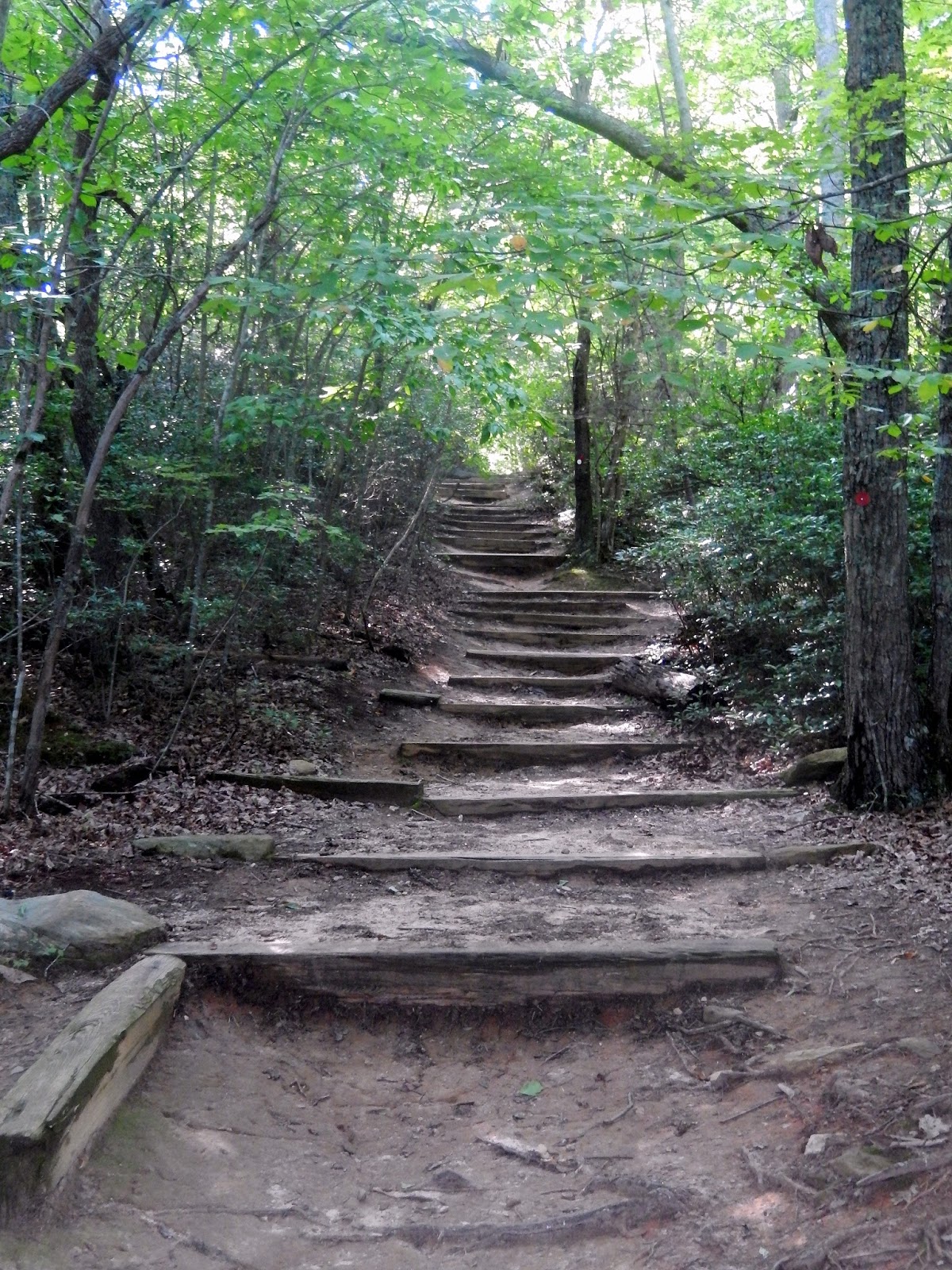
 The trail soon leaves the riverbank and begins its 500 foot meander up Fall Mountain. The trail is well maintained and well marked and contains long switchbacks which eases the climb. About a mile in, there are remnants of a fire and this lone standing burned tree is a good mile marker.


The trail quickly rises to a gentle sloping ridge that is remarkably clear of undergrowth. The only problem is the trees that block the view of the river below.

On the northwestern side of the ridge top is a natural rock wall from which we got occasional glimpses of the river below.


No doubt the views of a late fall or winter hike would be better. If I were a Ranger at the park I might show up one day with a chainsaw and create a nice overlook. I am sure the views are nice if you could see them.

 The ridge top is relatively flat of void of the undergrowth that usually is present in North Carolina forests. The rocks are a great place to rest your dogs. The rest of the hike is pretty much down hill.
 As is my custom, I always pause to either build or add to a trail cairn. It serves as my time to thank our Creator for the beauty of the day and the glory of His creation. Today there was a large trail cairn already constructed on the southern side of the ridge. And as I added stones to the top, I silently prayed my prayer of thanksgiving. But as I began to balance rocks at the top, my thoughts were drawn to Pastor Jadd Boulos who recently received a troubling diagnosis of cancer. Yet, every time I prayed a prayer for Pastor Jadd, the stone fell and I had to pray some more. For healing and strength and most of all for God's peace. Maybe you can say a prayer for Jadd too.

The rest of the hike is mostly downhill. I figure the summit was about 2.2 miles in, so I figured another two miles and we would be back in the parking lot marina...wrong...the trail is a little longer than the advertised 4.1 miles...and we also took a nice side trip. But I did find a neat feather from a large bird.

At a little more than 3 miles into the hike the trail flattened out and to the left was a clearing in the woods. Standing in the clearing is an obelisk noting the presence of a grave site.


Walking to the grave stone, I became aware that this was the family grave yard of the Kron Family. Dr. Francis J. Kron, his wife Catherine, and his two daughters, Adelaide and Elizabeth lived at the foot of Fall Mountain on a small ridge above the river.


Dr. Kron was born in Prussia and educated in Europe. His wife, Catherine Delamothe was born in France and they married in Paris in 1823. Following his wife's wealthy uncle to North Carolina, they built a homestead in the remote back woods of present day Stanly County where two daughters were born and raised.


Not far from their grave site is their restored home place. The house is a remarkably well restored replica of the original which stood on this site into the 1950's.


The house, medical office,

 A medical doctor in ante-bellum North Carolina was much sought after and he was known to travel the country side tending to his patients. He maintained a medical office which doubled as a hospital and was a known apothecary as well, developing Dr. Kron's little pills. Educated at the University of Pennsylvania, he was one of the very few physicians in the area.


Though well educated, neither Adelaide nor Elizabeth ever married. They eventually inherited but lost the fortune and plantation of their rich uncle across the river. Like their parents they are buried in an ill kept grave yard not far from the family home place which was known as "Attaway Hill".


Leaving the Kron Homesite, we proceeded down the trail. The trail down the mountain is deceptively long but eventually emerges into a grassy wooded river flats.

As we arrived at the marina parking lot, the detached voice from my Map My Fitness App announced a 5 mile hike. But the hike was not over until I got some pics of Lake Tillery from the Marina Pier.

 The access to the trail head relatively easy. Morrow Mountain State Park is located southeast of Salisbury off NC 52, or south of Lexington off NC 109 via NC 49. Follow the signs to the marina and the trail head is easy to find. - 8; The trail is well maintained and marked - 8....but the scenery is lacking-7; the effort to view ratio really does not apply since there is not much to see on the trail.

But add the historical home site and the riverside and you have a nice five mile 8 graded hike.


For more information on Dr. Kron and his amazing life, take a took a this website: http://stanlycountymuseum.com/dr-francis-kron/

Not far from their grave site is their restored home place. The house is a remarkably well restored replica of the original which stood on this site into the 1950's.


The house, medical office,
water well, and
green house tell a nice story of the life of a rural doctor and his family. A nice personal touch is the grapevine in that Dr. Kron was avid horticulturalist, growing many exotic plants and fruits, even providing his research to the Smithsonian.

 A medical doctor in ante-bellum North Carolina was much sought after and he was known to travel the country side tending to his patients. He maintained a medical office which doubled as a hospital and was a known apothecary as well, developing Dr. Kron's little pills. Educated at the University of Pennsylvania, he was one of the very few physicians in the area.
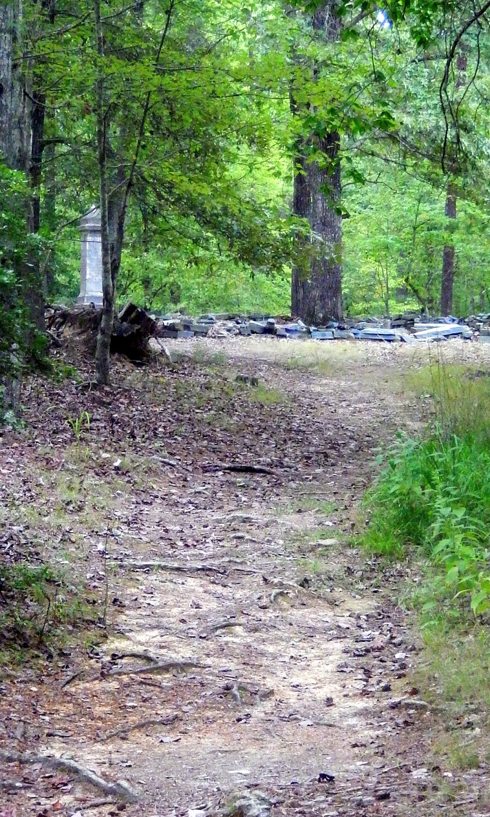
Though well educated, neither Adelaide nor Elizabeth ever married. They eventually inherited but lost the fortune and plantation of their rich uncle across the river. Like their parents they are buried in an ill kept grave yard not far from the family home place which was known as "Attaway Hill".


Leaving the Kron Homesite, we proceeded down the trail. The trail down the mountain is deceptively long but eventually emerges into a grassy wooded river flats.

As we arrived at the marina parking lot, the detached voice from my Map My Fitness App announced a 5 mile hike. But the hike was not over until I got some pics of Lake Tillery from the Marina Pier.

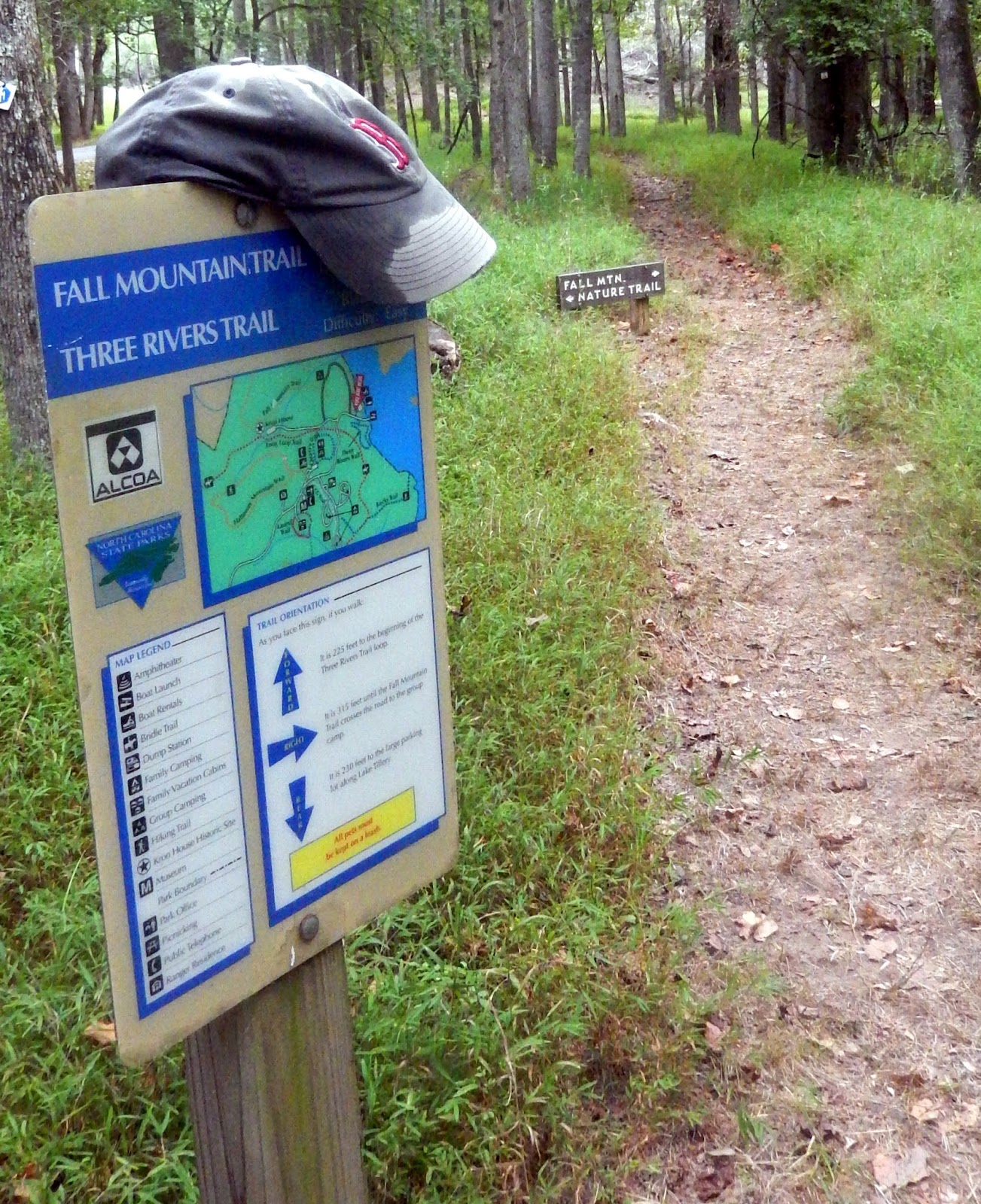 The access to the trail head relatively easy. Morrow Mountain State Park is located southeast of Salisbury off NC 52, or south of Lexington off NC 109 via NC 49. Follow the signs to the marina and the trail head is easy to find. - 8; The trail is well maintained and marked - 8....but the scenery is lacking-7; the effort to view ratio really does not apply since there is not much to see on the trail.
But add the historical home site and the riverside and you have a nice five mile 8 graded hike.


For more information on Dr. Kron and his amazing life, take a took a this website: http://stanlycountymuseum.com/dr-francis-kron/