CUMBERLAND KNOB- GULLY CREEK TRAIL


On September 11, 1935, construction began on the Blue Ridge Parkway. A project of the Civilian Conservation Corps (CCC), construction began a few miles north of Low Gap, North Carolina. Near Low Gap, the first recreational area opened to the public in 1937 was the Cumberland Knob Recreation area. Located about an hour from Winston-Salem, this park has for decades served as a gathering place for citizens of all ages. The visitors center was once a sandwich shop and is now adorned with pictures of our grandparents enjoying a day on the Blue Ridge Parkway.


From the back door of the sandwich shop in 1946, visitors could see the outline of Pilot Mountain to the Northeast.

The view from the back door of the Visitor's Center is hidden by the growth of trees but you can still see Pilot Mountain.

The reason the Fat Bald White Guy chose to visit Cumberland Knob was the proximity of the Gully Creek Trail to the newly constructed Blue Ridge Music Center located 4 miles north on the Parkway across the line into Virginia.

Performing this past Saturday was the Synder Family and Joe Mullins & the Radio Ramblers.

JESUS STOOD AND CRIED OUT SAYING: "IF ANYONE THIRSTS, LET HIM COME TO ME AND DRINK. HE WHO BELIEVES IN ME....OUT OF HIS HEART WILL FLOW RIVERS OF LIVING WATER. JOHN 7:38
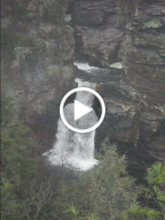
The Gully Creek Trail
The Gully Creek Trail Head leaves from behind the Visitor's Center at Cumberland Knob and descends nearly 900 feet along a spring fed creek bed to the gully below. The Trail is marked "strenuous" and we have learned to double any mileage on a trail head marker. Nevertheless the Fat Bald White Guy was undaunted by the challenge and the resulting hike was one of the best surprises of the summer!


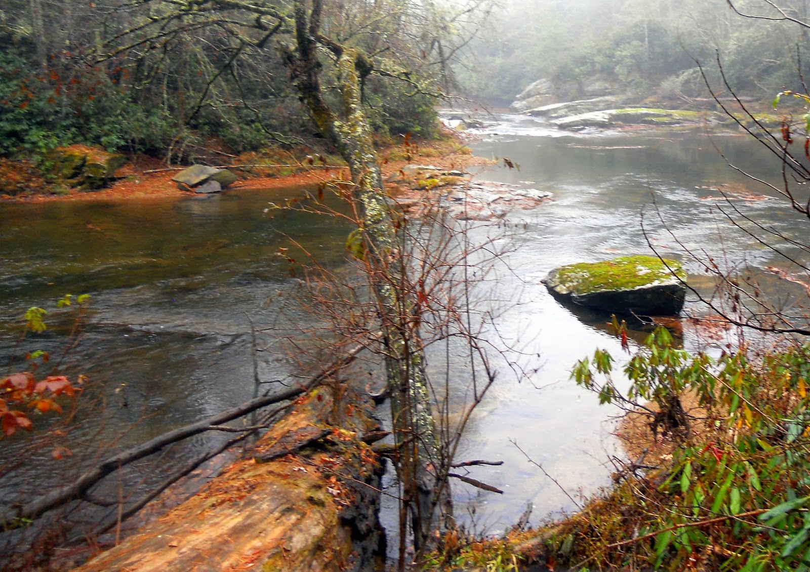
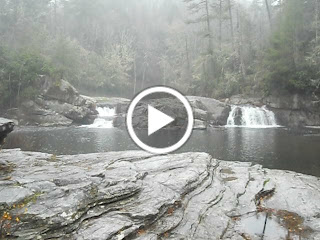
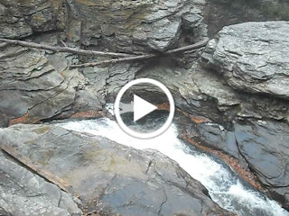
The trail meanders with the bank of the creek as water cascades down the mountain creating a roar as waterfalls of various sizes are created as water rushes over exposed rocks.

As the creek reaches the bottom of the gully, the trail and the creek merge. The trail crosses the creek many times over shallow fords. Don't worry about keeping you feet dry.


The creek is covered nearly completely by a forest canopy of verdant foliage. Sunlight occasionally bursting forth like a spot light illuminating the new rhododendron blossoms


Leaving the creek bed, and beginning the ascent to Cumberland Knob, the trail narrows and follows the ridge of the mountain in a manner that reminds you of how early settlers may have followed Indian hunting trails.


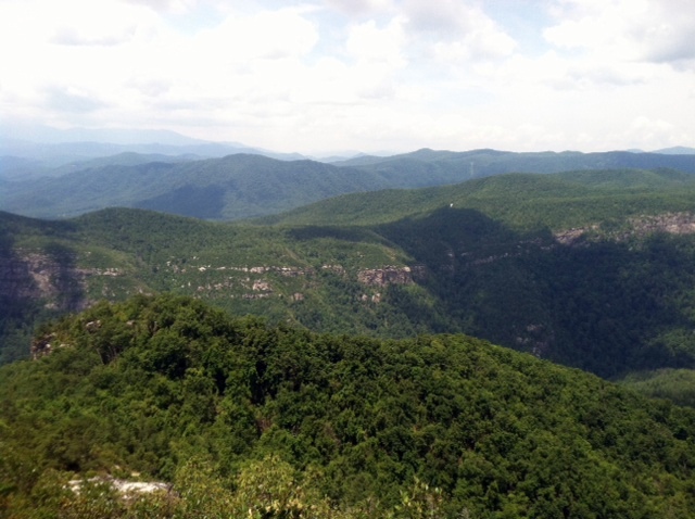
Occasional glimpses of the surrounding mountain peaks can be taken through gaps in the forest. This has to be a stunningly beautiful trail in the autumn. The "strenuous" warning on the sign at the trail head was but a distant memory when I was playing in the creek, now becomes a reminder as the thump of my heart easily outpaces my gait.
As you reach the base of the summit of Cumberland Knob you are given a choice of a 10 minute hike directly to the parking lot or a 30 minute bypass through Cumberland Knob. Thinking there to be a wonderful view waiting, we chose to make the climb to the Knob at elevation 2885, some 900 feet from the creek bed below. Our reward was not a view as surrounding trees obscures any vista. Instead we got to rest our weary bones on the benches of a 1938 CCC constructed picnic shelter.

An easy descent from the Knob shelter to the parking lot borders a large grass meadow where members of the Caudle Family Reunion were chasing kids and lounging in the sun. Time really has not changed this place very much. So if you want a challenging but rewarding hike.....a nice secluded place for a family picnic or just a taste of a place where your grandparents once visited .... Cumberland Knob and Gully Creek Trail is a great afternoon adventure....it also has a campground and a nice "comfort station" for those overnight guests.
The Fat Bald White Guy ranks the Gully Creek Trail an 8; Access is 9....Scenery is a 8......Trail is a 7 only because it ends with a disappointing vista after a long steep pull.....Next time we will reverse the trail and see it the return is quicker.
By the way the concert was great! The Synder Family consists of a 13 year old Fiddler and a 17 year old guitarist that are spectacular.
http://www.youtube.com/watch?v=gT_QpKk1TDE&feature=related Synder Family remakes "Call me the Breeze"
http://www.youtube.com/watch?v=58X6NSatp2Y a little sample of the Joe Mullins and the Radio Ramblers
Directions: Talk US 52 North past Pilot Mountain and just before it merges with US 77 take the exit for NC 189 toward Galax which takes you through Low Gap, NC and just north of Low Gap exit NC 18 to the Blue Ridge Parkway...take a right and Cumberland Knob is at MP 217....when you leave take a right and drive North four miles into Virginia to the Blue Ridge Music Center. Great interactive museum is on site.