THE THREE BALDS OF CARVER'S GAP

 The Appalachian Trail hugs the border of North Carolina and Tennessee at Carver's Gap. The renowned trail traces the ridge line of the largest mountain balds in the southeast. The seven mile trail snakes through over 1000 acres of mountain grasslands. What better place for the Fat Bald White Guy and his Faithful Hiking Companion to come to get a view of autumn in the Blue Ridge.
 The Roan Highland is a 20 mile massif. On the southern end is Roan Mountain which consists of five peaks divided by Carver's Gap. At 5512' the gap divides Roan High Knob and Roan High Bluff from the three balds, Round Bald, Jane's Bald and Grassy Bald.
  We chose to hike from Carver's Gap to Grassy Bald. Arriving at 10:00 am, we found the gap fogged over with visibility about 50 yards.
Not to be deterred we jumped on the trail confident that Ole Sol would do his job and burn off the mist by the time we reached the summit of the first bald. The trail is directly across the highway from the Carver's Gap Sign and is a broad graveled path rising about 300 feet to Round Bald.

But first we had to travel through some spooky woods...appropriately accented by the late morning fog. I was expecting to see Harry Potter and the Hogwarts crew fly through any moment.

 As we emerged from the green forest we found that the fog was far from lifting. In fact we were beginning to get worried that we picked the wrong part of the Blue Ridge to hike fearing that we may get fogged in all day.


As we reached the bottom of Engine Gap, we looked to the right side of the trail and saw the North Carolina Mountains and to left side of the trail we saw the panorama of the Tennessee mountains, each appearing as if a curtain had been raised.


We lingered taking in the incredible view for several minutes. As the clouds moved a new, incredible scene was revealed. Reaching into Tennessee, there were mountains as far as the eye could see.

We eagerly looked to our next destination. The summit of Jane's Bald was revealed as the fog lifted. On top of the ridge we could see people enjoying the view.


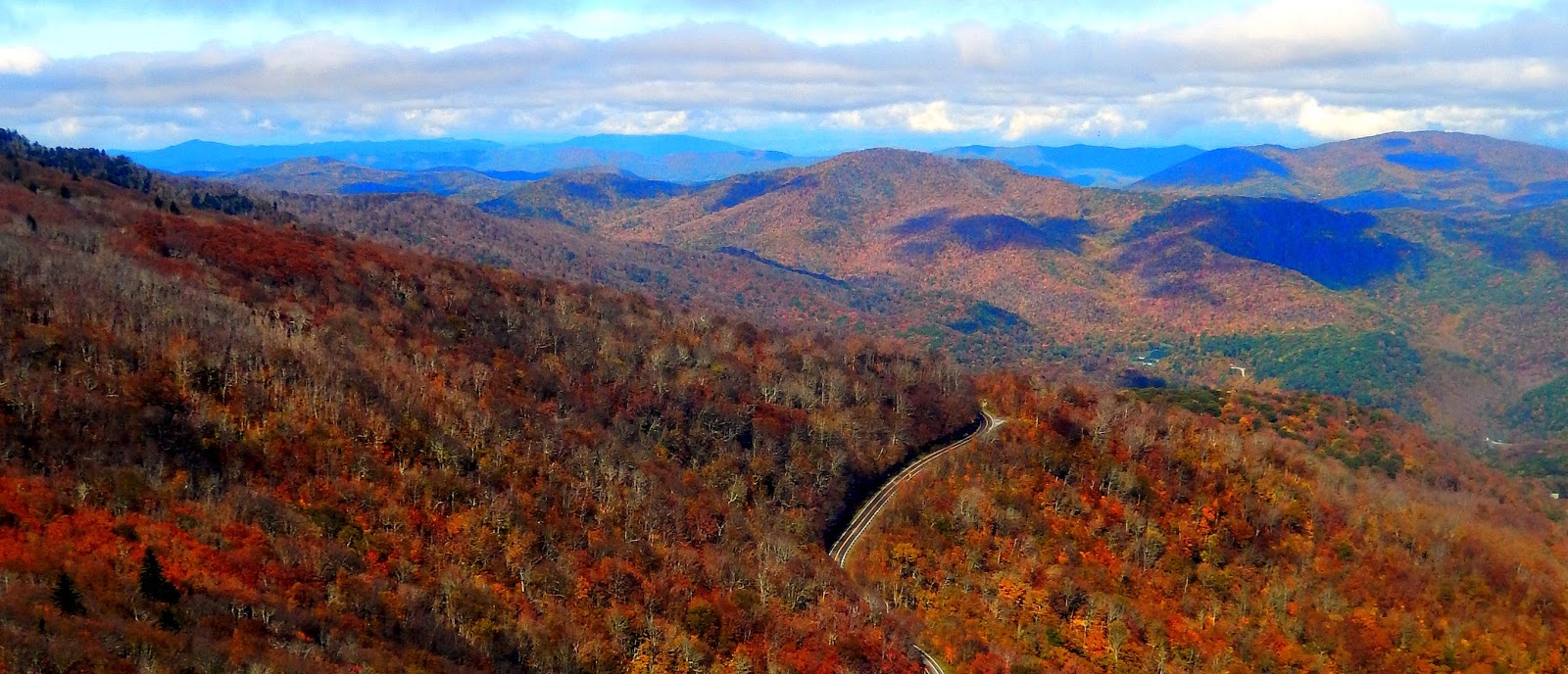


To the south, the outline of NC Highway 261 snakes down the mountain towards Bakersville.

Legend is that the summit, Jane's Bald, was named for an early settler who died of milk sickness. Whatever the story, her mountain top certainly offered us an incredible view.


 |
About 2/3 of a mile up the narrow trail we suddenly found ourselves on the lower slopes of the grassy bald which measures several hundred acres.
We stopped in our tracks as we realized looming in the distance was the distinctive outline of Grandfather Mountain!


 The trail snakes through the grasslands gently rising to the summit where is located a brass plaque placed in memory of Cornelius Rex Peake, a beloved mountain farmer who is buried on nearby Roan Mountain. From this spot we caught the best view of the summits of Jane's Bald, Round Bald and Roan Mountain.
Leaving this spot to explore the grassland bald. We marveled that at 6189 feet we were at an elevation higher the the peak of Grandfather Mountain. No wonder we had such a good view of Hugh Morton's mountain.


 Finding a nice rock cliff facing south we decided to take a power bar lunch break and wait for the clouds to lift over Mt. Mitchell. The grand dame of the Black Mountains had been shrouded by clouds all day but seeing the clouds moving, we were hopeful that she would peak out. She did not disappoint us!


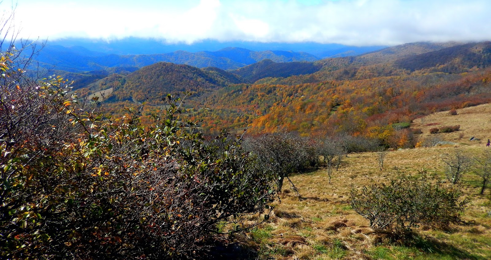
Leaving the bald we got a chance to linger over some stunning views to the north. The clouds provided an interesting contrast to the hillsides dotted with color of fall.

The elevation caused the multi-colors of the autumn mountainsides to look like ginger cake in the distance.

We also got another glimpse of the other balds and Roan Mountain. I think the Christmas Tree in the middle makes this picture!

Hiking out proved to be a bit more tricky than hiking up. The loose rocks of the narrow trail down from Grassy Bald combined with the wet rocks encountered from the descent of Jane's Bald resulted in two falls between us. Just call us "Grace". No injuries to anything but our pride. We paused and eagerly embraced the views we missed on Round Bald.

We got a nice view of Grassy Bald summit.


Two surprises were seen. The first was Sugar Top Condominiums and yet another view of Table Rock Mountain.

Roan Mountain is covered with evergreen. But you can also see how close the Round Bald Summit is to the parking area, which explained why this bald had become so sociable. One family was lounging in the sun while their mother was reading Genesis 1 from her smart phone. I could not help but ease drop catching phrases as I walked about snapping pictures.

"In the beginning God created Heaven and Earth...and called the light 'day' and the darkness 'night'...Let there be a firmament which was above the waters....and God called the firmament 'heaven'...and God called the dry land 'earth'...and said 'Let the earth bring forth grass, the herb yielding seed...' and the earth brought forth grass and the herb yielded seed...and God said: 'it is good'...AMEN!"


Each time I read one of your blogs, I am inspired again at the beauty of God's creation and the fact that I, too, need to get out on those trails more often!
ReplyDeletestart out easy. ...two great state parks are nearby.....Hanging Rock and Eno River...I have profiled them both in several entries....also the Piedmont Environmental Center in Jamestown is a lovely walk...TAKE A HIKE!
DeleteHi, I came across your blog yesterday and am loving the photos. As an adult I lived for 33 years within a 25-minute drive of Blowing Rock and the Blue Ridge Parkway and before that, as a child some of my first memories of the area are of going to Tweetsie R/R, going to Grandfather Mountain and crossing the Mile High Suspension Bridge as a somewhat scared but intrepid 12-year old. Many of the places you've photographed are familiar and well-loved (and photographed many times by many different cameras through the years. My only concern is that when I go to your blog my browser, Chrome, Windows 10, displays 'Not Secure' in the address bar. I generally don't go to websites that display this warning. Can you make your website secure so that lack of privacy isn't an issue when I want to visit your wonderful content?
ReplyDelete