CROWDERS MOUNTAIN

You may access both peaks from trails from the visitor's center. The trek to Kings Pinnacle is a moderately steep trail of 2 miles. The trek to Crowders Mountain is considerably longer. When we visited the park the first time we only hiked Kings Pinnacle saving Crowders Mountain for another day. Combining the hike with a trip to Kings Mountain National Military Park resulted in about 5 miles of hiking and a great day. (http://fbwg-hiking.blogspot.com/2014/03/kings-mountain-national-miltary-park.html)

Be ready when you visit Crowders Mountain State Park to enjoy "sociable" hiking. The park is very popular and the trails are often very crowded. Today was no exception as we parked in one of the last spots left in the parking lot!

Crowders Mountain was once part of a large mountain range. It is an example of a geological feature known as a monadnock and though only 1634 feet in elevation, the peak is 800 feet above the surrounding countryside. You see this geological formation in several locations in North Carolina. Nearby Morrow Mountain in Stanly county and the Three Peaks of the Suara Mountain range in Stokes County (Pilot Mtn, Sauratown Mtn, Moore's Knob). I have profiled each of these peaks in earlier blog posts. These left over mountains are remnants of a mountain range thought to be more impressive than even the Rockies, seem to rise from the Piedmont foothills. While not reaching impressive elevations, all boast some spectacular cliffs. Crowders Mountain is no exception.
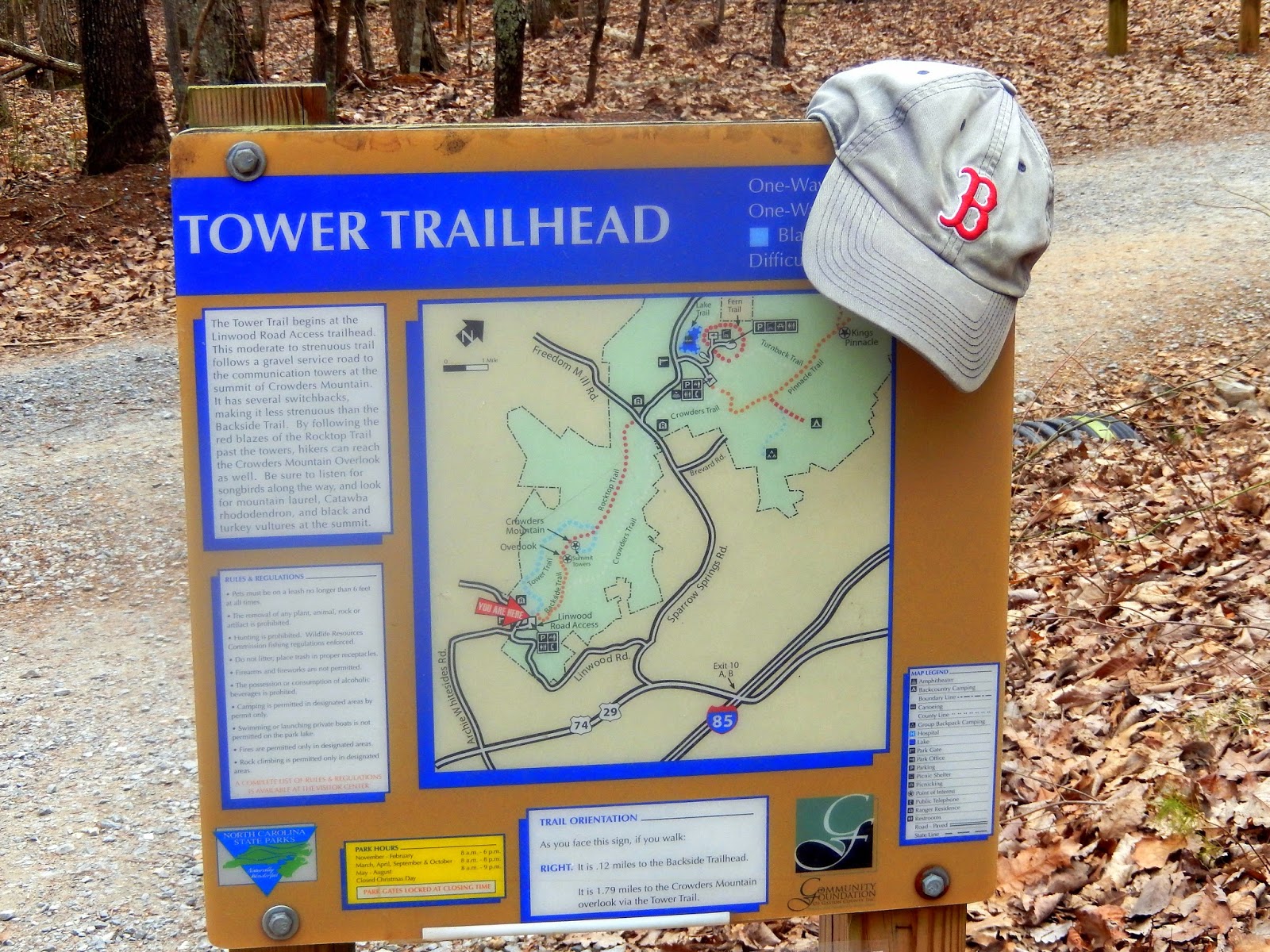 At the Linwood Road access, there are two trails to the summit. One is the Tower Trail which is a 1.8 mile trail along the gravel utility road to the southern part of the Crowders Mountain summit where transmission towers are located. The other is the Backside Trail which is a mile long trail to the northern part of the summit of Crowders Mountain. The Backside Trail is considerably more "sociable". Accordingly we took the Tower Trail.

The trail is a long and winding gravel utility road which allows occasional views of the rocky Cliffside which is used by many rock climbers. At the 1.25 mile mark there is a rock bench on the side of the road. Take my advice and stop and rest here. The next 3/4 mile is a 450 foot ascent.


We have seen almost monthly of reports of folks falling off Crowders Mountain and wondered what made this mountain so susceptible to such accidents. We soon got a look at some potential victims for this month's accident report.

The Tower Trail ends at the transmission towers. You can pick up the red blazed Backside Trail at the rear of the towers. It is a narrow rocky trail but there is a really nice cliff to the left that provides a picturesque view of the Crowders Mountain Knob.


 While we were resting on the cliff and enjoying the view of the Crowders Mountain Knob, we were entertained by an aerial dance of some hawks which my hiking companion chronicled.

 Leaving the tower area we hiked a short distance to a number of rock cliffs which were very sociably occupied by all sorts of people, families and youth groups. We got to talk to three lovely young ladies from Beijing. One was a graduate at UNCG who was working on a project studying brain nutrients. I was surprised with the 156 views the Fat Bald White Guy has gotten from China that they did not know me?!....they were kind enough to allow me to photograph them....hopefully their friends in China will know that they got to hike with the Fat Bald White Guy.
The views were nice from the many different cliffs. The real problem was that there were far too many people vying for a spot on an open cliff that it ruined the back to nature feel of the mountain. I chose not to venture out to the northern cliffs but I captured a great pic of a couple on an isolated cliff.


 The way back to the parking lot is via Backside Trail which means going down steps and if you read this blog you know the FBWG hates steps on the trail....I only am thankful that we took the Tower Trail up so that I only had to go down the steps as I am sure would have vapor locked on this climb. From the base of the steps there is a nice view of the rock wall of the Crowders Mountain Knob, no doubt a favorite for climbers.

 The trail down was a wide well maintained trail. The Backside Trail is quite steep and would not be a crowd favorite on a hot summer day.
Thanks for the post. Husband and I went to park this past Saturday. Went up on Crowder Trail and down on Rock Trail. Rock Trail is an appropriate term as it was 85% climbing over rocks. You should try it sometime since I didn't see it on your blog. We enjoyed it a lot.
ReplyDeleteyes....we have visited Crowder Mountain twice....I believe the Rock Trail connects the two pinnacles....may try it again soon....thanks for following our blog....FBWG
ReplyDeleteThank you for your blog. I was wondering where exactly you took the first photo in the blog? Do you have a reference that is more panoramic? Looking to get some reference for an oil painting. Any help would be appreciated.
ReplyDeleteI was on the pinnacle to the south of the large knob. It was so crowded I did not venture to the big knob. There are several pictures from the same position in the blog. Sorry for the delayed response but I have no other pictures of the knob
ReplyDeleteI have bad knees any suggestions?
ReplyDelete