Sunday, August 16, 2020

JOYCE KILMER NATIONAL FOREST AND YELLOW CREEK FALLS

 TAPOCO LODGE

Outside of Robbinsville North Carolina on a lonely stretch of Tapoco Road is this gem of a hotel.
https://tapoco.com/.  The Lodge was constructed in 1930 by the Aluminum Company of America which was working on hydroelectric projects in the region.  The Tallahassee Power Company-"Tapoco" was part of this project.  The Lodge was finally renovated and open to the public in the 1990's.  Check it out...great place to stay!

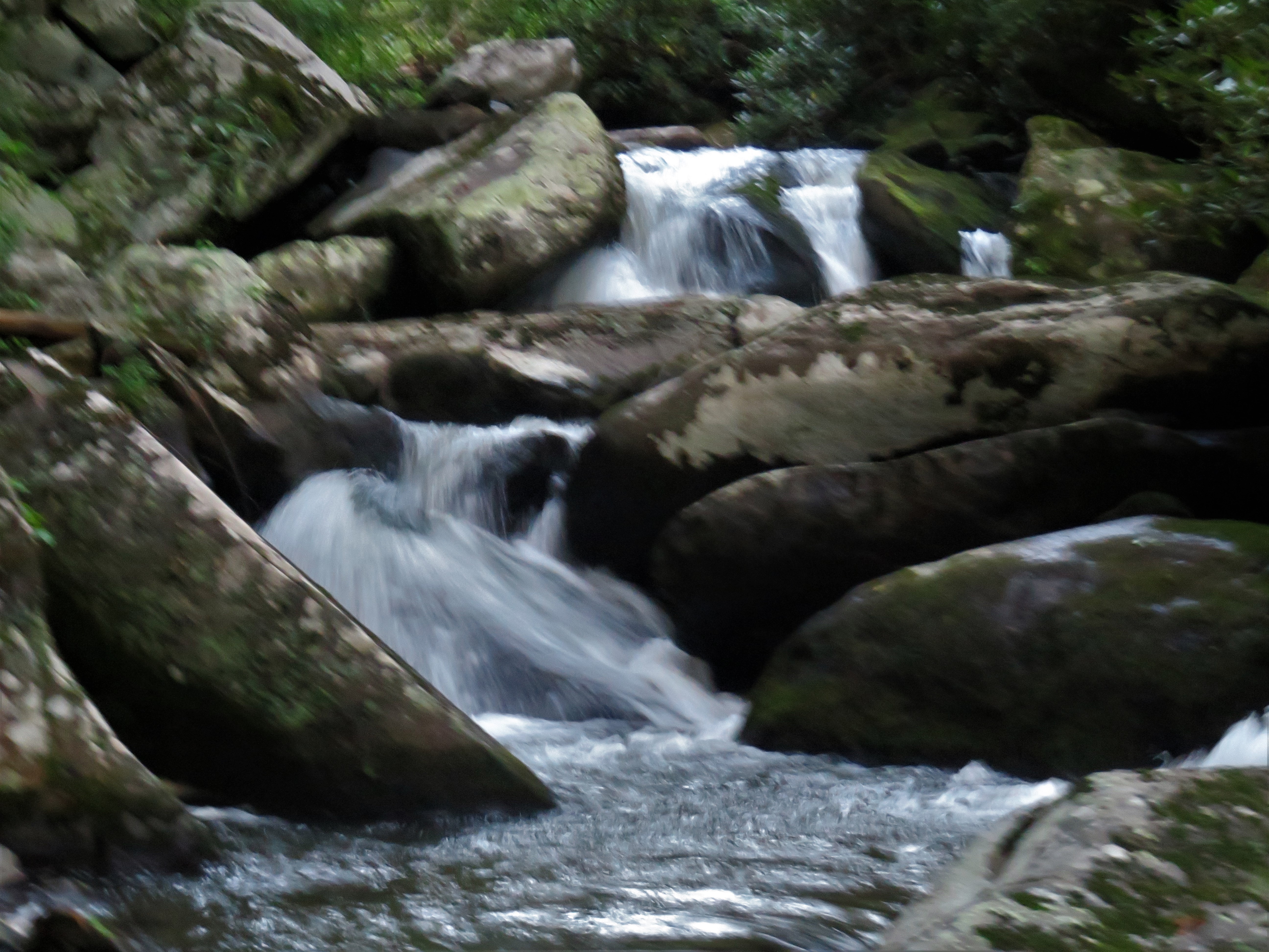
YELLOW CREEK FALLS- Just up the road from the Tapoco Lodge is a short trail taking you to a series of falls. We visited there late in the evening and had to rush our hike to beat the sundown but nevertheless found a wonderful mountain creek full of rapids and waterfalls.   

The waters flow from a larger waterfall that we unfortunately did not get to see.   The larger falls are at the end of a 3/10ths of a mile trail. I include a picture from the site Romantic Asheville. 


Downstream is a series of smaller waterfalls and rapids that create a steady roar as the water cascades over rocks flowing into the nearby Cheoah River.
The creek contains smaller rapids that are interesting as well, each forming an ever changing waterfall.
This is a great short trail to visit if you are staying at the Tapoco Lodge or are otherwise lost on Tapoco Road!

JOYCE KILMER NATIONAL FOREST

A few miles from the Tapaco Lodge is the famous Joyce Kilmer National Forest. 
 Joyce Kilmer was a famous poet who was killed in World War I in 1918.  He is most famous for a short poem entitled Trees. The National Forest is a 3800 acre forest preserves dedicated as a memorial to Kilmer in 1936.
             I think I shall never see
                A poem as lovely as a tree
                A tree whose hungry mouth is prest
                Against the earth's sweet flowing breast
                A tree that looks at God all day
                And lifts her leafy arms to pray
                A tree that in summer may wear
                A nest of robins in her hair
                Upon whose bosom snow has lain
                Who ultimately lives with rain
                Poems are made by fools like me
                But only God can make a tree
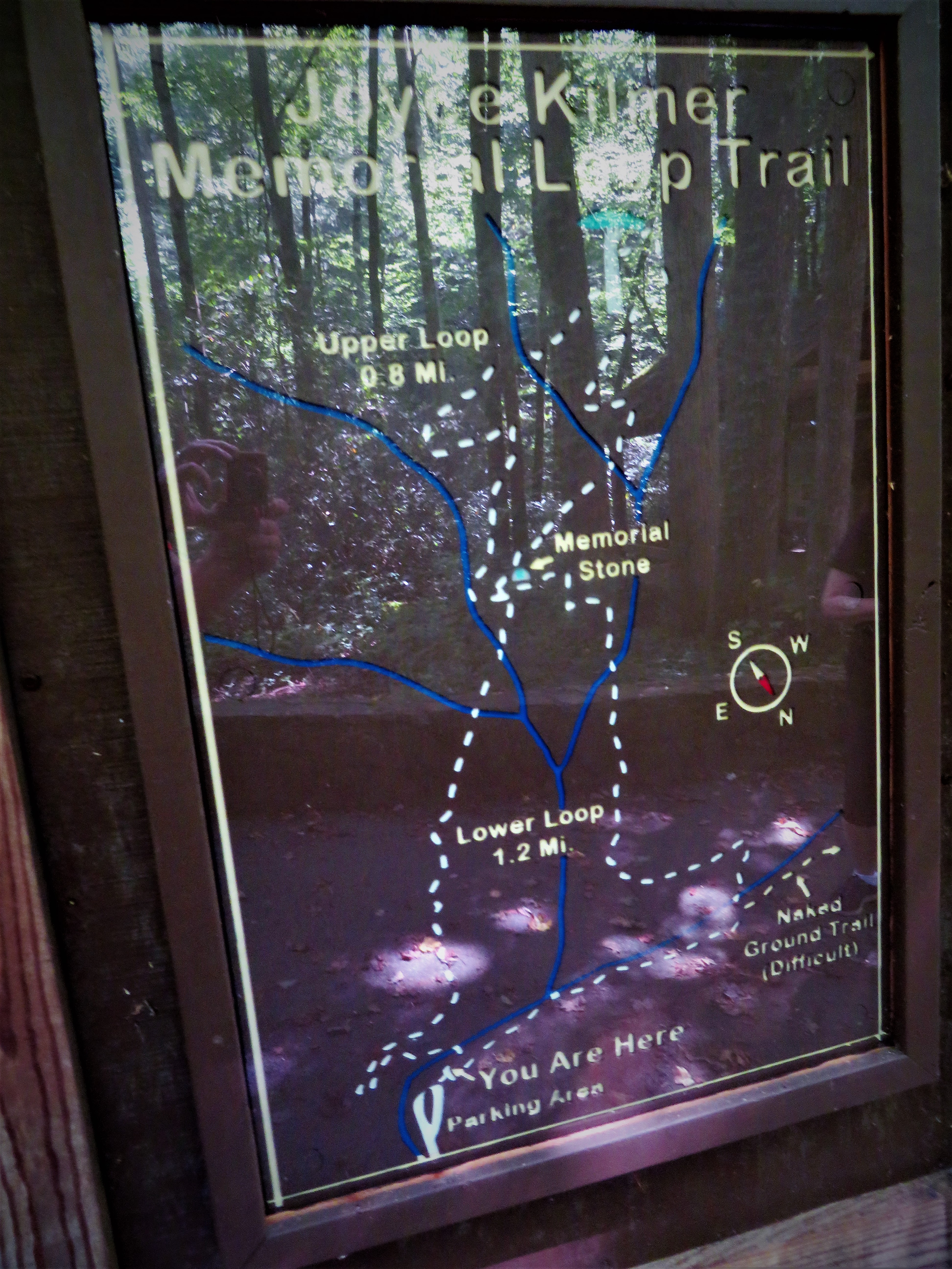
The main trial begins at the trail map sign adjacent to a parking lot.  The trail bridge nearby had been closed so the lower loop was closed and all hikers were forced onto one narrow trail. 
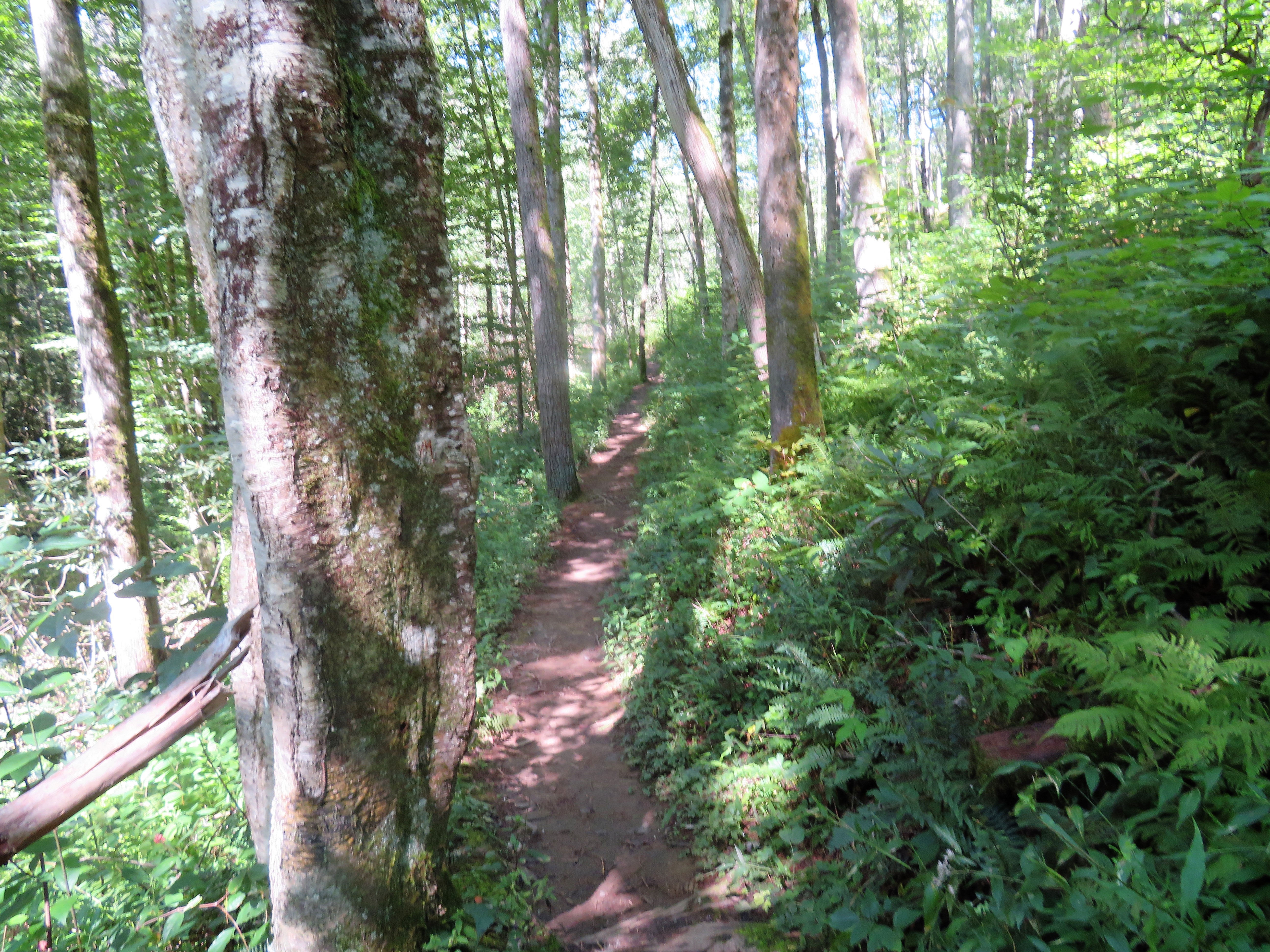
The trail led up a deceptively steep trail that on the hot and humid morning was more that enough for the FBWG thumper.  The trail is also very well traveled and marked.  We met many other hikers coming and going along the narrow trail throughout the morning. 
Early in the trail is a neat bridge crossing a mountain stream.  The bridge may be easily the
most photographic feature of this otherwise very boring trail.  The trail is really a pretty typical North Carolina mountain trail through the woods.  It is devoid of interesting features. It is a nice hike but I was very disappointed with the scenery but liked this bridge!
I have learned that the lower loop was "renovated" by the explosive removal of dead trees in 2010 in a manner that was supposed to imitate a "a natural windthrow".  I guess that is what I saw..

At the intersection of the figure eight loops there is a large rock and a small memorial to Joyce Kilmer. It is from this point on that larger trees appear near the trail.  One of which is featured at this stop.
Further up the trail are larger trees but in truth I was so bored with the trail that we decided to turn around...I guess the tree poet was not in me that day.

Joyce Kilmer National Forest is a great forest preserve but I was looking for a bit more in a trail experience.   We will return next time and I will give it another chance so I am not going to rate the trail. But I will offer a verse from the Joyce Kilmer poem "Folly":
                O the folly of the child
                The ready courage of the fool
                Lord, crush our knowledge utterly
                And make us humble, simple men
                And cleansed of wisdom, let us see
                Our Lady Folly, let us see
    The air is like a butterfly...with frail blue wings...
    The happy earth looks at the sky... And sings! 
                            - Joyce Kilmer

Saturday, August 15, 2020

CHEROKEE WATERFALLS

 SOCO FALLS and MINGO FALLS

SOCO FALLS- Traveling on NC Highway 19 through Maggie Valley, the road rises to the famous Soco Gap.  At this point the Blue Ridge Parkway intersects with the state highway.  Just over the ridge is the Qualla boundary line of the Eastern Cherokee Nation. Pass the sign welcoming you and look to the left.  There is a small parking lot on the side of the highway.  This is the trailhead for the Soco Falls.


From the parking lot there is a short walk down a well worn path to the observation deck.  From the observation deck there is an acceptable view of the main waterfall.  The secondary cascade is hard to see from that vantage point.
To get a look at the secondary falls, you have to scramble a bit down a very slippery, steep, well worn path.  Climbing ropes have been erected to assist with the traverse down the hill.  On the day we visited the falls were very crowded and while the FBWG is not shy to venture into a waterfall scramble, I worked my way halfway down the trail to take my pictures to avoid muddy scramble up return trail.  
The best vantage point for me turned out to be on top of the secondary falls from which I took a couple of really nice pictures of the main cascade.  

There I met  a young lady named Kayla from Florida whom I watched free climb up to my perch. Told her I would make her famous!  Her boyfriend joins her in traveling the Blue Ridge Parkway this summer.

Great quick stop on the road to Cherokee. I hope the Tribal Leadership will invest some of their casino profits improving access to the base of the falls.  With the amount of traffic the trail down is getting some steps are in order.  Give this fall a rating of 8...would have been higher if access was better.


MINGO FALLS - The other waterfall found near Cherokee is the Mingo Falls.  This one is a bit harder to find. It is off NC Highway 441 on Big Cove Road.  It is right up the road past the KOA campground.  The trailhead features steps...150 steps to be exact...a nice way to start a hike!


After climbing the stairs the trail follows the Mingo Creek to the base of the falls where there is a nice bridge from which you can observe the falls.  The falls are majestic!  Standing over 120 feet tall, the waterfall is one of the tallest I have seen in North Carolina. 

All waterfalls have souls and you must get up close

to them to feel them.  Fortunate for me a lady took off up the stream to get close to the falls. Seeing how easily she made her way up stream, I quickly jumped in and started my own scramble, leaving my Faithful Hiking Companion on the observation bridge.  Getting close to the falls I made some great pictures, but when I turned around I found my Faithful Hiking Companion photographing me!


The Cherokee called these falls, the Big Bear Falls. I am not sure where the name "Mingo" originated for the falls aside from the fact that Mingo was Daniel Boone's Cherokee friend that Ed Ames played in the Disney movie we all watched as children.
These falls are rated as 10...not a better one in North Carolina.  Easy access...great one to visit.


Friday, August 14, 2020

HUCKLEBERRY BALD

 HUCKLEBERRY BALD

The 5600 foot summit of Huckleberry Bald is the highest peak on the Cherohala Skyway in Graham County, North Carolina.  My Faithful Hiking Companion and I visited this wonderful spot in the late August evening.  We were the only hikers on the summit and enjoyed the 360 degree view of the world from this wonderful bald top mountain.
You can find the trail head near mile marker 9 on the Cherohala Skyway which leads from Robbinsville North Carolina to Tellico Plains Tennessee.  The Skyway is known for its scenic curvy drive across the Cherokee National Forest in Tennessee and the Nantahala National Forest in North Carolina.  Built in 1996, the name was taken from both National Forests..."Chero" "Hala".  Huckleberry Bald trailhead is easy to find if you pay attention to the elevation signs.  The trailhead is at 5300 feet and the trail begins at a fire road next to the sign shown above.
From this point there is a hike of 2.5 miles round trip mos
tly along a fire road crossing a lower bald, through a wooded area emerging on the summit of a larger bald.  It is a thumper but not too strenuous. We hiked at the end of the day. It was about 75 degrees.  I imagine a hike in the middle of the day may be pretty hot as most of the hike is through a large open field.  Remember to stay hydrated.
About a quarter mile mark, the gravel fire road merges with a grassy path in a lower bald.  Be sure to wear long pants on this hike as the grass is thigh high. The grass is full of summer wild flowers and butterflies.
The upper bald destination is easily seen.  Once you reach the summit of the lower bald, there is a decline to the base of a wooded incline, there the trail again returns to an established fire road.  This is the halfway point to the summit.  The climb will get your heart rate up but it is a short and very manageable climb.  
Don't dismiss the views from the lower bald. The low clouds, the flowers, butterflies and views of the upper bald make this a very pleasant part of the hike especially when it is coupled with a cool breeze!
Emerging from the woods, the upper bald summit opens up and a narrow trail through the high grass leads to a very impressive memorial to two men who died over 100 years ago on top of this mountain.  It seems that in 1899, two men set out for Robbinsville in the middle of the winter but never got there.  A year later their bodies and several empty jugs of whiskey were found near the summit of Huckleberry Bald. Drunk and lost they froze to death.  For some reason only the body of Andy Sherman was interred there. The body of the other man, Paul O'Neill was given to a local doctor as a medical exhibit.
Passing by the gravesite, we found the summit about 100 yards away.  From that point there is a 360 degree view of the surrounding mountain ranges.  
There was a stunning vista in every direction we looked.  First to the east:
The blue mountains of the Nantahala National Forest seem to mingle easily with the clouds. 
To the southeast a view of the lower bald is seen.  It seems so far away but provides a nice contrast to the distant blue ridges that seem to roll on live sea waves.
The northern sky bore an ominous bank of clouds which fortunately moved on without raining on our hike.
We could also see the skyway
leading up the mountain from Robbinsville.
The western view into Tennessee was the most interesting.  Many mountains and nearby peaks were outlined in various shades of blue.
My Faithful Hiking Companion was most intrigued  by a small copse of "Christmas Trees" on the ridge.
I can imagine the beauty of this place in autumn is indeed stunning.  Wintertime would be interesting as well.  But camping on top of this ridge beneath stars might be a real experience, that is unless you are afraid of the ghost of Paul O'Neill looking for Andy Sherman... or perhaps another drink of whiskey!
Many thoughts carried with me as I trudged back to the car.  The beauty of the mountains outlined against the sky, the delicate flowers growing wild along the path, and the colorful butterflies that seemed to emerge like flying flowers in our path.  Indeed if the very hairs of my head are numbered by the same artist who frames the ever changing outlines of the sky with mountains that are thousands of years old, and takes time to paint the multi-colored wings of butterflies that live but a few days, how majestic must He be!

"But ask the animals and they will teach you, or the birds in the sky and they will tell you, or speak to the earth and it will teach you, or let the fish of the sea inform you. Which of these does not know that the hand of the Lord has done this? In this His hand is the life of every creature and the breath of all mankind."  Job 12: 7-10

Amen!

What can I say about a magnificent hike like this?! The access is ideal, the trail is easily found and well maintained, the scenery is spectacular and the effort to view ratio is about as good as it gets for a short hike.  This is a grade 10 hike that one everyone should experience.  I can't wait to do it again!


In Memoriam  
Cynthia Anne Walker Mikesell 
August 4, 1952- August 12, 2020
1 Corinthians 13:7


DEEP CREEK NATIONAL PARK WATERFALLS

THREE WATERFALLS ON ONE HIKE


 Any trip to Bryson City, North Carolina should include a ride on the Great Smokey Mountain Railway, a tube ride down Deep Creek and a visit to three wonderful waterfalls.  We only had time for one of the three, so we chose to chase waterfalls!

Located just a few miles from downtown Bryson City, North Carolina is the Deep Creek National Park.  Too visit all three waterfalls is a 2.5 mile moderately easy trail.  Nearest the trailhead is the unusually name Juney Whanks waterfall, along the Deep Creek tubing trek is the Tom Branch Falls and at the head of the Deep Creek rapids is the majestic Indian Creek Falls.  The map at the trailhead is helpful but only if you modify it a bit for comfort and convenience, something the Fat Bald White Guy is pretty good at.

 JUNEY WHANKS WATER FALL:

The trailhead for the Juney Whanks waterfall is located right beside the trailhead map. It is a surprisingly steep hike to start the day.  The trail switches back to join the horse trail that loops around the park. It is a well maintained and well marked trek of no more than a third of a mile.

A small bridge takes you across in front of the Juney Whanks falls allowing the Fat Bald White Guy to get close to the waterfall.  It is a relatively small waterfall but a waterfall nonetheless. 

 The falls are named for Junaluska Whanks who was a settler who is thought to be buried nearby. Or perhaps it is really named for the Cherokee phrase "juney whank" which means "where the bear passes".  Who knows? It is a narrow fast moving cascade of about 30 feet in height.  Cool spray greets you as you cross the bridge at its mid point.


 Leaving the waterfall, the trail leads down to the banks of the Deep Creek to a wide gravel path just a few hundred yards from the second waterfall of the day the Tom Branch Falls.


TOM BRANCH WATERFALL:


The Tom Branch waterfall is located adjacent to Deep Creek.  Several trail benches are arrayed for the enjoyment of all. Sit and watch the falls when it is quiet or enjoy the passing tubers.  When we arrived, there were no tubers, so we enjoyed the quiet view.

The falls are framed by a large tree on the opposite bank.  No matter where I moved this tree or its limbs were a part of every photograph.  Then it dawned on me that this waterfall existed when this tree was but an acorn.  Now the tree is a silent sentinel to the beauty of the waterfall.  So I decided to make the tree part of the picture.


 INDIAN CREEK WATERFALL:

The last waterfall of our trip was the Indian Creek Waterfall.  It is located about a mile from the Tom Branch Waterfall.  The trail is wonderfully alongside the fast flowing Deep Creek which increasingly becomes alive with tubers carrying orange, blue, red and yellow tubes, eagerly jumping in a floating happily down the river.

 Most tubers will put in at the first bridge which is about halfway between the Tom Branch Falls and the Indian Creek Falls.  But the experienced tubers will trudge up the trail almost all the way to Indian Falls to get the fastest and longest rides.


 The Indian Creek Falls is by far the best waterfall of Deep Creek National Park. It is over forty feet tall with active multiple cascades.  When we arrived a family was spending extra time swimming at the base of the falls and lest I disturb them I moved up the trail to get some pictures above the falls.  About 300 yards is a bridge that crosses Indian Creek.  The upstream view above the falls was nice and calm.


 Returning downstream to the falls, I discovered the family still playing in the water and pointing to the top of the falls.  There stood one of their own, a teenaged girl trying her best either to be a river nymph or a member of the Darwin Awards for 2020.  Oblivious to the danger she walked along the top of the falls posing for her adoring family. Thankfully, she left no worse for her indiscretions.  

 Soon she climbed down and the family left and the Fat Bald White Guy had the falls to himself! I took several pictures and a couple of selfies.  This is a great waterfall and one I could see inspiring lots of play in the water at its base. I was even told that back in the day a friend of mine slid down the slick side of the falls..."wearing jeans" he noted!


Before we left we ran into a couple visiting the North Carolina mountains for the first time.  Jim and Kelly were from Corpus Christi Texas.  When I told them I was the Fat Bald White Guy and wanted to make them famous, they eagerly posed for a picture! Great folks from a great state...glad to have met them!


 What a great hike?!  We put in a pretty easy 2.5 miles and got to see three great waterfalls and enjoy the bankside hike along a mountain river.  Got to come back and do some tubing and ride the Great Smokey Mountain Railway. The trail was a 9, well marked and maintained, trail head was easy to find, even though finding the park proved to be a bit of challenge due to lack of cell service for Waze App. Scenery is a solid 9.  Cumulatively three waterfalls in 2.5 miles is a real find.  Effort to view was about right.  Overall a solid grade 9 hike and one most everyone can easily manage.