ROCK JOCK TRAIL in the Linville Gorge

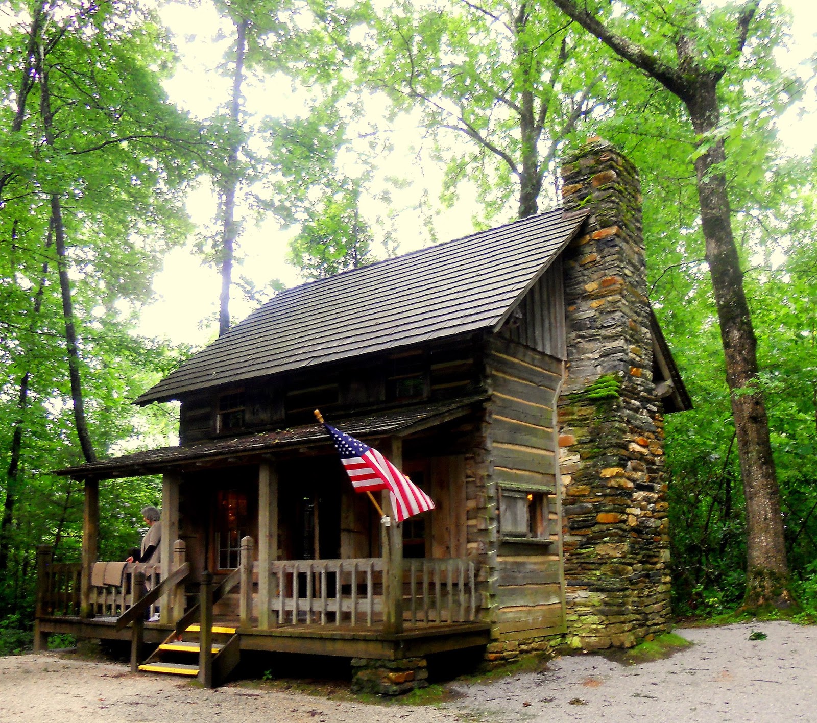 At the northern entry to the "highway" there is an information cabin manned by some of the nicest people in the mountain. There you can see a nice large map of the Linville Gorge, buy souvenirs and get some good information on the weather.
 Speaking of weather....my hiking companion listened to Ed Matthews of News 2....I checked out the weather on my Weather Channel app on my I Phone.....I expected the rain to end, and the skies clear for a late afternoon hike up Rock Jock trail. My hiking companion told me confidently that Ed Matthews said it would not clear until sometime after 5 pm.... of course she was right!
 The Rock Jock trail is a ridge trail on the western side of the Gorge much like the Jonas Ridge trail is on the eastern side. I am led to believe that the trail is but a remnant of a once larger trail that once connected Wiseman's View to the Pinchin Trail which was displaced by a forest fire in 2007. The trail showed the new regrowth of nature replenishing the forest with greenery. We accessed the trail at the Conley Cove Trail Head. Meeting a hiker coming up from Conley Cove on the Linville River, we discovered that the frequent rains had made all the trails to the river cascades of water. A point we would learn on our on accord as we took the drier Rock Jock Trail.
The clouds streaming up the Gorge from the south obscured the peaks of the all too familiar mountains to the east. Still we were awed by the views all along the trail. Many side trails led us to rock outcroppings which provided stunning view of the river below.


About a 8/10ths of a mile, the trail led to a magnificent cliff, known as Hackers Point. I photographed this cliff from the adjoining ridge. I did not know then I would soon be standing on the edge of this cliff enjoying the view. From this location we took a break and took in various views of the Linville Gorge.
Looking north we got a look at the northern end of the gorge near Devil's Cliff.

The river is very brown and even from this distance I could tell that it was swiftly moving and riding high in its banks.

Across the gorge from Hackers Point is the North Carolina Wall which was obscured by clouds. Still we occasionally got a glimpse of the ridges and the lush green foliage.
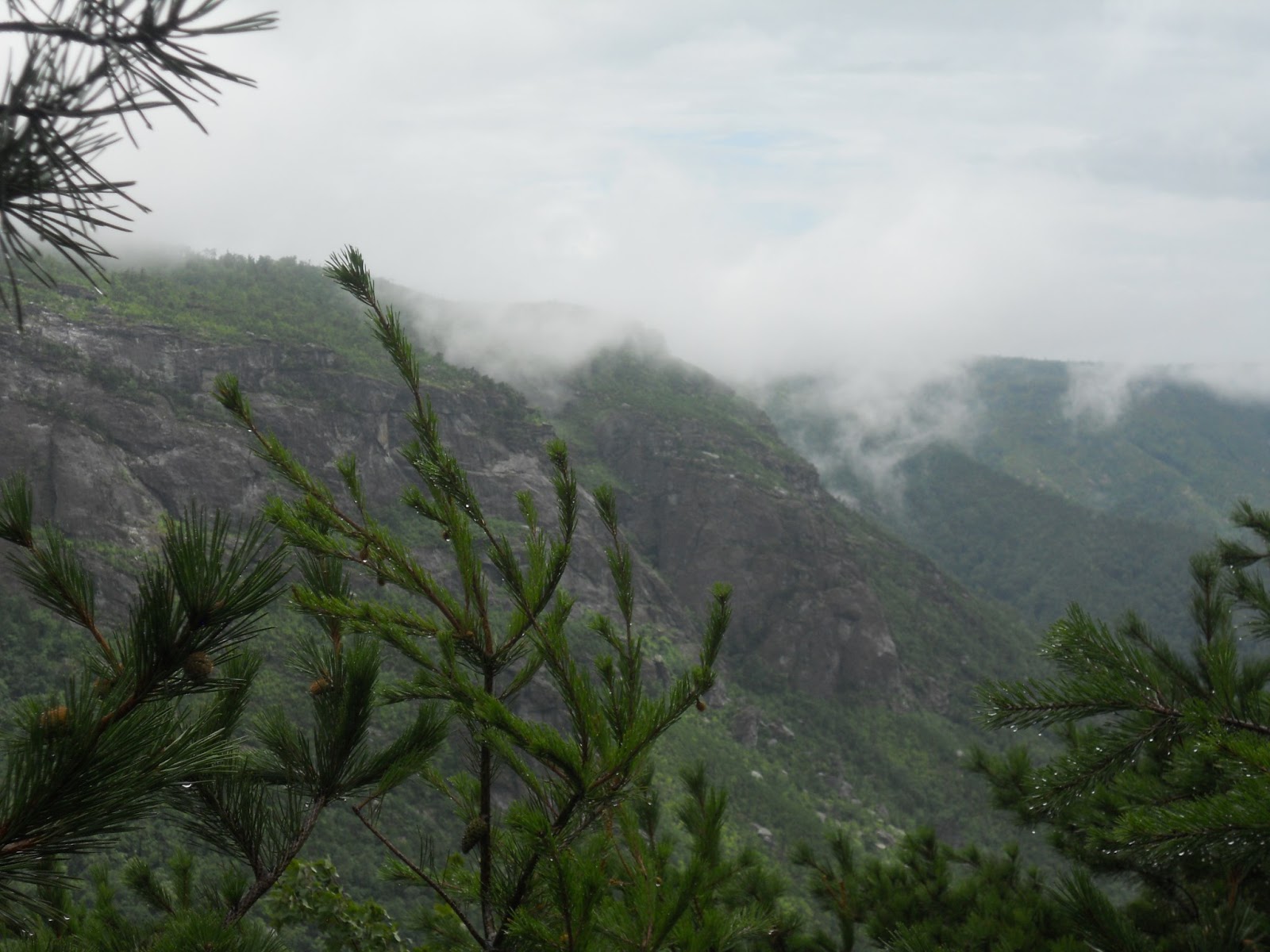
Though we were disappointed that we could not see the peaks of the eastern side of the Gorge, the views of low hanging clouds over the mountain ridges offered some impressively changing views of the Gorge that you do not get to see on a clear day.

As we left the Hackers Point, we took the first trail we saw expecting it to be the Rock Jock Trail...and for awhile that is what we thought.
It was an easy trail crossing a ridge with some nice wildflowers adorning our path.


I rebuilt a trail cairn on a log....only to find a larger cairn just a few feet down the trail. As is my custom on the trail, each rock I place is my prayer of thanksgiving for an amazing creation of nature which we are enjoying...and my own personal prayer for forgiveness for taking God's creation and presence in my life for granted.


It soon became apparent that the trail was leading us beneath a rocky cliff. The entire mountain seemed to be weeping. Everywhere we looked was a new waterfall. The trail was turning into a canal and it became easier just to walk in the water rather than around it.....
.

As we slogged along the trail the roar of the rushing water became much louder and soon we found ourselves standing beneath one of the neatest waterfalls I have ever seen. I think it is called BlueJay Falls.
The water was flowing from the top of a rock face some 25 feet high and extending at least 80 feet in length. Various smaller waterfalls flowed across this stone edifice but in the middle was one large waterfall.

We splashed around in the falls laughing like little kids playing in a creek. We were soaked from head to toe but did not mind one bit because there is just something about waterfalls that make the rest of the world just disappear.


We left the falls hoping for a drier trail and for a little while it seemed that we were trudging up the mountain along an established trail. Then a familiar roar got louder and we found that the trail up the mountain was along a rocky slope which had become for all intents and purposes a waterfall!.... Now I have never climbed up a waterfall and made it about half way when it began to rain. Prudence got the best of me, realizing that we could climb up the rocky falls coming down in a driving rain storm might prove a bit more adventurous than the FBWG could handle. So we turned around and hiked back out in a downpour.
 The Rock Jock Trail may be one of the best trails in the Gorge on a clear day....we can't wait to return. The Waterfall is a real treat well worth the effort to get there to enjoy..... So access is 8....great parking off Kistler Highway....trails are a 7 today...too wet...too slippery.....scenery is an 8 for today...but I expect it could be at least a 9 on a clear day....overall ranking is a solid 8
Since the day was early, we decided to see where the Kistler Highway would end up as we drove south....along the way clouds obscured the views until we got to the southern end of the Gorge, then we got a couple of great view of Lake James


Wonderful scenery! Thanks for sharing. Piles of prayer rocks are great idea. "The earth is the Lord's and the fullness thereof."
ReplyDelete