NEW YEAR'S DAY WITH EASY JAKE
 |
"When we tire of well-worn ways, we seek for new. The restless craving in
the souls of men spurs them to climb and to seek the mountain view." - Ella Wheeler Wilcox
|
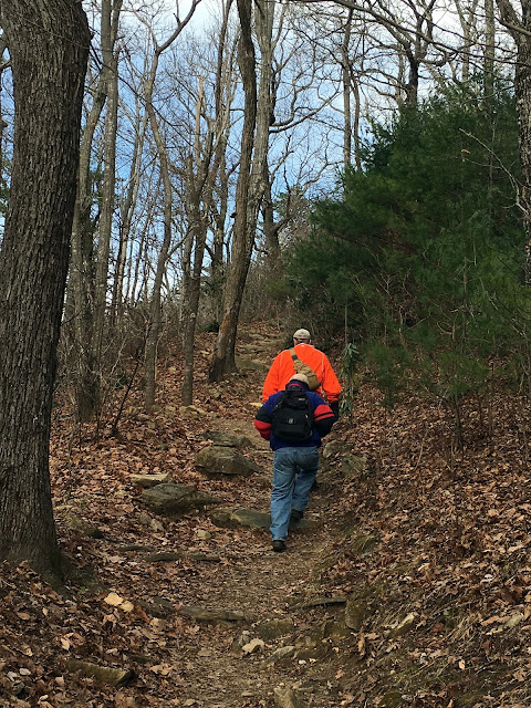 For the last three New Year's Days we have celebrated by hiking in the Linville Gorge. In each of those years we were accompanied by my pal, Easy Jake. Jake wanted to hike Table Rock this year and we were happy to oblige. While we have blogged this trail twice before, it is a trail that gives more each time we hike it. It was a great day with temps in the high 30's. Fortunately the gate to the road to Table Rock Picnic area will not close until January 4. The normal busy parking lot was only half full. The trail is only supposed to be one mile long but I have found it to be deceptively long and steep. Today was no exception but we broke up the hike with visits to Little Table Rock and Devil's Cellar. You can check out our other Table Rock hikes by following these links:

http://fbwg-hiking.blogspot.com/2015/06/linville-gorge-table-rock-little-table.html
http://fbwg-hiking.blogspot.com/2012/06/table-rock-mountain-one-of-most-scenic.html

The nice thing about winter hikes in the Gorge is that you get to see views that are otherwise obscured by summer vegetation. The first leg of the summit trail is a steep climb from the parking lot.


Stopping to take in the views was a good way to let the old thumper calm down. The view north we could see the cliffs of Little Table Rock and the western wall of the Gorge. To the south toward the chimneys with the silhouette of Mt Mitchell in the distance was a real treat. Damage from the 2014 fire was still apparent. It is obvious Little Table Rock was severely damaged but Mother Nature has brought the mountain back very nicely nonetheless.

 |
| photo by FHC |

 |
| Photo by EasyJake |


 Having scrambled for the best views we could get from Little Table Rock, we returned to the trail. Next stop would be Devil's Cellar, a place I had never visited, but trail research provided by LinvilleGorge.net proved accurate again. About a quarter of a mile or so up the summit trail are split rocks. On the right just past the split rocks is a shortcut created by the old summit trail. Ignore this and proceed on the newer switchback trail. Right before the switchback there are two trails. Choose correctly and you will find Devil's Cellar. Summit to the right...the Cellar to the left...Easy Jake led the way.
The Cellar is a deep crevasse separating the northern wall of Table Rock from a rocky tower. The cliffs are several hundred feet high and provide some stunning views to the east.

 |
| photo by FHCA |
 The cliffs provided a several level rock scramble. Each level providing a different view of the eastern mountains. My Faithful Hiking Companion stayed behind to photograph some interesting rocks in the crevasse. Easy Jake and I went to the top to get a good view.
 |
| photo by FHC |
What she photographed in the Cellar was kinda creepy. The rock on the bottom left looks like it has a face with glasses on its eyes and a nose and mouth clearly seen. It reminds me of the frozen in rock enemies of the Ice Queen in the movie Chronicle of Narnia. The rock on the right looks like a finger....she told me a middle finger....what do you think?
 |
| photo by EasyJake |
The spur trail to Devil's Cellar is a must. I don't know why I had not visited there on previous hikes but will return soon to explore the site more. We left there and returned to the summit trail which is steep but not very long.

At the top we stumbled to our favorite place on the northern cliff and ate our power bar lunch. The view of Hawksbill and Grandfather there is stunning. But just as nice is the view, we met some nice folks too. Laura and Allison had trudged up the last leg of the trail with us. Accompanying them was a chocolate lab named "Layla". The dog's owner is Allison's brother who is serving overseas....prayers for his safe return! Of course the FBWG had make them famous!

 |
| photo by EasyJake |
 |
| photo by FHCA |
My Faithful Hiking Companion took this great shot of nearby Lake James. So did Easy Jake. I call it the Blue Lake as every time we view from a top of a peak in the Gorge it is a different shade of blue.
 |
| photo by EasyJake |
 |
| photo by FHCA |
Easy Jake and I scrambled across the summit rocks seeing how far we could go leaving my Faith Hiking Companion to take pictures of our exploits.

On the way we got to meet a nice couple, Chris and Sheri. Sheri is from California. It was her first time in NC Mountains. She enjoyed the sights but she complained that she was not quite dressed for the cool weather. Chris is a real smart young man...first cause he is an NC State grad...secondly because he snagged him a really beautiful lady from California.


 |
| photo by FHCA |
At the end of the rocky spine of the Table Rock summit, it looks like you can fall off the world. In truth as the rocks end at a nice flat open space begins that allows for more views on each side of the mountain. As we stood there taking in the sights we heard the huff and puff of a family of hikers as they emerged from the western side. It seems that there is a very easy trail from this end of the summit down to the trail which initially we took to the summit. Easy Jake and I took this trail down, leaving my Faithful Hiking companion to scramble back the other way.
The hike down to the parking lot is a quick and easy downhill scamper making you understand that the summit trail is not much over a mile long at best. We had a great day returning to the mountain that inspired the Fat Bald White Guy and his Faithful Hiking Companion to begin our journey and this blog...going home is always good for the soul.

I once worried about winter hiking not providing enough color to enhance the distant scenery. I have found by hiking New Year's Day that the color of the Gorge adapts to the season and in many ways it is just as stunning on a clear winter day than in the middle of the summer.
 |
| FBWG on Billy Buck Bluff by EasyJake |
We hiked 3.5 miles. It is an hike that is easy to rate. The access is a 10. The Table Rock parking lot is so very accessible and the pit toilets are a nice and needed accessory. The trails are well maintained and easily followed. The spur trails to Little Table Rock and Devil's Cellar enhance the hike- 10; The scenery cannot be any better. Everywhere you look is a scenic overload-10; the effort to view ratio is also near perfect as you need to exert yourself on a hike to appreciate the views earned. Overall this is a 10 hike. One that if you are planning a visit to the Gorge, you need to put at the top of you list.
 |
photo by FHC
|
Props to Easy Jake for coming to our rescue as back up photographer. It seems I forgot to bring my camera, so Jake and my Faithful Hiking Companion supplemented my IPhone photographs. We missed hiking with his granddaughter Madison but were happy to have him along nonetheless. The photograph below is among his best of the day.
 |
| photo by EasyJake |
http://fbwg-hiking.blogspot.com/2014/01/new-years-day-hike-to-hawksbill-from.html


