FEDERAL POINT AND FORT McHENRY
An education conference meeting in Baltimore took the FBWG and his Faithful Hiking Companion off the trails this weekend....but you know what I say...."A hike is where you find one"!
We got to spend some time in Baltimore Inner Harbor, Federal Point and at historic Fort McHenry.
FEDERAL POINT
Baltimore Inner Harbor is really a park created around an harbor. Many interesting boats, shops and sights, all accessed by a brick walk stretching for over ten miles.
It is within walking distance from both sports stadiums.
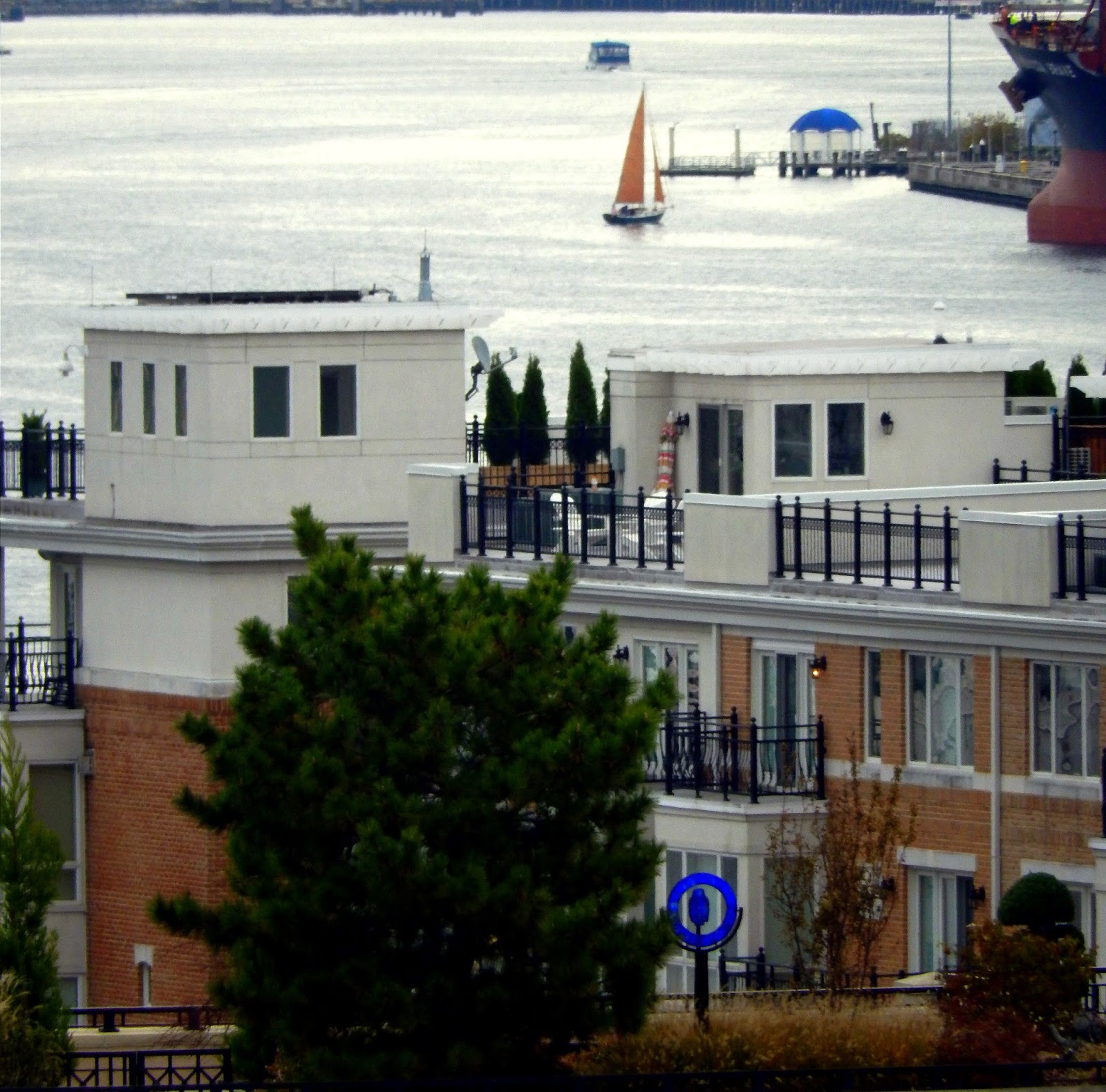
Looming above the Inner Harbor is a promontory which looks like the remnants of a small fort. In truth it is Federal Point, a historic park which has been preserved. From this point are the best views of the Baltimore Inner Harbor and the skylines of this great city. It is a nice hike from the walk ways surrounding the Inner Harbor to Federal Point but the view is worth the effort. If you don't feel like walking it is an easy ride with parking surrounding the park.
 If you find yourself visiting this city, make the hike from the Inner Harbor to the Federal Point. You really have not visited the Inner Harbor until you have visited Federal point.
Centered in the middle of the Point is a large American flag which can be seen from all parts of the Inner Harbor reminiscent of what we would soon see at Ft. McHenry
If you find yourself visiting this city, make the hike from the Inner Harbor to the Federal Point. You really have not visited the Inner Harbor until you have visited Federal point.
Centered in the middle of the Point is a large American flag which can be seen from all parts of the Inner Harbor reminiscent of what we would soon see at Ft. McHenry.
The park was the site of Baltimore's celebration of the ratification of the Constitution where 4000 people showed up.
 The park provided a nice combination of late summer flowers and late fall color. It contains a nice play ground and historic statues commemorating the defense of Baltimore in the War of 1812.
The Point is not only within walking distance of the Inner Harbor it is the centerpiece of a neighborhood of restored homes and offices. I think it would be a great place to live and work.
 From the Point you can see the vibrant life of the port of Baltimore and the neighborhoods that surround the Inner Harbor.
 We also ate at Bubba Gump Shrimp...a great waterside restaurant themed around the iconic movie Forrest Gump. The food was good but a trip into the souvenir store allowed me to make political commentary on the state of public education policy in North Carolina and support one of my favorite candidates.
FORT McHENRY
We all know the story of our National Anthem but somehow you cannot appreciate the song without visiting the place that inspired its lyrics. Fort McHenry is just a few miles from the Inner Harbor and is a wonderful place to visit and interact with the history of our nation.
 War broke out with Britain in 1812. British Forces landed at North Point but were fought to a stalemate on the outskirts of Baltimore.
Needing the artillery of British fleet to break the stalemate required the elimination of Fort McHenry which stands strategically guarding the Baltimore Harbor.
War broke out with Britain in 1812. British Forces landed at North Point but were fought to a stalemate on the outskirts of Baltimore.
Needing the artillery of British fleet to break the stalemate required the elimination of Fort McHenry which stands strategically guarding the Baltimore Harbor.
 Seeking to obtain the release of a friend detained by the British, attorney Francis Scott Key sailed in the midst of the British Fleet on the eve of the bombardment of Fort McHenry. Being detained on the ship, he watched in horror as the fort was bombarded throughout the night. As dawn's early light revealed the result of the bombardment, Key looking through a spy glass was relieved to see that the fort had not fallen. He penned these famous words. The fort is now a national historical monument and is restored to allow the visitor to understand the importance of the battle which inspired the lyrics of our National Anthem.
"O say can you see by the dawn's early light, what so proudly we hailed at twilight's last gleaming?"
Seeking to obtain the release of a friend detained by the British, attorney Francis Scott Key sailed in the midst of the British Fleet on the eve of the bombardment of Fort McHenry. Being detained on the ship, he watched in horror as the fort was bombarded throughout the night. As dawn's early light revealed the result of the bombardment, Key looking through a spy glass was relieved to see that the fort had not fallen. He penned these famous words. The fort is now a national historical monument and is restored to allow the visitor to understand the importance of the battle which inspired the lyrics of our National Anthem.
"O say can you see by the dawn's early light, what so proudly we hailed at twilight's last gleaming?"
 A mile loop surrounds the fort which we took to provide us with a nice hike before visiting the fort. We took many interesting photographs. We were greeted by a white pigeon playing with a grey squirrel.
 Old Glory dominates every aspect of a visit to Fort McHenry. The large flag blowing in the wind is something that a photographer cannot resist. I must have photographed this scene from 50 different angles.
"Whose broad stripes and bright stars through the perilous fight, o'er the ramparts we watched were so gallantly streaming."
Old Glory dominates every aspect of a visit to Fort McHenry. The large flag blowing in the wind is something that a photographer cannot resist. I must have photographed this scene from 50 different angles.
"Whose broad stripes and bright stars through the perilous fight, o'er the ramparts we watched were so gallantly streaming."
 "O say does that Star Spangled Banner yet wave?"

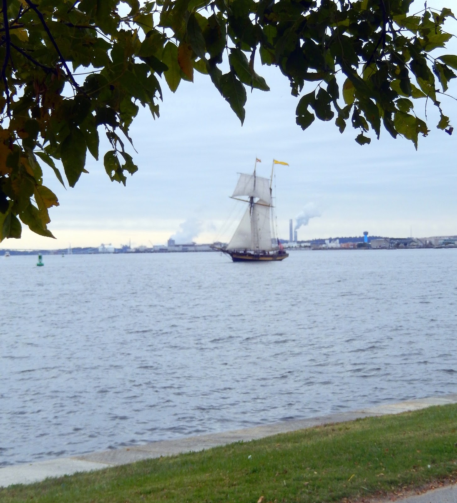
 We were treated to the Pride of Baltimore as she sailed by the fort. It was a nice contrast to the busy port of Baltimore that featured various pleasure craft interspersed with commercial vessels anchored in the harbor.
From the seawall, we could see Old Glory flying high about the gun emplacements as we followed the walk around to the backside of the fort.
"What is that which the breeze, o'er the towering steep, as it fitfully blows, half conceals, half discloses? Now it catches the gleam of the morning's first beam in full glory reflected now shines in the stream: Tis the Star Spangled Banner, O long may it wave, o'er the land of the free and the home of the brave!"
We were treated to the Pride of Baltimore as she sailed by the fort. It was a nice contrast to the busy port of Baltimore that featured various pleasure craft interspersed with commercial vessels anchored in the harbor.
From the seawall, we could see Old Glory flying high about the gun emplacements as we followed the walk around to the backside of the fort.
"What is that which the breeze, o'er the towering steep, as it fitfully blows, half conceals, half discloses? Now it catches the gleam of the morning's first beam in full glory reflected now shines in the stream: Tis the Star Spangled Banner, O long may it wave, o'er the land of the free and the home of the brave!"
 Time has eroded the earthen ramparts but the old fort still is an imposing site as it bristles with cannon pointing in every direction.

 On the back of the fort the loop path diverges at a wonderfully burnt orange tree. From here you can see how the fort rises on the ridge and can see in the distance one of the more unusual features of the park.
Orpheus, the Greek god of music is the subject of a massive tribute to Francis Scott Key erected to commemorate the 100th anniversary of the battle. What a naked mythological god has to do with a military fort is beyond me. Thankfully it is on the backside of the fort and you have to walk around the fort to see it.
Entering the fort on an inner loop walkway, we passed by the seaward battery. These guns are period correct and provide a gunner's view of the harbor. The bomb ships of the British were arrayed in front of the current modern bridge standing about 2 miles from the fort.
 These guns had a maximum range of 1.5 miles and were useless to counter fire against the bombardment of the fort.
Entering the Fort through the sally port, we got a close up view of the extremely large Star Spangled Banner.
 The fort is French designed as a five pointed star. It was built between 1797 and 1800 on what was known as Whetstone Point replacing a fort that had long protected the Baltimore Harbor.
There are cavernous magazines at every point which protected the ammunition and powder needed for the fort's guns.
The fort is French designed as a five pointed star. It was built between 1797 and 1800 on what was known as Whetstone Point replacing a fort that had long protected the Baltimore Harbor.
There are cavernous magazines at every point which protected the ammunition and powder needed for the fort's guns.
 The interior of the fort contained the administrative buildings that housed a garrison of 1000 officers and men who were commanded by Lt. Colonel George Armistead on September 13, 1814 when it came under a twenty-five hour bombardment by the British Fleet
Despite the ferocity of the bombardment, very little damage was done to the fort. In fact only four men were killed and 24 were wounded. Standing in the far corner of the ramparts, I read of the death of two of those soldiers as I looked back on the fort recalling a line in the anthem:
"O thus be it ever when free men shall stand between their loved homes and wars desolation."
 The fort currently exhibits gun emplacements installed after the civil war. These 15" cannon were state of the art at the time and are known as Rodman Guns.
From the ramparts of the fort, the peaceful activity of the harbor can be observed. Many sail boats were leisurely passing by.
Fort McHenry is now at peace. The answer to the question posed by Francis Scott Key in his first verse of the anthem is answered in the fourth verse and today is apparent to all who visit this site.
"Blest with vict'ry and peace, may the heav'n rescued land Praise the Power that has made and preserved us a nation! Then conquer we must, when our cause it is just, and this be our motto, In God We Trust. And the Star Spangled Banner in triumph shall wave o'er the land of the free and the home of the brave!"
CELESTIAL POINT AND DEVIL'S CLIFF

 Hoping to catch the Gorge in full autumn splendor, we were disappointed to find we were about two weeks early. Nevertheless our trip to the famous Celestial Point and equally beautiful Devil's Cliff did not disappoint. The subtle fall colors added to the Gorge beauty to our enjoyment. Hiking down Jonas Ridge Trail from the peak of Gingercake Mountain was a real treat.
In previous trips to the scenic cliffs of Hurricane Wall we had climbed Sitting Bear Mountain. Forsaking that climb for the easier romp down Jonas Ridge Trail made a much easier hike. Finding the trail head in Gingercake Acres has always proved elusive for me, but I actually followed directions and made it there with no trouble. The views from the cabins in Gingercake Acres are amazing!
Hoping to catch the Gorge in full autumn splendor, we were disappointed to find we were about two weeks early. Nevertheless our trip to the famous Celestial Point and equally beautiful Devil's Cliff did not disappoint. The subtle fall colors added to the Gorge beauty to our enjoyment. Hiking down Jonas Ridge Trail from the peak of Gingercake Mountain was a real treat.
In previous trips to the scenic cliffs of Hurricane Wall we had climbed Sitting Bear Mountain. Forsaking that climb for the easier romp down Jonas Ridge Trail made a much easier hike. Finding the trail head in Gingercake Acres has always proved elusive for me, but I actually followed directions and made it there with no trouble. The views from the cabins in Gingercake Acres are amazing!
 The trail from the end of Grandview Circle Extension is a quick steep hike to the top of Gingercake Mountain making me question whether this was an easier route but it proved to be a short hike to the 4120' peak, the highest point in the Linville Gorge.
The hike down Jonas Ridge Trail to the intersection with Devil's Cliff trail is no more than 3/4 quarters of a mile. The distinctive six rock entrance made the trail easy to find. Finding the trail to Celestial Point was easy too as it is about a third of a mile down Devil's Cliff trail. Ck our our New Year's Day hike for specific directions. http://fbwg-hiking.blogspot.com/2015/01/linville-gorge-celestial-point.html
 On the way to the point, we passed the rock formation made famous by Maddie and Mike on our New Year's Day hike and caught a glimpse through a forest window of Table Rock and Hawksbill, nicely framed by colorful leaves.
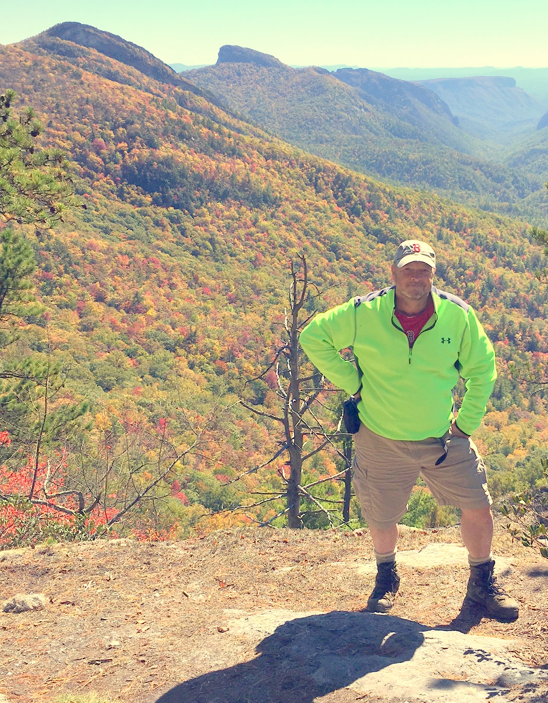
 Words can never adequately describe the view from Celestial Point. Truthfully as stunning as the pictures are, they only tell part of the story too. Scenic overload is on display. You are forced to sit down and take in the view, that in fact is enveloping you as you gaze at the natural wonder of the Linville Gorge. I really could stay here for hours.
The leaves have just started turning. The lower elevation of the southwestward facing gorge, has delayed autumn. Just over the ridge to the northeast, around Grandfather Mountain, the leaves are in full color. Still the colorful accents on the slope of Hawksbill Mountain added a nice touch to my favorite peak.
I could not resist photographing my two favorite peaks from various angles, trying to get the best look at the colorful accents to their natural beauty. It is hard to imagine that these hills were so recently the site of a massive forest fire! Nature has a way to heal even the most severe attacks by man.
Looking down Hurricane Wall, the color nicely framed the picture of the western side of the gorge. There is something I like about the scraggy pines at Celestial Point. They add to the picture, even though I am sure others are tempted to saw them down. They are silent sentinels sharing the best view of the gorge with us. There is something noble about their presence.
It is hard to pick out the best pictures of Celestial Point for this blog. All the pictures we took at this place deserve display. Since the hike was short we had a choice to make....Devil's Cliff or Sitting Bear....we chose to hike down to Devil's Cliff. But before we describe that part of the hike....one last look at Celestial Point
 The Devil's Cliff trail is a moderately steep downhill hike to some wonderful cliffs overlooking the Linville River. As we trudged down the trail, several side trials drew my attention, each providing another wonderful view of the gorge...and one tangling me in briers giving me several nice gorge tattoos for the day.
The trail down to the cliff was longer than I remembered and with the leaves covering the path hid a number of rocks and roots that occasionally stubbed our toes. Getting there we were again treated by a great view of the Gorge, this time with sound of the river roaring in our ears.
The Devil's Cliff trail is a moderately steep downhill hike to some wonderful cliffs overlooking the Linville River. As we trudged down the trail, several side trials drew my attention, each providing another wonderful view of the gorge...and one tangling me in briers giving me several nice gorge tattoos for the day.
The trail down to the cliff was longer than I remembered and with the leaves covering the path hid a number of rocks and roots that occasionally stubbed our toes. Getting there we were again treated by a great view of the Gorge, this time with sound of the river roaring in our ears.

 We met a man named "Doug" and his wonderdog "Hogan". Seems this dog is 16 years old and has hiked with Doug all over the gorge. What a great dog!
 Scrambling over the cliffs, Doug wanted me to point out to him Babel Tower. From the northern part cliffs, the Tower could be clearly seen. It stands like a fortress guarding the river.

 From the northern cliffs looking south, more beautiful views of the Gorge are on display. The one of the right is "Snakehead Rock".
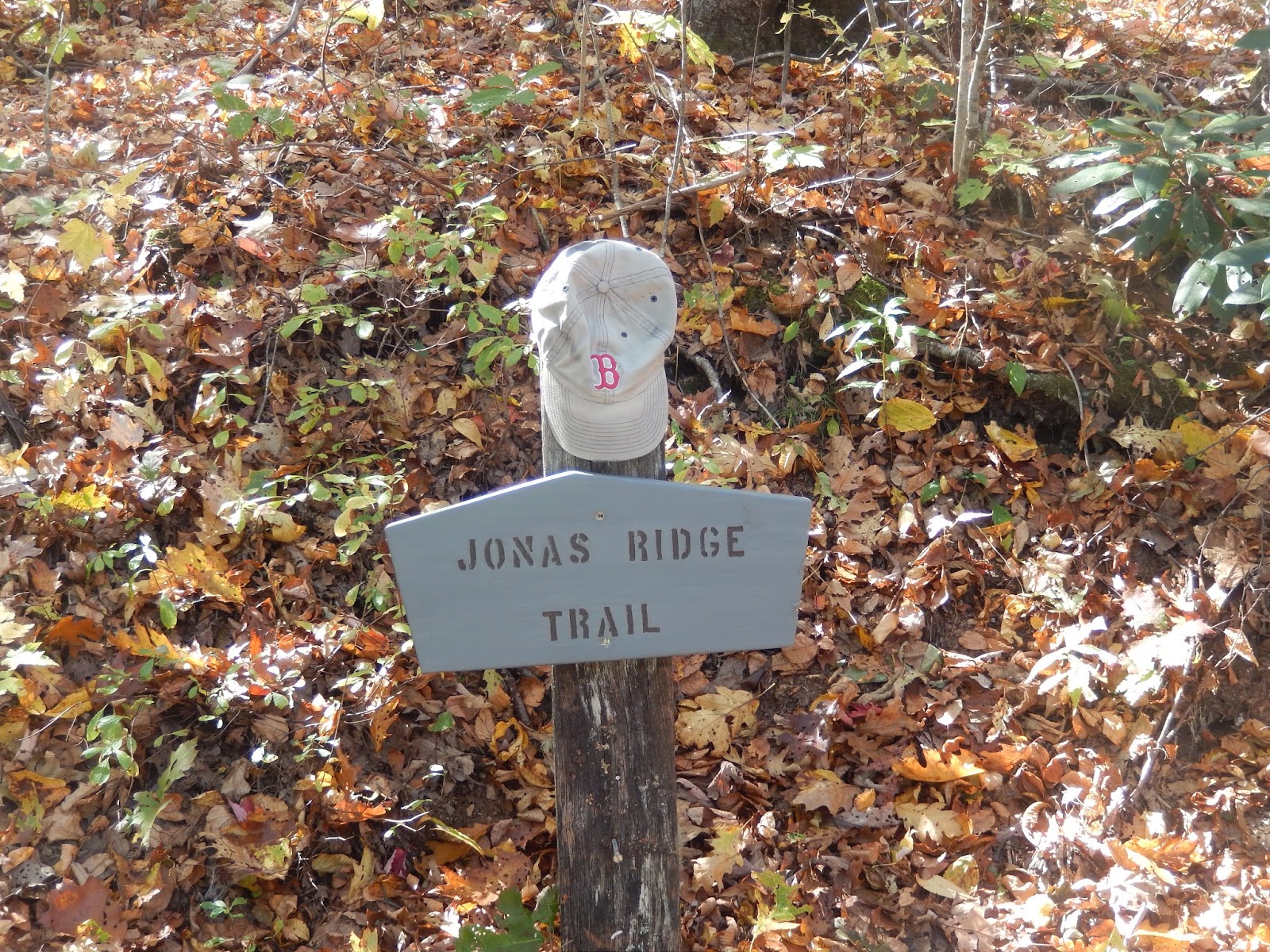
As I was taking a picture of my Boston Red Sox hat a top Devil's Cliff rock, I heard a rumble in the woods.
 The rumble was a family of three kids, a mom and dad....three dogs....and check this.... a pig! Yes, a pig. Seems that "Rosie" is the favorite pet of a little girl named "Meadow" who followed the family from its nearby house on to the trail. So I decided to take a picture to make them famous.
 What can I say about this hike....beautiful fall day...temperature in the 50's....Celestial Point and Devil's Cliff are two of the most scenic places in the Gorge...great day for a hike....Trail is a 9...trail head is off Grandview Circle...you can find it from Valley drive or Table Rock Drive via Rhododendron. Parking is limited but access is great...8; The scenery is also a 9 as we were disappointed to be too early for the peak leaves. Effort to view ratio is tilted toward the view even though the 900 foot elevation change causes a pretty steep climb out...but due to the length of the trail is only moderately steep.

 The hike is a solid 9....don't know why anyone would hike up Sitting Bear if they knew how easy it was to hike down from Gingercake! It is a game changer as far as access to Celestial Point. It would be easy to combine a hike to the cliffs of Sitting Bear and keep this hike under 6 miles. Today we did a little over 5 miles and enjoyed every step.


 If you find yourself visiting this city, make the hike from the Inner Harbor to the Federal Point. You really have not visited the Inner Harbor until you have visited Federal point.

 The park provided a nice combination of late summer flowers and late fall color. It contains a nice play ground and historic statues commemorating the defense of Baltimore in the War of 1812.


 A mile loop surrounds the fort which we took to provide us with a nice hike before visiting the fort. We took many interesting photographs. We were greeted by a white pigeon playing with a grey squirrel.
 Old Glory dominates every aspect of a visit to Fort McHenry. The large flag blowing in the wind is something that a photographer cannot resist. I must have photographed this scene from 50 different angles.


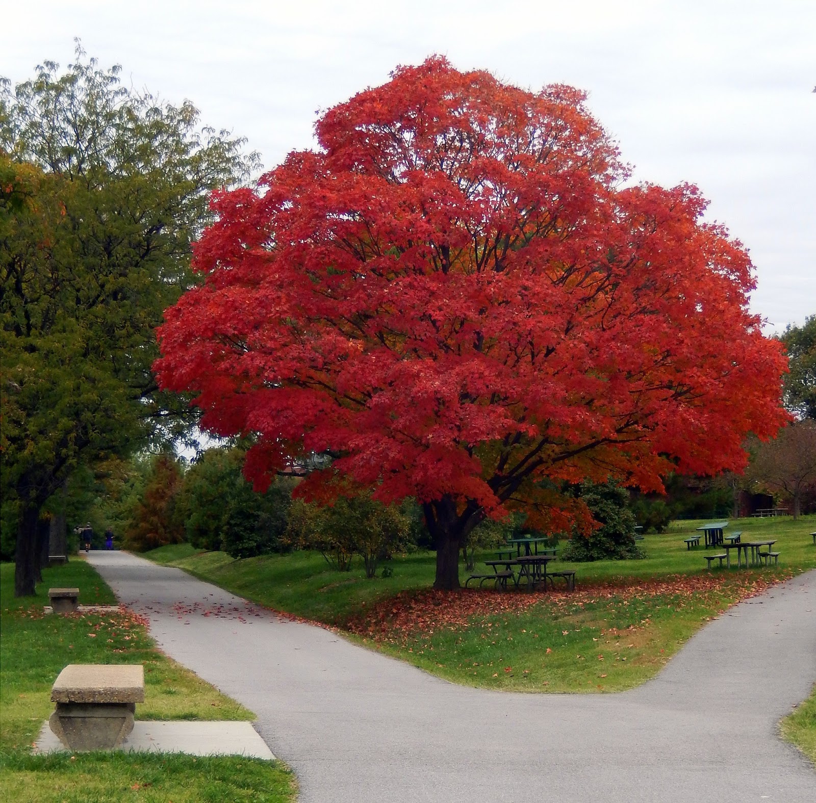

 On the back of the fort the loop path diverges at a wonderfully burnt orange tree. From here you can see how the fort rises on the ridge and can see in the distance one of the more unusual features of the park.


 The fort is French designed as a five pointed star. It was built between 1797 and 1800 on what was known as Whetstone Point replacing a fort that had long protected the Baltimore Harbor.
 The interior of the fort contained the administrative buildings that housed a garrison of 1000 officers and men who were commanded by Lt. Colonel George Armistead on September 13, 1814 when it came under a twenty-five hour bombardment by the British Fleet