Saturday, July 14, 2012

Linville Gorge - Hawksbill Mountain

HAWKSBILL MOUNTAIN

                        at LINVILLE GORGE

A NOTE FROM THE FAT BALD WHITE GUY:


On Saturday (7/14/12) we returned to the Linville Gorge.  Some have called this place "the Grand Canyon of the East".  It may be one of the prettiest places on the face of the earth.  Our destination- HAWKSBILL MOUNTAIN.  It was a mountain we saw first on our visit to Table Rock Mountain....and when I learned that scenes from the movie Last of the Mochicans were shot there...I had to make the climb....What I am about to share with you is simply breathtaking.....it does not get any better than this folks!


I will lift up my eyes unto the hills-from whence my help comes?  My help comes from the Lord, the maker of the Heavens, the Earth and the Mountains....Psalm 121


THE HIKE:

We began our hike from the Sitting Bear Mountain Trail Head....located off North Carolina Forest Service Road 210...the same one you use to get to Table Rock. This trail joins the Jonas Ridge trail which runs the length of the northeast rim of the Linville Gorge from Gingercake Mountain to Hawksbill Mountain.


One thing I have learned is a necessity is good intel about the hike...I recently joined an online forum for Linville Gorge hikers   (http://www.linvillegorge.net/smf/index.php)  
The information on this site is invaluable if you are going to hike the Gorge.  Not only did the good folks there provide an excellent map to download, but before the hike I asked what I should expect and received some very accurate information.

The Jonas Ridge Trail is a narrow forest covered path that is not used a lot.  From the Sitting Bear Trail Head, the Jonas Ridge Trail traces the ridge line up a smaller unnamed peak....(I think I will call it Bubba Mountain)....Because of the forest we were unable to enjoy the magnificent view of the the Gorge to the west and the mountains to the East....Spring hike would be the best time for these views....Nevertheless we were not disappointed for what we saw was simply incredible.


Rhododendrons formed a tunnel-like canopy over the trail for many long lengths... petals from the "Summer Whites" filled the path reminiscent of how Whitney's flower girl gave her the same honor last year as she came down the aisle to take her marriage vows....but as nice as the flowered path was, the real beauty was right above our heads.


While it is long past the peak for "Summer Whites" to bloom....there were many blooms waiting for us to enjoy.....especially if we took time to notice!


The pink buds soon give way to an explosion of white color that dots the forest with a silky texture of radiant white often spotlit by sunlight breaking though the trees

Notice the raindrop clinging to the petals in the picture below


Flowers were not the only thing we noticed along the trail..... There was this large tree in the middle of the trail somewhere near the peak of Bubba Mountain that my trail companion said reminded her of the talking trees in the Wizard of Oz!.....What do you think?


Rhododendrons were not the only thing blooming along the trail.  Yellow, purple and white wild flowers were intermixed with some really pretty ferns.


We even shared one part of the trail with a honey bee....sorry that the picture is fuzzy but bees move very fast....look at the little guy working hard in the bottom left corner of the picture!

                           This odd fellow was growing from the top of a rock at the pinnacle of Bubba Mountain.


The Jonas Ridge Trail ends at the trail leading to the summit of Hawksbill Mountain.....trouble was there were three choices....and as we contemplated our path with the help of a map....along came two disgusting people.   Two twenty-something folks who were running!  Yep...a tall tatted shirtless man followed by a winsome lass....heck that could have been a Cherokee brave being chased by his squaw if we had been in Dan'l Boone's day.....but here we were having huffed and puffed over Bubba Mountain and we are dissed by two overly healthy young folks who ran by us and disappeared down a trail that I suspect ends up at the bottom of the Gorge.....by the way...the trail up to Hawksnest was the center path!


On the way up we were teased with several nice window views of the mountains to the east of Hawksbill.  The summit trail is pretty steep but very manageable....and when you reach the summit you are facing southwest toward Table Rock Mountain....


When we visited the peak of Table Rock Mountain a few weeks ago we took a nice picture of Hawksbill Mountain blanketed by a cloud shadow....it was nice to see Table Rock with the same cloud blanket covering the peak....you can see how the shape of the summit of Table Rock might have been used by Cherokees for religious rituals....it has a most distinctive summit profile, rivaling that of Grandfather Mountain.


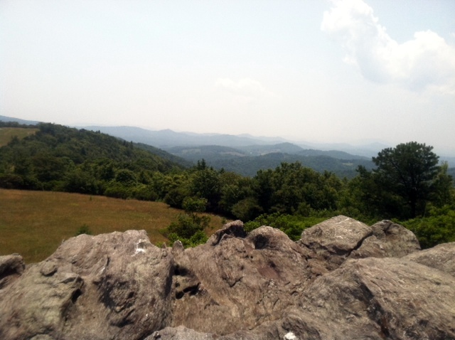
From the southern summit of  Hawksbill Mountain you can look down the Linville Gorge and can see the river in the foreground and Lake James in the distance...no picture can aptly describe this view...it does not look real....more like a painting.

Looking to the left of Table Rock....southward.....you can make out the faint outline of Lake James.....what a great line of clouds!


The western rim of Linville Gorge is formed by a long mountain which I believe is named "Linville".  Remember the Gorge is named for a man who once explored the Gorge but did not survive the Cherokee haircut.


As we relaxed on a large rock enjoying the mountain breeze and letting our "dogs" breathe, our peace and quiet was disturbed by a barking dog!   Yep, a couple with two dogs trudged to our side of the summit.....but that was a good thing..."Hey if you think the view from this side is great....wait till you go to the other side" said the man.....Heck and I thought the little outcropping a few yards beneath our boulder was the "hawksbill"  ....what did I know!  To fully appreciate the many views provided you by Hawksbill Mountain, you have to follow the paths that seem to lead everywhere!.....but first you have to go to the North end of the summit....there you will experience the real "hawksbill"!

From the "Hawksbill" you can view the Linville River as it leaves the Falls and begins the journey to Lake James......Wonder if anyone has ever base jumped from here?


Zooming in on the Linville River.  Hard to believe that small river made this big hole!
Some very brave young ladies frolicked on the edge of the cliff that forms the distinctive "Hawksbill".  Bet they did not know the Fat Bald White Guy would make them famous! 

Looking Northeast from beneath the beak of the "Hawksbill" you can see the faint outline of both Sugar and Grandfather Mountains.


If you look over the edge of the cliff, you see the forested valley floor.  Watch that first step!

Looking southwest from the Hawksbill, you can see another view of the Gorge.....you can see nearly the entire length of the Gorge from this part of the summit.

You can also get another glimpse of the cloud blanketed peak of Table Rock Mountain.


Seemingly growing out of the the granite rock are some amazingly beautiful flowers, bushes and flora.


By following a path leading to the eastern part of the summit you find yourself on a ledge overlooking mountains to the east...a wonderful interplay of shadows and clouds accent the distant "Blue Ridge"

This was by far the best hike of the season.....we figured we hiked about five miles total....the path gave us a variety of wonderful views of mountain vegetation and ended at one of the most scenic peaks in the Blue Ridge.  Table Rock is stunning because it provides a 360 degree view ....but although the views from Hawksbill are harder to work for, they provide a much better view of the Linville Gorge.

What can I say....this was a great hike....10++....if you like Table Rock you will love  Hawksbill! 

Next Week: Mt Rogers...the highest peak in Virginia!

Saturday, July 7, 2012

Doughton Park on the Blue Ridge Parkway - Basin Cove

Caudill Cabin  

           Basin Creek Cove  

                       Doughton Park


In 1916, fifty families lived in the Basin Cove community of Wilkes County.  If you have seen the movie  Sgt York....or  maybe Cold Mountain...you can get an idea of what it must have been like to live in such an isolated locale.   The Cove is a narrow slit of earth made wide by the flow of  mountain stream....that by the time it gets to Longbottom  Road, some 6 miles away, it  is swift enough to dam for a hydro-electric turbine.....steep mountain walls rise up from the creek bed...the cove is so narrow, there is hardly room for one cabin on each side of the creek

What happened to the Basin Cove Community is ever on your mind as you walk along a  path most likely very similar to the one used by the community over a century ago. By 1916, fifty families lived in Basin Cove.  But one July day in 1916, rain began and did not stop for 24 hours.  When it subsided, three people were dead and most of the homes were washed away.  Soon thereafter all the residents moved away leaving the remnants of their community to be reclaimed by the forest.  Only the Caudill Cabin survived.


Getting to the Trail Head is not easy if you have not been there before.  It is located on Longbottom Road, halfway between Traphill Road and NC 18.  Coming from Traphill Road you will miss Longbottom Road if you are looking for the road sign (we did!) as it is hidden by tree limbs....but it is the first road to the right after Traphill Elementary School. It is simpler to follow the signs to Stone Mountain Golf Course.

Once at the Grassy Gap Road Trail Head you will hike the longest 1.6 miles of your life to the Basin Creek Trail head.  The hike is easy along a fire road following the Creek upstream.  There is a large primitive camp site at the Basin Creek Trail head as  several of Doughton Park's trails intersect here.


Flatland math says that 3.3 +1.6 = 4.9....but the Fat Bald White Guy is in the Mountains and we have learned that mountain math is very different from flatland math....my GPS says that we walked over 7.25 miles from the Longbottom Road trail head to the Cabin..... making it a 15 miles round trip instead of a 10 miler as we expected....go figure!


The Basin Creek Trail begins wide and level as it follows on a small ridge line above the creek along a forested route.  From here you would never expect to get your feet wet but the trail crosses the Creek at least 16 times and wet feet is something you learn to deal with.


The trail becomes narrow as it snakes up the Cove.   It generally follows the creek and is nicely marked with blue dots which helps immensely as you choose your route across the creek and then have to pick up the trail on the other side.


The Blue Dots did not help us navigate around these downed trees...we could not tell where the trail was until I waded up the creek and saw the trail on the other side of these trees.


During one of our rest breaks I found myself sitting on a rock beneath two of the most unusual trees I have ever seen......I called them  Crooked Twins


Summer Whites are every where you look.  They adorn the mountain forest.  I love the way the buds are so pink they are almost purple.....The Glory of the Lord is all around us if we just look!


A mossy log spans the creek over mossy rocks at one of the creek crossings.....you know something.... moss covered rocks tend to be a bit slippery when wet!


The further you travel up the creek, the steeper the mountain walls that surround the cove tend to be.   I think in most places the Cove is not 50 yards wide.  I love the way the sun "spotlights" the top of this rock cliff.


This waterfall makes the Fat Bald White Guy all time best waterfalls....the upper falls flow into a basin, the size of a large bath tub....rain kept me from lounging in that tub on the way out....what a great pic that would have been!


While the trail should be labeled "moderate", its length combined with the temperature and humidity today made the trek very strenuous for the Fat Bald White Guy......Barry Baker warned me on Facebook this morning....."Hydrate, Hydrate, Hydrate" ....and I thought I had ....drank a couple of Gatorades on the way up and carried in Gatorade and water....but by the end of the trek up to the cabin, I was experiencing some signs of dehydration which was greatly limiting my ability to hike out of the woods.....


As I sat on a rock looking up this creek and was seriously concerned that two remaining bottles of water were not sufficient to relieve my dehydration....two Forest Nymphs came to my rescue.  We all knew that God protects drunks and fools....but who knew He looked after Fat Bald White Guys too!  You see as I sat there I observed for the first time all day a butterfly....first there was a Yellow one...then a Purple one...( must be ECU Fans?!)...As they performed an aerial dance over the creek in front of me...they let loose some serious Pixie Dust....and soon it began to rain.  A cool rain that soon turned into a downpour....and it felt like I was standing in a cold shower at home....my body temp cooled....my cramps disappeared....and my energy returned...Who said God was a Tar Heel....GO PIRATES!.....ARRRGH!


The Fat Bald White Guy rates this trail - 7

Access is hard to find, long walk in - 6

Scenery is great esp w/ history of Cove - 8

Trail is well marked, clear, easy to walk but too many creek crossings - 7


Next Week back to Linville Gorge....Hawksbill ....

Sunday, July 1, 2012

Doughton Park on the Blue Ridge Parkway - Bluff Mountain Trail

Bluff Mountain at Doughton Park


Again owing to the proximity of Doughton Park (Mile Post 241) to the Blue Ridge Music Center (Mile Post 204), the Fat Bald White Guy decided to take on some of the 30 miles of trails in the Doughton Recreation Area.  


Because narrow is the gate and difficult is the way which leads to life, and there are few who find it.
 Matthew 7:14

We decided to hike to the Bluff Mountain overlook and nearby Brooks Knob...and chose to do so by way of a wonderful mountain meadow trail.  The meadow once provided pasture....and entry to the meadow is through a narrow gate....and the imagery had me getting my Jesus on.


The trail begins at the Old Soda Shop and after a quick trip over a forest ridge you enter into a magnificent mountain meadow from which are many wonderful views of the surrounding mountains.  From the Old Soda Shop to Bluff Mountain Overlook is about 1.75 miles.  It is a very moderate trail.  Wear sunscreen!
The meadow is on a mountain ridge line and from either side of the trail you can see mountains in the distance as far as the eye can see.


Throughout the meadow are rock out-croppings and lonely trees which provide a needed place to rest and shadow to soothe the sunburn!


The trail winds its way over a ridge and soon you can spy in the distance the summit of Bluff Mountain

The Bluff Mountain Overlook can be accessed from many different locations.  There are wonderfully secluded picnic areas all along the trail.  If you are not up to a two mile hike, you can enjoy the meadow and the overlook from many closer access points.  At the base of the meadow leading to the summit is a large parking lot.  From this parking lot the summit is only .25 miles away- easy flatlander jaunt!


Once you reach the summit of the meadow the trail intersects with the Alligator Back trail.  This trail leads from an overlook on the Parkway to the Bluff Mountain Summit.  If you don't want the sunburn this may be a shadier hike.  At this point the trail turns into a typical narrow mountain path for about 25 yards and you reach a nice shelter with a needed bench to rest your weary bones!  


From the summit (3796 ft) you can see the Blue Ridge Parkway in the distance winding its way north toward the Brinegar's Cabin.

 Near the shelter is the faint outline of another trail. The Bluff Mountain Trail turns down the mountain at this point.  From a map in a hiking trail book I knew that somewhere down this trail was Brooks Knob.  Trouble is no park sign refers to Brooks Knob so I was left to ponder its location.  But the warnings on the sign were a bit ominous!


This part of mountain was once part of the pasture. Old fence posts mark the general outline of what was once part of a mountain meadow. Over many years the meadow was untended and trees and vegetation have taken over.  But unlike most mountain trails, this trail is overgrown due to the many breaks in the forest canopy which allows sunlight to spur the growth.   If you look carefully you can see parts of a fern forest.


Brooks Knob

I almost missed the path to Brooks Knob as I eagerly bounded down the trail.  The path to the Knob is about .25 mile from the Bluff Mountain Shelter on the right.  It leads to a wonderful cliff that overlooks Brooks Creek....but I suspect you have to wait until winter to see the creek as the mountainside is lush with vegetation obscuring the view to the basin below.  Still you will not be disappointed as there is a nice window view of the mountains to the north.


The knob is a great place to take a break from the hike as there is a peaceful feel to the place. We were refreshed by a gentle cool breeze.  It proved to be  a nice place to stretch out and enjoy the scenery.  As I looked to the right I saw an amazing display of rhododendrons growing from the side of a rock cliff.


The hike out was every bit what the sign had predicted....a strenuous uphill climb through lush green vegetation often spotlit by bursts of light shining through openings in the forest canopy.


As we rested a Bluff Mt. overlook shelter, we were entertained by four magnificent hawks performing an aerial waltz.


Every time we emerged from the shed, more hawks would appear. Guess we looked like some kind of animal in distress.

I learned on this hike that reversing your hike is not a bad thing as I really saw some things on the way back that I did not fully appreciate on the way in.


For example, the meadow is full of many varieties of wild flowers.  They do not jump out at you but if you pay attention they will bring a smile to your face as you realize how nicely they accent the lush meadow trail.

  Rhododendrons blooming is the way mountain folk know summer has arrived.  I call them "summer whites".  More importantly a trail like this reaches into the spiritual side of the Fat Bald White Guy. I guess it was started by the narrow gate but on the hike out, the meadow reminded me of another important lesson.

Bishop Lane Sapp of Calvary Moravian Church in Winston-Salem presided over the funeral of Senator Hamilton Horton and he began with a prayer:  

"Lord teach us that just because we cannot seen beyond the horizon does not mean that something is not there"       AMEN!


Fat Bald White Guy rates this trail an 8


Access is 8.... Scenery is 8.... Trail is 8...great trip...five mile hike was a workout but was great fun!