Sunday, April 30, 2017

PALMER MILL, SALTVILLE, VA.

THE PALMER MILL

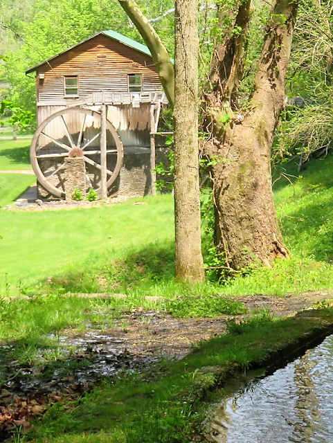
Located in Saltville, Va., the Palmer Mill is a restored waterwheel grist mill.  The mill on this site dates to 1800.  It was renovated in 2006 and now serves as a community theatre.
The mill is located near the historic downtown of Saltville, Va.  It is the site of natural occurring salt marshes which date to prehistoric times.  The town proclaims itself to be the "Salt Capitol of the Confederacy".   Two battles were fought here to secure the valuable salt mines located in the community.  The first was a Confederate victory, the second resulted in the destruction of the salt mines by Union General Stoneman.


The mill is located some distance from a small stream that serves as its water source.  But upstream is a small mill pond that  collects water from various springs which connects to a channel leading to the mill's race.


On the day we visited the little mill pond was overflowing.


The old mill race had collapsed from disrepair still funneled water to the wheel.  It is not likely the waterwheel works but all the parts are there.


It was hard to leave the Palmer Mill as there were so many different and interesting angles from which to photograph the old mill and the mill pond. The swift flowing stream and the springs exploding from the hillside were very picturesque.


The old mill site is a wonderful addition to this small community of 2200.  This is a great small park where I am sure hosts many community events.
On the way out of Saltville, we spotted a display of railroad trains and stopped to take a photo.
There were two locomotives and a caboose.  All immaculately preserved in the center of a downtown park.


White's Mill Abingdon Va

WHITE'S MILL


Located on White's Mill Road outside of Abingdon, Virginia, we found White's Mill beside a curve in the road.
It is a three story structure which was rehabbed in 2013 has existed on this site since the late 1700's. Active waterwheel powered milling continued until 1989.  It was registered with the National Registry of Historical Places in 1974.


The mill is open to the public and on the day we visited we had free run to explore all three stories of this iconic building. 


Starting on the first floor I had to wonder what it would have been like to sit by a fire in this hearth.


The second floor appears to be the main floor where all the milling took place and is full of remnants of a bygone era.


I don't know what any of these contraptions do but they are very interesting nonetheless.


On the third floor, a variety of interesting items were stored.  It appears that the milling machinery on the first floor is somehow connected to these machines on the third floor.

In the corner of the third floor were a pair of wagon wheels and the remnants of an old buckboard....hope someone reassembles this one day.

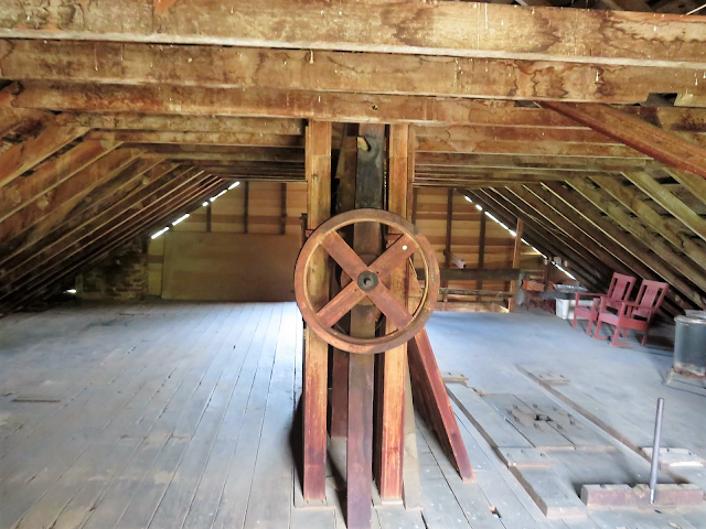
The attic was accessible as well....the old floors creaked and moaned with every step but I had to explore nonetheless.
I am not sure what this wheel does.  But it appeared to be connected to the milling operations in the floors below

But the real views were provided by the old mill as I walked around the outside of the building.  Thinking of how this old structure has stood here for 200 years, I wish it could talk... an oh the stories it would tell.


I photographed the old mill from every angle possible focusing on the old water wheel.


The blue sky provided a nice backdrop to the white painted mill.  For old pictures, the mill was not painted until the restoration.  Weathered wood provides character but the white siding is perfect for this old structure.
The mill is used for community events.  We were a couple hours early for BBQ and music...if you are in the area, you may want to check their entertainment calendar.
Leave you with a couple of black and white filter versions of the mill to add a different perspective to the visit.


http://whitesmill.org/history-restoration/


Appalachian Trail - Whitetop Mountain


BUZZARD'S ROCK
Whitetop Mountain is second highest peak in the state of Virginia.  Located in the southwest corner of the state and rising 5500 feet in elevation, one can easily see  mountains in four states.   On the southeastern slope of the summit of Whitetop mountain is a large meadow, a mountain bald.  Prominent amidst this bald is Buzzards Rock. 
There are two ways to get there.  One is easy, the other is hard.   The Fat Bald White Guy and his Faithful Hiking Companion rarely choose easy.   The easy trek is to drive the gravel road to the top and walk down a trail about a half mile long to the rock.
The harder way to get there is a 3.5 mile out and back hike from Elk Garden along the Appalachian Trail.  It is really easy to find.  Take the Chilhowie exit off I-81 and follow the signs to Whitetop Mountain.  Elk Garden is at the foot of a wonderful bald.  The AT trail north crosses this bald. 
The trail up Whitetop Mountain to Buzzards Rock is the AT-South and begins on same side of the road as the parking lot.  It is a wooded trail that gently but continuously ascends the mountain.
Spring is late at this elevation. Still mountain wild flowers are in full bloom and line both sides of the trail and dot the landscape wherever I looked.  The trail is a typical AT trail in that it is rocky and well worn but easily followed.


A tree the name of which I do not know but looks from a distance like a dogwood was in full blossom and adorned many of the features of the trail like this old weathered tree.
The trail is deceptively steep.  About 1000 feet in elevation is achieved in 2.5 miles of the 3.5 mile hike to Buzzards Rock. It is rated by some as moderate but I think that is an AT rating.  I would say moderately strenuous but very fair.  The trail architect constructed the trail to allow for a constant but moderately steep climb.  We only realized the steepness on the journey back. 


The trail is interrupted several times by cascading creeks whose sound sometimes can be heard well before they are seen.  On a humid day the creeks serve the FBWG well as I usually wet my hat in the cool water.


We paused to rest our dawgs at the halfway point and took in some of the flower blossoms.  I was especially drawn to the baby Stinky Benjamin blooming delicately next to the path. But my Faithful Hiking Companion really liked the "dainty" yellow flowers. 


From this point the trail became more rocky and there was an occasional opportunity to scramble over and down some of the rock formations blocking the trail.  All were manageable and provided some nice variety to the hike.


Of course we looked for a Keebler Elf beneath this tree and found neither an elf nor any cookies.


Nearing whatat appeared to be the summit, the trail became less steep and we encountered this sign. 


Seeing that we had traveled 2.5 miles, I was thinking the Buzzard Rock would not be much farther as we emerged onto the edge of the large bald.  But as it turns out there is another mile to hike through an orchard like trail. 
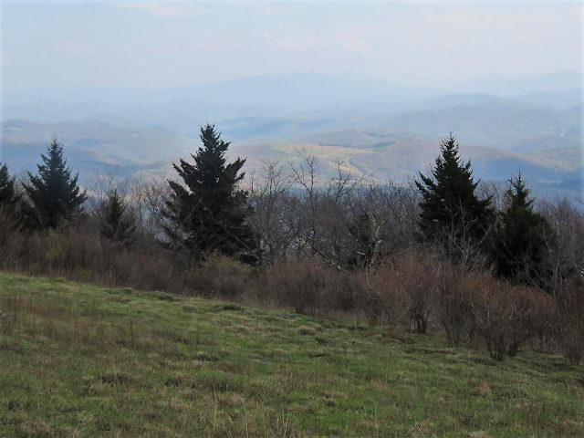
The meadow-like bald allowed for some brief views of the surrounding mountains.
The trail crosses the gravel summit road and proceeds back into the forested trail. 


But as we left the meadow we got a glimpse of our destination. 


The outline of Buzzards Rock was clear before we descended into the trees.
The trail to Buzzards Rock took us through a forest of orchard sized trees typically seen at this elevation.  It was an enchanted forest type of trail of nearly a mile before we emerged onto another mountain bald at the foot of Buzzard Rock.
The Rock sits on the southeastern slope of the summit of Whitetop Mountain and faces south. From the top of this rock there is a 180 degree view of the surrounding mountains.  Due to the overcast of the day, our views were limited but I believe this may be one of the best views in southwestern Virginia. Scrambling to the top of the rock I got to sit and contemplate the beauty of the surroundings.
The best views were to the northeast as the clouds were coming from the southwest.
Still the clouds and the interplay with the sun and the grass of the bald allowed for some interesting views.
There are other rocky overlooks across the southeastern slope but distant thunder soon drove us from the summit.  We will return again someday and but I think we may drive up for the views next time!


We trudged back down the trail more quickly than we trudged up the trail...not just because it was downhill but we were trying to out run the rain...which we did.  But I still stopped for an occasional picture.


Buzzard Rock hike is something short of seven miles round trip.  It is a great workout.   A steady uphill but tolerable hike through the mountain woods....crossing streams, rocks and meadows....ending in a large expansive bald from which views are incredible....it is well worth the trip.   But if you are a view junkie....take the road up.   The access is a 9....the trail is a 9....the scenery was an 8 because of the overcast conditions....overall a 9 hike...if you want to hike part of the AT this is the hike to take.
My guess is that on a clear fall day, this may be one of the best places in the Appalachians to see the fall colors on display.