Sunday, July 16, 2023

Hurricane Creek Trail and Max Patch

 OFF ROAD ADVENTURES OF THE FAT BALD WHITE GUY - Hurricane Creek

PART ONE: 


In January 2023 after waiting 694 days, the Fat Bald White Guy took delivery of a Ford Bronco Wildtrak...that we named "da Bronk"...it is a fantastically engineered off road vehicle..."smarter than a fifth grader"...and one fun drive.  A trip to one of the best off road trails in the Great Smoky Mountains provided yet another adventure for the Fat Bald White Guy and his Faithful Hiking Compainion. We took our first solo trip to Hurricane Creek near the North Carolina/Tennesse border just off Interstate 40. 
There are many videos on You Tube detailing the trail but the most important thing to know is how to get there.  Hurricane Creek is a forest road that is off the right of way of a busy Interstate 40 at milepost 8.  You should stop at the Haywood County Rest Area at Milepost 10...there are no rest rooms on Hurricane Creek.  Look for the exit sign for Harmon Den Road.  Just past that sign the guardrail ends and the road intersects with I-40 at that point.  So as soon as you see the sign, get off onto the safety lane and slow down to a near stop. Check out the You Tube videos before you go. Hurricane Creek Road Entrance


The road is a generally unimproved forest road, not quite a logging trail but close. A narrow one lane road with the mountain on one side and the creek on the other. We visited just after a summer thunderstorm and the road bed was muddy but very passable and surprisingly solid.  The initial part of the road takes you through some cabin areas. Don't stop there and air down as there is a better place up the trail.


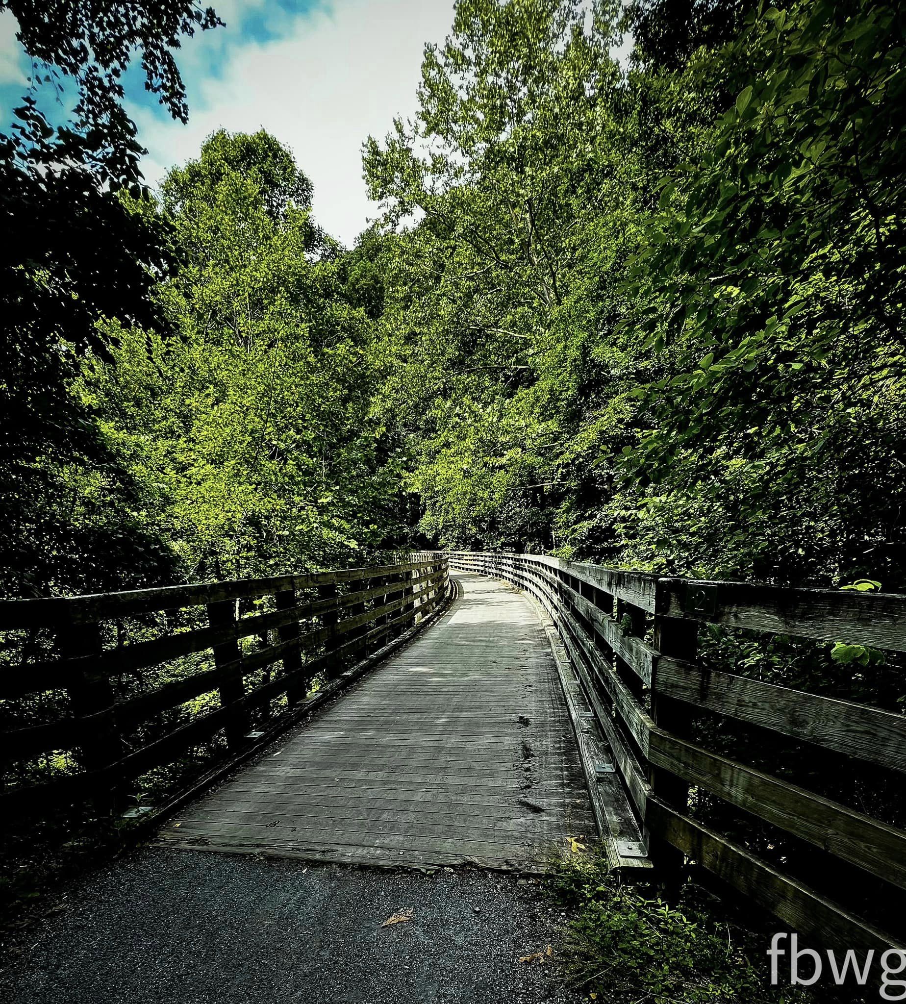
The trail narrowed after leaving the cabin area and soon we encountered the first creek crossing. Right next to the trail at this point is a large camp site.  There is plenty of room there to air down and get out and take a few pictures. 

Fording the creek is a rite of passage for newbies on the Hurricane Creek Trail...we documented it filming the trail cam....woo hoo!


The trail generally follows the creek and is a rocky path but not very technical. The scenery is simply incredible.  Birds, flowers, the roar of the creek, it is a very serene and calming ride. 

At the second water crossing my Faithful Co-Pilot waded the creek to get a picture of Bronk fording the creek and she got a great video that could be a Ford Commercial. 

Traveling up the trail, it became more technical and on the trail camera became invaluable. To be able to know where your tires are going and to see across the hood, there was no need for a spotter.


At this point, the rail sloped severely toward the creek which was about 30 feet below the road.  The tree blocked the trail and forced a dangerous and narrow approach.  Thanks to some trail instruction from a you tuber I understood the correct approach and Bronk was a beast.  Watch the video...and understand I was holding my breath the whole time.

We made a wrong turn on the trail and ended up traveling up a very steep and more technical trail. We went right when we should have gone left. We ended up on the other side of the mountain at Bear Wallow Gap when we intended to be at Max Patch Gap.  But nevertheless, it was great fun.


And of course, we found the bus!  The most identifiable feature of Hurricane Creek Trail is the iconic abandoned school bus campsite. 
Taking a scenic route through Bear Gap and back to I-40 then up the Harmon Den Forest Road, we made out way to out ulitmate destination Max Patch...the top of a bald with a 360 degree view!  But along the way saw some neat scenery


Lots of folks on You Tube have more descriptive reviews of Hurricane Creek and are more experienced off roaders than the FBWG.  Nevertheless, I have my opinion...what a great trail but not for the faint of heart.  The trail is manageable with the right equipment.  Bronk sits on 35" tires and is engineered to do this kind of off roading.  Even so, there are a few very technical approaches which most off roaders can manage. 


The access is convenient but challenging. The trail is narrow and a short wheel base vehicle has an advantage for sure.  The water crossings are fun but not very difficult.  A rookie off roader like the FBWG made it by himself...of course we know that the Good Lord looks after drunks, fools and fat bald white guys!


If you have an off road itch about you this is one fantastic trail...and the payoff is that it is just a more interesting way to get to Max Patch our ultimate destination for the day!


FOR MORE ABOUT MAX PATCH...CHECK OUT  PART TWO:


Sunday, July 9, 2023

BIKING WITH A FAT BALD WHITE GUY: THE VIRGINIA CREEPER TRAIL


 The Virginia Creeper Trail runs from Abingdon Virginia to Whitetop Station near the North Carolina line.  It is a linear recreational park that follows the abandoned railway right of way of the 1880 Abingdon Coal and Iron Railroad.  I profiled the ride from Whitetop Station to Damascus previously. Whitetop Station to Damascus On a hot July day, my faithful Biking Companion and I biked the "Road to Damascus"!


The Virginia Creeper Trail begins in Abingdon, Virginia.  You can find it right off Interstate 81. A charming welcoming station is next to the trailhead where you can get maps and information about the history of the trail. The trail is about 34 miles long and is divided into two sections with the hamlet of Damascus lying exactly at the halfway point.  Most folks take the shuttle at Damascus and coast 17 miles down the mountain from Whitetop Station.  Been there done that...we wanted a new ride...we chose 16.5 mile ride from Abingdon.


On this day I was repping The Great Cycle Challenge, a charity ride we have participated in for the last five years.  The Great Cycle Challenge raises money to fund childhood cancer research.  We ride in memory of our great nephew Beau Stanley.  Check us out and join us if you can, donate if you are willing but pray for a world without children suffering from cancer! Beau's Buddies


There are 47 trestles along the length of the entire creeper trail.  The first trestle is at the start of the Road to Damascus.


The trail is a crushed gravel the width of a railway right of way that snakes its way downhill throught the farmland of Southwest Virginia.  Very shaded, very pleasant and very scenic.  

The many scenic vistas of farmland, mountain meadows and rivers are separated by very uniquely reconstructed trestles.  This one has a nice curve.


My favorite is Trestle #7.  The angled supports are most interesting and the pastures surrounding it are very picturesque.

One crosses Lake Holston and offers a beautiful view of this mountain lake.


Halfway to Damascus there is a wonderful rest stop Alvarado Station.  There is a small park along the Holston River with a memorial gazebo with several shaded swinging benches where you can rest, watch the river creep by and listen to wind chimes....and oh, by the way there are bathrooms too!


Along the route there are many riverside cabin rental opportunities.  But at Alvarado station there is a very unique opportunity in a restored railway building.


The trail also offers many scenic vistas.  I have always been fascinated by the rock cuts created in the railroad right of way.  The difficulty of cutting the right of way in the 1880's is a marvel of the ingenuity of 19th century engineers.  One such cut was along a curve in the right of way.


The serenity that surrounds you as you ride this trail is uplifting.  Don't rush the ride, enjoy the sounds, the smells and the beauty that surrounds you. It is a rare treat in a busy world!


Some trail notes to consider. Abingdon to Damascus is downhill to Alvarado Station.  From Alvarado Station to Damascus is a moderate incline. Anyone can make this ride. Going from Damascus to Abingdon, the rider will be faced with an 8 mile ascent from Alvarado Station to Abingdon. It is a manageable climb, similar to what we encountered on the New River Trail but beware as on a hot summer day, the ascent may ruin your ride if you are not up for the experience.

Rating this trail is pretty easy.  It may be the best bike trail I have ever ridden.  The access is very easy to find. Just off I-81 in the wonderfully scenic town of Abingdon, Virginia...the trail is meticulously maintained with smooth crushed gravel with ample signage.  This trail unlike the Whitetop Station to Damascus is not social. You encounter very few people. The scenery is not overwhelming breathtaking but is a continuous serene vista.  A few warnings though...in the summer the trip from Alvarado Station to Damascus can be very hot, so hydrate and take your time. Also, make sure you have a commitment for a shuttle back to Abingdon. Most outfitters in Damascus are not set up to do this ride. Sundog Outfitters accommodated us nicely but they only offered one time slot.  This ride is a solid 10...a bucket list experience.  We will be back in the fall for sure!


Sunday, June 18, 2023

LINVILLE GORGE - BYNUM BLUFF TRAIL

 SUMMER HIKE TO ANNIVERSARY FALLS


In December 2015, My Faithful Hiking Companion and I celebrated a wedding anniversary by hiking the Bynum Bluff Trail down to the Linville River.  We had no idea we were visiting this stunning waterfall.  Not knowing its name we dubbed it "Anniversary Falls"  On this June day in 2023, we serendipitously ended up hiking it again...what a great trail!  Check out the earlier review at this link: https://fbwg-hiking.blogspot.com/2015/


Finding the trailhead is pretty easy.  It is the second trailhead past the visitor cabin on the Kistler Highway on the western side of the Gorge.  The sign is hard to see but when you pass the Pine Gap trailhead, the next parking lot is your destination. 


The trail down to the river is relatively short.  We measured it as 1.5 miles to the waterfall.  As described in the earlier blog post, the trail starts along the ridge line above the Bynum Bluffs and follows the ridge until it circles around the bluffs.  At this point, you have a trail spur that continues straight but the Bynum Bluffs trail is to the right and begins a descent.  
A couple short switchbacks take you to the base of the northern end of Bynum Bluffs.  For the next half mile, the trail descends to the intersection of Pine Gap and Linville Gorge Trail.  


Heavily wooded, the trail has a nice shade protecting us from the afternoon sun.  In the winter there are interesting forest windows to the Gorge, but in the summer the foliage hides the views.  
Mountain Laurel has begun to bloom and the sun occasionally poked through a hole in the foliage to spotlight the blossoms.

This portion of the trail is the steepest, but it soon empties into a large campsite.  This campsite is a little less than a mile from the trailhead.  It is just above the intersection of the Pine Gap/Linville Gorge Trail.  
The trail crosses the Linville Gorge Trail and continues downhill.  Not far from here are a few spur trails that give some nice teaser views of the river.  Never forsake a spur trial as it is there for a reason. One took us to a nice cliff overlook.


The roar of the river and the falls begin to resound off the walls of Bullface Mountain.  This part of the trail is less steep and is very enjoyable.  It made the FBWG smile! 

The trail empties along a wide rocky beach that forms a bend in the river. Be sure to look up and enjoy the majesty of the rock wall cut into Bullface Mountain formed by the flow of the Linville River over a couple of million years.
There are many places to explore but if you are like us, the waterfall calls! We took the first trails to the right and soon were in the middle of a campsite overlooking the magnificent Anniversary Falls.
The falls stretch the width of the river and form three large cascades.  Waterfalls have souls.  When you get close to one you can feel it breath.  This one roars with life. 
We took some time to look downriver and could see all the way to the next bend as it winds downstream toward Babel Towers.  Sitting in the sunshine and feeling the cool air coming off the river was so very peaceful, we did not want to leave!  


This is a great trail.  Tough but short climb out, but as far as river trails go this one has it all.  Check out Anniversary Falls and feel the magic!

"I gave my heart to these mountains the minute I stood by this river with its spray in my face, and watched it thunder into foam, smooth to green glass over sunken rocks, shatter into foam again. I was fascinated by how it sped by and was always there; how its roar shook both the earth and me!" - Wallace Stegner