ENO RIVER STATE PARK - LAUREL BLUFF TRAIL

For the last five years, Easy Jake has joined the Fat Bald White Guy and his Faithful Hiking Companion on the first hike of the New Year. Until this year we hiked Linville Gorge. Seeing that temps there were in the single digits, we decided to travel eastward to the Eno River State Park. We began the hike at 19 degrees, but ended it at a balmy 27 degrees!

We hiked the Laurel Bluff Trail in the May of 2013 and a detailed account of the trail is contained in that blog. See: http://fbwg-hiking.blogspot.com/2013/05/eno-river-state-park-laurel-bluff-trail.html

 It is an interesting trail as it meanders through the remnants of the Durham City Reservoir that served the city from 1887 - 1927. The stone foundations of the pump buildings are along the Pump Station Trail which is a 1.5-mile loop trail that runs along with the Laurel Bluff Trail. The trail is well marked and maintained. Access is at the end of Rivermont Road. The access is not marked on Cole Road as are other Eno State Park access points. Turn left off Cole Road on Rivermont. You pretty much got to know where you are going to find it. The trail is a moderate trail with some short climbs atop the river bluffs. In the summer the trail is adorned with magnificent mountain laurel blossoms.
 Easy Jake and I climbed to the basement of the foundation of the pump house. From there you can imagine the size of this facility. The picture below was taken in 1905. The dam that impounded 6 million gallons of water no longer exists. We are standing in the basement of the remnants of the old pump station seen in that picture. The water from the reservoir was pumped to a 3 million gallon reservoir on the top of Huckleberry Hill 8300 feet away, where it provided gravity pressure for the city of Durham. It was quite the engineering feat. The quality of the masonry work still remains even though the structures are long gone.
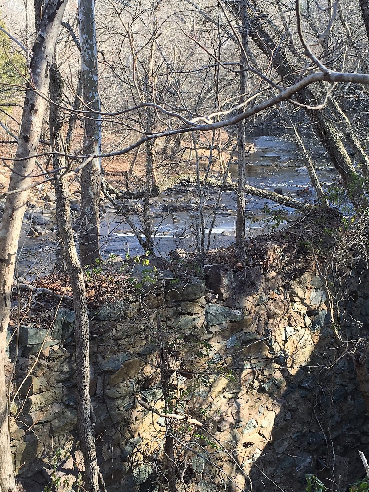
The river at the Pump Station is calm enough that on this cold morning it had a film of ice across the surface. The ice provides a great reflection.

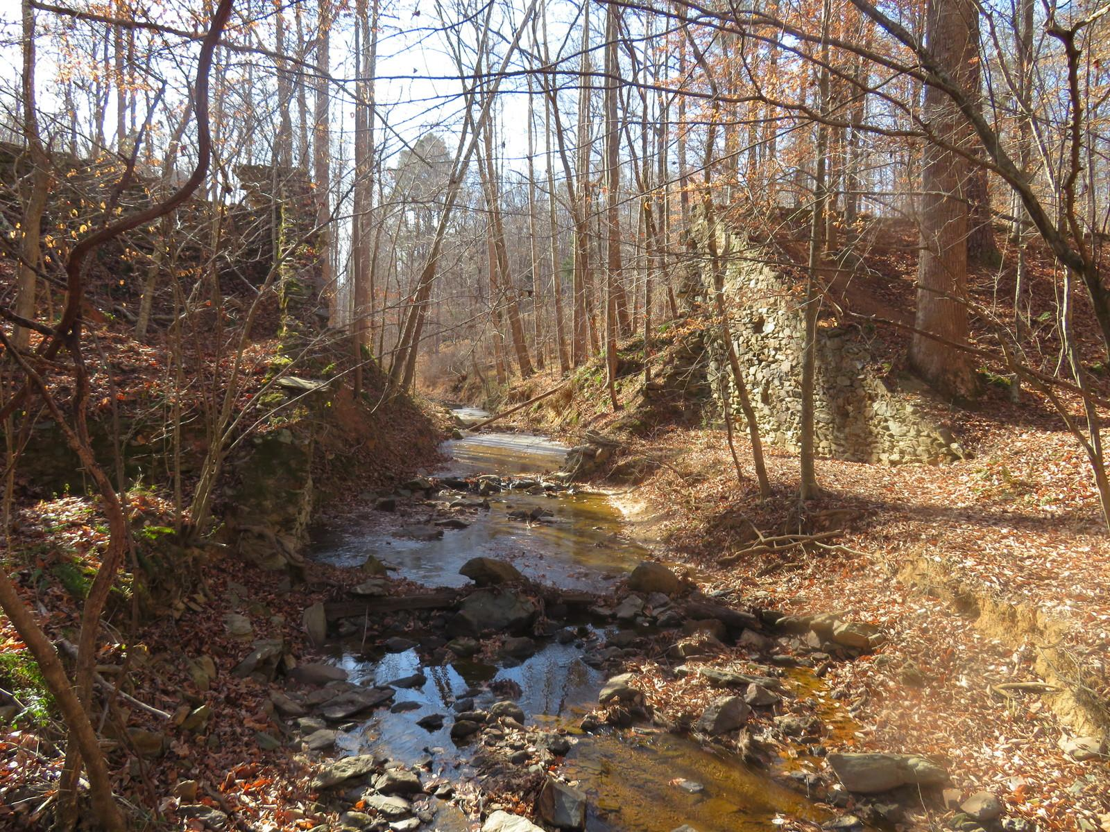
Near the pump station is the Nancy Rhodes Creek where there was erected a large floodgate that stands today like a castle wall. The gate created a smaller reservoir on the Nancy Rhodes Creek. This structure is often hidden in the summer by the foliage but is one of the more interesting structures left on the site.
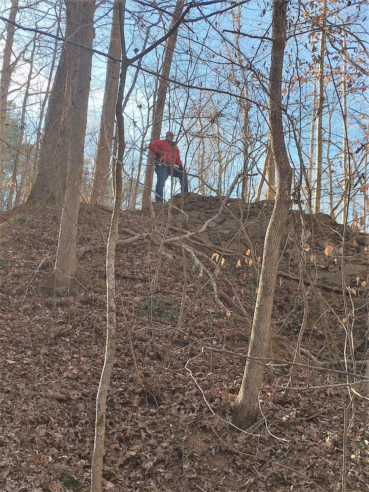
Like a young boy, I had to climb around the "castle" wall. My Faithful Hiking Companion took a picture of me on top of one of the walls.
Looking at this structure, you get an understanding of the amount of masonry work that was required to construct this reservoir and its attendant facilities. This wall has stood for over 100 years.


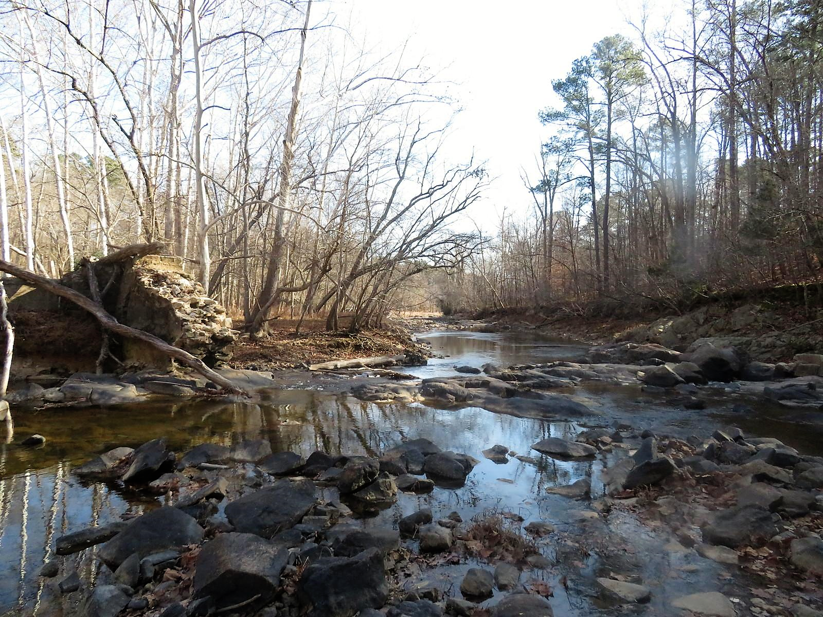
 Before leaving the pump station, my Faithful Hiking Companion took this picture of the Eno. We then trudged down Laurel Bluff trail. The views of the river were nice. The Eno River never disappoints. Winter on the Eno was no exception. Gone was the green of summer replaced by different shades of brown and grey. The river has a few small rapids and was spotted with icy patches. It flowed with a lazy confidence knowing where it was going and not in a hurry to get there. I am reminded of the Andrew Weyth quote: "I prefer winter and fall when you feel the bone structure of the landscape -the loneliness of it, the dead feeling of winter. Something waits beneath it, the whole story doesn't show."
The trail crosses several river bluffs which in the summer are adorned with laurel. Today with the summer foilage dormant, better views of the river were available to us.

 Our destination was the remnants of an old dam just west of Guess Road. The distance from the trailhead to this point was 3.5 miles. At the 3.25 mark stands as a silent sentinel, a chimney. This chimney is the in the middle of the foundation of a small cabin. An old pump and the stone chimney is all that remains of this dwelling. It would be nice to hear the stories this old chimney would tell. The chimney must have been constructed by the same masons that built the Nancy Rhodes Creek wall. Looks like it is still being used by campers. Wolfpack in da house!
 Not far from the old homestead is the remnants of the dam. It is located across the river from a rocky beach. No doubt a nice swimming hole in the summer, but on the first day of the year, it is just a picturesque section of the Eno. At the dam, the Eno separates to form two channels around an island. The dam still guards one channel. On the island is a stand of river birch trees.
As we noticed in 2013, the view downstream is stunning.
Notice the reflection of the birch trees in the lower left corner. I could not resist trying to get a better picture of this unique reflection.

No matter the angle, the view downstream at this point is worth the 3.5-mile walk to get here. The icy film floating on the surface of the river adds interesting texture to the photo.

 Leaving the rocky beach at the dam was tough but the longer we stay immobile, the colder we got! Hiking at a brisk pace certainly made the 20-degree weather tolerable but sitting on a rock beside the river was another thing entirely. We did not linger long at the rocky beach but greatly enjoyed it nonetheless. Easy Jake begins his last week of work tomorrow. He has been my banker and faithful friend. He has served the Kernersville community well. It was our pleasure to kick off his last week of work with a pleasant hike on the Eno. Happy Retirement...you earned it!
 When in doubt, hike the Eno. The Eno River State Park is convenient to both the Triangle and the Triad. It offers a variety of trails for all kinds of hikers. The river is the center of each hike and offers a different view on every trail. I like the Laurel Bluff trail the best. It is picturesque and has a variety of bluff views of the river. Access is 8...you better GPS the trailhead...trail is a 9...well marked and maintained... the scenery is a 9....effort to view is about right due to the length of the hike...overall 9 rated hike.
 HAPPY NEW YEAR 2018 !


