Saturday, October 18, 2014

Pisgah Mountain Range - Mt Pisgah

MOUNT PISGAH


When George Vanderbilt looked from his bedroom window each morning from his palatial villa outside of the hamlet of Asheville, North Carolina, there was to the south, a mountain looming in the distance. It marked the boundary of his estate. It is Mt. Pisgah.  

It was just below the summit of this mountain that he constructed his hunting camp where it is said he resided most summers.  Buck Spring Lodge was torn down in 1963 leaving only stone foundations as remnants of a once glorious past.


But the views that Vanderbilt enjoyed are still there.  

 In 1776, James Hall accompanied Gen. Gordon Rutherford to the French Broad River valley to put down a Cherokee insurrection.  Noting the rich land in the valley, he compared it to that given to the children of Israel. Presbyterian minister George Newton picked up on the parallel and is credited to naming the highest peak over looking the river valley, "Mt. Pisgah".
Getting there is pretty easy.  Take the Blue Ridge Parkway south from Asheville and at milepost 408 you turn left into the Mt. Pisgah parking lot.  The first overlook to the right takes you to the short trail to the Buck Spring Lodge site.  
The upper parking lot is to the left where you find the trail head to Mt. Pisgah. There are many outstanding overlooks within short walks of both parking lots.


Mt. Pisgah at 5721 feet is easy to spot as it looms large over the ridge and unfortunately sports an ugly antenna for WLOS television station. There ought to be a law against defacing such a magnificent mountain with such an ugly structure!
The trail is labeled a 1.5 mile trail with 712 feet in elevation. I am not sure of mountain distances anymore.  It seemed longer and steeper to me but what does a Fat Bald White Guy know?  It starts off easy enough with a wide forest trail that soon becomes wet from the many springs on the mountain, including this one with a nice small waterfall.  


A fall hike up Mt. Pisgah is a treat in that the sparseness of the leaves affords the hiker with many opportunities to view the surrounding mountainsides from forest windows.  


The overcast day provided for many distant mountain tops to be spotlit by the sun piercing though the parting clouds, giving this one mountain a "snowcap" effect.   We also got a glimpse of the Blue Ridge Parkway noting the elevation we were climbing!


Of course the best thing about the many forest windows is that it provided the FBWG with a chance to stop and catch his breath while taking a photo.  


By the way did I tell you the trail was steep? The trail starts out with a gentle incline, turns into a creek then becomes a steep rock path up a mountain and finally steeper steps to the summit.


At the top of the first section of rock stairs there is a switchback and at this place we got one of the better pictures of the day.  The peak to the far right is Fryingpan Mountain and atop this peak is a fire tower. More on that in another blog!


From this overlook the path turns toward the summit of Mt. Pisgah and about half way up offered two more forest window views. 


At the summit we were met with the ugly monstrosity of the television transmission tower. Fortunately an observation deck was constructed beside it. Still what should have been a 360 degree view of the mountains was reduced to a 270 degree view.  I know.. not bad... but this is Mt Pisgah, and I am sure Moses got to see all the Promised Land without having to worry about the television viewers of WLOS.  The FBWG wants some of that same love, that's all.


Enough complaining....what we saw was breathtaking!  In every direction but one, there was a picture that needed to be taken.  Words cannot describe the wonderful interplay of color and light the overcast day provided. 
There appeared to be an endless sea of mountain tops in every directions.  Clouds dipping low seemed to lift just enough for us to see the panorama of nature laid before us.
In the distance we could make out the city of Asheville and I even could zoom in on the Biltmore Estate some 25 miles away!


Some individual features of the scenery caught my attention. I zoomed in on "The Pisgah Inn"   It is managed by the park service and has some of the most incredible views of any rooms of lodging in the world.  And is this an unusual mountain top home or a ski slope?


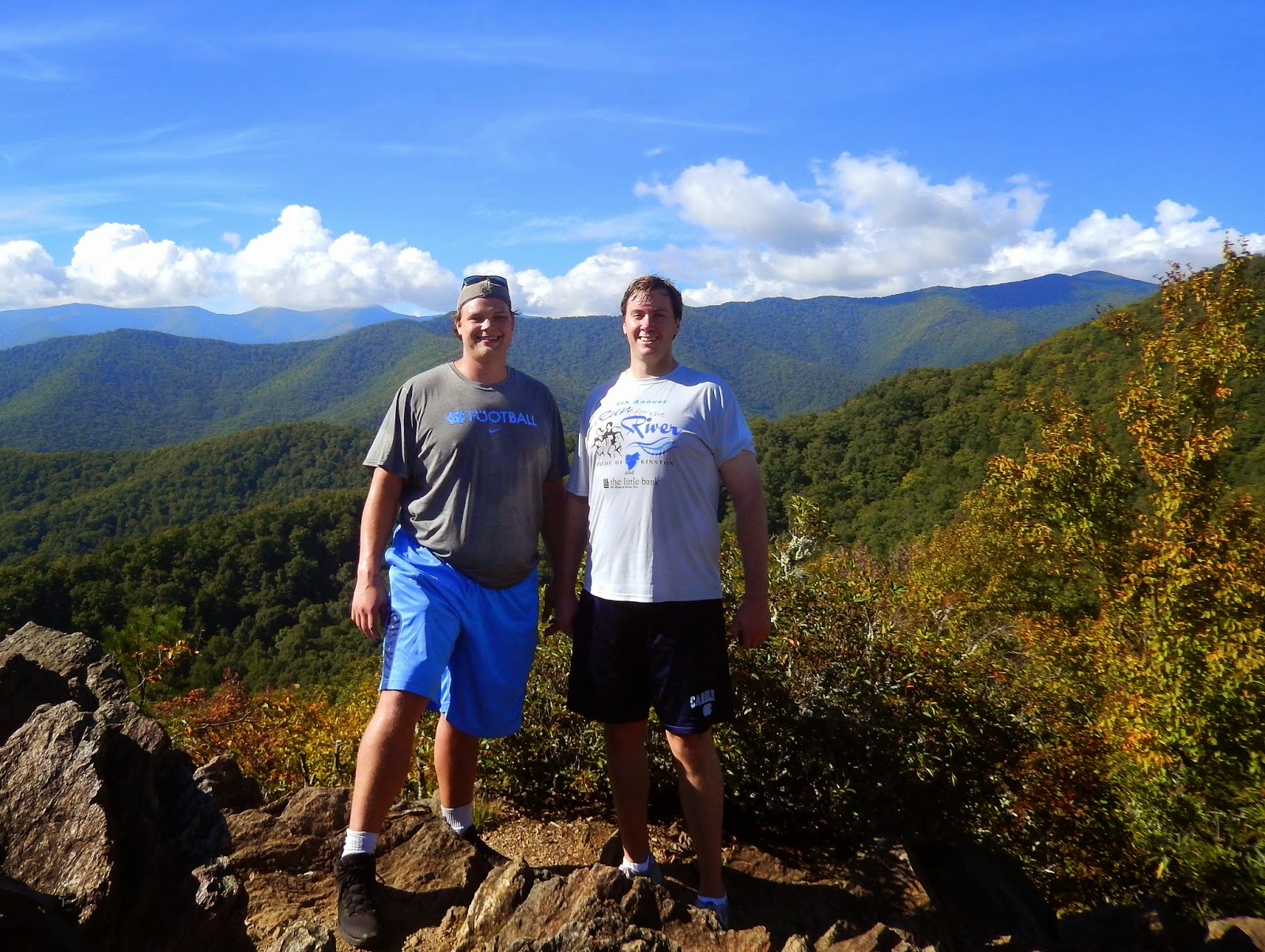
But the best thing about hiking is the nice people you meet on the trail.  Something about being on the trail makes people extra friendly.  We met Anna and Frank on top of Mt. Pisgah.  They are from Raleigh and are fellow NC State alums.  Of course I offered to make them famous by placing their picture in the blog and they agreed.  A great looking couple!


Needless the say the hike down the mountain was considerably easier.  After seeing the wonderful vista from atop Mt. Pisgah, we felt exhilarated and refreshed.  But as is our custom, we paused and built a cairn and with every stone thanked our Creator for the magnificence of His creation and the privilege of our experience.


In fact we even got another hike in later in the afternoon. 
Note the firetower on the mountain peak to the right. That is our next destination -Fryingpan Mountain. Check out our Fryingpan Mountain Blog entry!


Rating this hike is easy....access is a 10...easy to find and park....trail is an 8...muddy and rocky but well marked and maintained... scenery is a 9....would have been a 10 but for WLOS...don't ever watch that station!....effort to view ratio is solid....hard but short climb but the payoff is huge 


...a solid 9 hike....if you visit Asheville ....take this hike!


Sunday, September 28, 2014

Ridgecrest

 Rattlesnake Knob and Copperhead Knob

Ridgecrest
The Fat Bald White Guy was able to attend the inaugural Black Mountain Weekend hosted by North Carolina Lt. Governor Dan Forest.  A double treat was that my son the Real Big White Guy (RBWG) was able to attend it with me.  Great men's conference, but looming above the Ridgecrest Center was the Rattlesnake Trail. The FBWG and his new hiking companion, the RBWG, could not resist!


One of our speakers was Frank Turek who is the author of a book entitled.  "I Don't Have Enough Faith to be Atheist"  http://crossexamined.org/ 
 Frank pointed out many truths of science and history that pointed to the existence of an awesome Creator God.  The sign reminded us of a verse he cited. 

 "For since the creation of the world, God's invisible qualities - his eternal power and divine nature - have been clearly seen, being understood from what has been made, so that people are without an excuse" (Rom. 1:20)
From the parking lot outside our residence lodge we could see the sun breaking up the clouds and the first evidence of fall adorning the trees.  My brief trail research had good news and bad news.  The trail to the Rattlesnake Knob was only 1.5 miles long but climbed 750 feet.  A side excursion to Copperhead Knob was a .4 mile round trip. So I expected a four mile round trip.... but no one counted the extra 100 feet or so elevation from the parking lot to the trail head.  This was a steep climb. And you know how much I dislike steps! 
The Real Big White Guy hustled up the steps leaving me huffing and puffing behind....oh the advantages of youth!  


After climbing two different flights of steps we encountered a steep narrow trail which made me wonder if we would ever find the trail head to Rattlesnake Knob.


When we finally arrived at the trail head my viewranger app registered .8 miles!  And we did take note of the warning on the sign... more on that later!  


The trail is really a narrow logging road and is surrounded by tall trees, wildflowers and lush rhododendrons.  Oh yes, did I mention that the trail was steep?
Noticing that we were knocking down cobwebs on the trail I related to the RBWG a lesson learned on Rockjock Trail in the Linville Gorge.  The presence of cobwebs indicated we were the first ones on the trail and therefore no one had scared away the snakes!  We learned on Rockjock when we encountered a Timber Rattler that snakes like to lounge in the afternoon sun on lonely trails.  No sooner than I said that, I stopped and pointed to the trail ahead.  There was Mr. Nicholas Noneck.


Truly a beautiful snake. It was black with blue stripes. From the color we concluded he was a Carolina Panther Snake.  This is all we saw of him.  It took several well placed rocks to get him to move from his warm spot, as we chose to obey the sign and not pet him.


Not far from the Carolina Panther snake we got our first glimpse of Ridgecrest in the distance.  It sure did look a long way off and we had not reached halfway point yet!  Soon we came upon the Copperhead Knob spur trail.  The sign said the knob was .2 miles away.  We climbed along a narrow trail and the RBWG pointed out the evidence of a recent fire. 

 While we debated whether is was a natural or controlled burn, the RBWG stopped and proved to me that he had learned something on the trail.  Our second Nicky Noneck was lounging in the sun.  It was a small rat snake which really look like a tree limb.
This snake was more easily identified as a Carolina Rat Snake, sometimes referred to as "Fedora".  It took great exception to be interrupted from its afternoon sun bath, but eventually conceded the trail to us.  The trail up to Copperhead Knob is very narrow and overgrown to the point that we were looking for the real thing as we climbed to the top.  Getting to the knob, the RBWG, exclaimed as he got his first glimpse of the distant mountain vista, "Now I know why you hike!"
From Copperhead Knob you have a nearly 180 degree view eastward.  Ridgecrest, Black Mountain and Interstate 40 seemed quite small when framed by the distant blue ridge.  Thinking of our brothers down at Ridgecrest, I was reminded of a Psalm of David: 


"As the mountains surround Jerusalem, so the Lord surrounds his people from this time forth and forever" (Psalm 125:2)


After returning to the Rattlesnake Trail we trudged up a steep incline to a large camping site which served as an intersection of sorts for two trails.  The logging road continued to the right and a sign directed us to the narrow trail on the left to Rattlesnake Knob.  I told the RBWG that this is the type of trail we encounter in the gorge.  It was narrow, steep and rocky.  The effort was worth it!
The view is to the north and west and with some rock scrambling we got to see nearly 180 degrees of mountains in every direction.


Waiting to greet us on the summit was John Newby, an assistant district attorney from Kinston.  John played football at Furman and is a very big white guy (VBWG).  I could not resist taking a pic of the RBWG and his new friend, VBWG.  Any Sasquatch sightings in the area can now be disregarded.

"Before the mountains were born, or you gave birth to the earth and the world, even from everlasting to everlasting, You are God! " Psalm 90:2


The Lord is my rock, my fortress, my deliverer. My God, my Rock in whom I take refuge, my shield and my horn of salvation, my stronghold and my salvation, my Savior... 2 Samuel 22:3


Rating the trail will be difficult.  As far as effort to view, the trail is about right.  It is far from an effortless trail.  It is deceptively steep for such a short distance.  Our round trip was 4 miles and I would bet from the parking lot to the summit of Rattlesnake Knob and Copperhead Knob we climbed 900 feet.  The access to the trail is great if you can get into Ridgecrest ....8;  the trail is well marked and well maintained but aside from the views from the knob, there is not much to see...7; the views are great....mountains in every direction form a nice back drop to the Ridgecrest Center below....9....intangibles...my first hike with the RBWG ...10+  The trail is a solid 8....if you are at Ridgecrest you have to take this hike!
One last thing....I like Mike!  He has the endorsement of the Fat Bald White Guy. For that matter I am sure the Real Big White Guy and the Very Big White Guy also support him.  Please vote for Mike!